 |
|
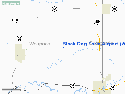
Location & QuickFacts
| FAA Information Effective: | 2008-09-25 |
| Airport Identifier: | WS76 |
| Airport Status: | Operational |
| Longitude/Latitude: | 088-49-28.3700W/44-28-14.4300N
-88.824547/44.470675 (Estimated) |
| Elevation: | 898 ft / 273.71 m (Estimated) |
| Land: | 48 acres |
| From nearest city: | 7 nautical miles SE of New London, WI |
| Location: | Waupaca County, WI |
| Magnetic Variation: | 02W (1995) |
Owner & Manager
| Ownership: | Privately owned |
| Owner: | Scott & Nancy Clungeon |
| Address: | County Rd T
Manawa, WI 54949 |
| Phone number: | 920-982-4147 |
| Manager: | Scott Clungeon |
| Address: | County Rd T
Manawa, WI 54949 |
| Phone number: | 920-982-4147 |
Airport Operations and Facilities
| Airport Use: | Private |
| Wind indicator: | Yes |
| Segmented Circle: | No |
| Control Tower: | No |
| Sectional chart: | Green Bay |
| Region: | AGL - Great Lakes |
| Boundary ARTCC: | ZMP - Minneapolis |
| Tie-in FSS: | GRB - Green Bay |
| FSS on Airport: | No |
| FSS Toll Free: | 1-800-WX-BRIEF |
Runway Information
Runway 09/27
| Dimension: | 2250 x 40 ft / 685.8 x 12.2 m |
| Surface: | TURF, |
| |
Runway 09 |
Runway 27 |
| Traffic Pattern: | Left | Left |
| Displaced threshold: | 0.00 ft | 400.00 ft |
| Obstruction: | | 60 ft bldg, 300.0 ft from runway |
|
Radio Navigation Aids
| ID |
Type |
Name |
Ch |
Freq |
Var |
Dist |
| CLI | NDB | Clintonville | | 209.00 | 02W | 9.7 nm |
| PCZ | NDB | Waupaca | | 382.00 | 01W | 11.7 nm |
| AQ | NDB | Kooky | | 407.00 | 02W | 23.9 nm |
| SG | NDB | Depre | | 332.00 | 02W | 30.0 nm |
| AIG | NDB | Antigo | | 347.00 | 02W | 43.2 nm |
| FZK | NDB | Wausau | | 243.00 | 01E | 43.9 nm |
| ISW | NDB | Wisconsin Rapids | | 215.00 | 01W | 44.1 nm |
| OCQ | NDB | Oconto | | 388.00 | 03W | 46.0 nm |
| GRB | VORTAC | Green Bay | 102X | 115.50 | 01E | 27.5 nm |
| STE | VORTAC | Stevens Point | 043X | 110.60 | 01W | 30.6 nm |
| OSH | VORTAC | Oshkosh | 055X | 111.80 | 02E | 31.1 nm |
| AUW | VORTAC | Wausau | 053X | 111.60 | 02E | 39.7 nm |
Remarks
Images and information placed above are from
http://www.airport-data.com/airport/WS76/
We thank them for the data!
| General Info
|
| Country |
United States
|
| State |
WISCONSIN
|
| FAA ID |
WS76
|
| Latitude |
44-28-14.430N
|
| Longitude |
088-49-28.370W
|
| Elevation |
898 feet
|
| Near City |
NEW LONDON
|
We don't guarantee the information is fresh and accurate. The data may
be wrong or outdated.
For more up-to-date information please refer to other sources.
|
|


