 |
|
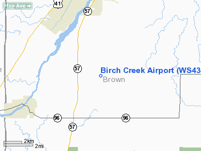
Location & QuickFacts
| FAA Information Effective: | 2008-09-25 |
| Airport Identifier: | WS43 |
| Airport Status: | Operational |
| Longitude/Latitude: | 088-03-30.3640W/44-21-19.9690N
-88.058434/44.355547 (Estimated) |
| Elevation: | 813 ft / 247.80 m (Estimated) |
| Land: | 0 acres |
| From nearest city: | 6 nautical miles S of De Pere, WI |
| Location: | Brown County, WI |
| Magnetic Variation: | 01W (1985) |
Owner & Manager
| Ownership: | Privately owned |
| Owner: | Steve Salmon |
| Address: | Birch Creek Airport Llc, 2888 Sunray Lane
Green Bay, WI 54313 |
| Phone number: | 920-662-0269 |
| Address: |
|
Airport Operations and Facilities
| Airport Use: | Private |
| Wind indicator: | Yes |
| Segmented Circle: | No |
| Control Tower: | No |
| Sectional chart: | Green Bay |
| Region: | AGL - Great Lakes |
| Boundary ARTCC: | ZMP - Minneapolis |
| Tie-in FSS: | GRB - Green Bay |
| FSS Toll Free: | 1-800-WX-BRIEF |
Airport Communications
Runway Information
Runway 08/26
| Dimension: | 2800 x 50 ft / 853.4 x 15.2 m |
| Surface: | TURF, |
| |
Runway 08 |
Runway 26 |
| Traffic Pattern: | Left | Left |
| Obstruction: | 40 ft trees, 100.0 ft from runway | 70 ft trees, 100.0 ft from runway |
|
Radio Navigation Aids
| ID |
Type |
Name |
Ch |
Freq |
Var |
Dist |
| SG | NDB | Depre | | 332.00 | 02W | 4.1 nm |
| AQ | NDB | Kooky | | 407.00 | 02W | 16.9 nm |
| OCQ | NDB | Oconto | | 388.00 | 03W | 31.9 nm |
| CLI | NDB | Clintonville | | 209.00 | 02W | 33.0 nm |
| SUE | NDB | Sturgeon Bay | | 414.00 | 03W | 39.7 nm |
| PCZ | NDB | Waupaca | | 382.00 | 01W | 41.2 nm |
| MTW | VOR/DME | Manitowoc | 047X | 111.00 | 02W | 21.3 nm |
| FAH | VOR/DME | Falls | 37X | 110.00 | 02W | 36.4 nm |
| GRB | VORTAC | Green Bay | 102X | 115.50 | 01E | 13.3 nm |
| OSH | VORTAC | Oshkosh | 055X | 111.80 | 02E | 30.7 nm |
Remarks
- 2 PERCENT GRADE DOWN RY 26/UP RY 08.
Images and information placed above are from
http://www.airport-data.com/airport/WS43/
We thank them for the data!
| General Info
|
| Country |
United States
|
| State |
WISCONSIN
|
| FAA ID |
WS43
|
| Latitude |
44-21-19.969N
|
| Longitude |
088-03-30.364W
|
| Elevation |
813 feet
|
| Near City |
DE PERE
|
We don't guarantee the information is fresh and accurate. The data may
be wrong or outdated.
For more up-to-date information please refer to other sources.
|
|


