 |
|
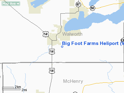
Location & QuickFacts
| FAA Information Effective: | 2008-09-25 |
| Airport Identifier: | WS73 |
| Airport Status: | Operational |
| Longitude/Latitude: | 088-34-36.3600W/42-31-15.0600N
-88.576767/42.520850 (Estimated) |
| Elevation: | 1000 ft / 304.80 m (Estimated) |
| Land: | 0 acres |
| From nearest city: | 3 nautical miles SE of Walworth, WI |
| Location: | Walworth County, WI |
| Magnetic Variation: | 01W (1990) |
Owner & Manager
| Ownership: | Privately owned |
| Owner: | Big Foot Farms, Inc. |
| Address: | Rt 1 Box 62 Coyle
Walworth, WI 53184 |
| Phone number: | 312-572-8809 |
| Manager: | Leslie W. Parman
DIR OF AVIATION/WASTE MANAGEMENT INC. |
| Address: | 3003 Butterfield Rd
Oak Brook, IL 60521 |
| Phone number: | 312-572-8809 |
Airport Operations and Facilities
| Airport Use: | Private
PERSONAL USE. |
| Segmented Circle: | No |
| Control Tower: | No |
| Sectional chart: | Chicago |
| Region: | AGL - Great Lakes |
| Boundary ARTCC: | ZAU - Chicago |
| Tie-in FSS: | GRB - Green Bay |
| FSS Toll Free: | 1-800-WX-BRIEF |
Runway Information
Helipad H1
| Dimension: | 75 x 75 ft / 22.9 x 22.9 m |
| Surface: | ASPH, |
| |
Runway H1 |
Runway |
| Traffic Pattern: | Left | Left |
|
Radio Navigation Aids
| ID |
Type |
Name |
Ch |
Freq |
Var |
Dist |
| LVV | NDB | Lake Lawn | | 404.00 | 00W | 10.7 nm |
| JVL | NDB | Janesville | | 375.00 | 03E | 21.3 nm |
| RA | NDB | Paser | | 206.00 | 00E | 31.5 nm |
| GM | NDB | Teels | | 242.00 | 02W | 33.2 nm |
| UES | NDB | Waukesha | | 359.00 | 01W | 34.9 nm |
| DKB | NDB | Dekalb | | 209.00 | 02W | 35.7 nm |
| RYV | NDB | Rock River | | 371.00 | 01W | 39.8 nm |
| ME | NDB | Deana | | 350.00 | 00E | 41.3 nm |
| BL | NDB | Yanks | | 260.00 | 02W | 44.8 nm |
| MS | NDB | Monah | | 400.00 | 00E | 47.0 nm |
| FEP | NDB | Freeport | | 335.00 | 00E | 47.8 nm |
| BUU | VOR/DME | Burbun | 092X | 114.50 | 01W | 15.8 nm |
| JVL | VOR/DME | Janesville | 090X | 114.30 | 03E | 23.5 nm |
| ENW | VOR/DME | Kenosha | 029X | 109.20 | 02W | 28.9 nm |
| RFD | VOR/DME | Rockford | 045X | 110.80 | 01E | 32.9 nm |
| OBK | VOR/DME | Northbrook | 077X | 113.00 | 02W | 33.1 nm |
| HRK | VOR/DME | Horlick | 124X | 117.70 | 02W | 36.7 nm |
| DPA | VOR/DME | Dupage | 021X | 108.40 | 02E | 39.2 nm |
| LJT | VOR/DME | Timmerman | 072X | 112.50 | 02W | 42.6 nm |
| ORD | VOR/DME | Chicago O'hare | 086X | 113.90 | 02E | 43.8 nm |
| BAE | VORTAC | Badger | 111X | 116.40 | 02E | 38.1 nm |
| MKE | VOT | Milwaukee | | 109.00 | | 39.5 nm |
| ORD | VOT | Chicago O'hare Intl | | 112.00 | | 44.0 nm |
Remarks
- (H1-52) 50 FT TREES 500 FT S & 75 FT BLDG 1000 FT SW.
- PRVDD APCH/DEP RTE OPS FM 270 DEG TO 150 DEG EXCLUDING OVERFLIGHT OF SEVERAL RESIDENTS 1/2 MI TO N & NE; TKOF LNDG AREA MKD; WIND INDICATOR IS MAINTAINED; NO NGT OPS BE CONDUCTED & NON-OBSTRUCTING SAFETY BARRIER BE INSTALLED.
Images and information placed above are from
http://www.airport-data.com/airport/WS73/
We thank them for the data!
| General Info
|
| Country |
United States
|
| State |
WISCONSIN
|
| FAA ID |
WS73
|
| Latitude |
42-31-15.060N
|
| Longitude |
088-34-36.360W
|
| Elevation |
1000 feet
|
| Near City |
WALWORTH
|
We don't guarantee the information is fresh and accurate. The data may
be wrong or outdated.
For more up-to-date information please refer to other sources.
|
|


