 |
|
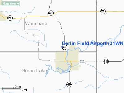
Location & QuickFacts
| FAA Information Effective: | 2008-09-25 |
| Airport Identifier: | 31WN |
| Airport Status: | Operational |
| Longitude/Latitude: | 088-57-45.4140W/43-59-29.9300N
-88.962615/43.991647 (Estimated) |
| Elevation: | 773 ft / 235.61 m (Surveyed) |
| Land: | 18 acres |
| From nearest city: | 2 nautical miles NW of Berlin, WI |
| Location: | Waushara County, WI |
| Magnetic Variation: | 01W (1985) |
Owner & Manager
| Ownership: | Privately owned |
| Owner: | 2pdi Corporation |
| Address: | W1380 Robert Lane
Berlin, WI 54923 |
| Phone number: | 920-361-0624 |
| Manager: | James Shy |
| Address: | W1380 Robert Lane
Berlin, WI 54923 |
| Phone number: | 920-361-0624 |
Airport Operations and Facilities
| Airport Use: | Private |
| Wind indicator: | Yes |
| Segmented Circle: | No |
| Control Tower: | No |
| Landing fee charge: | No |
| Sectional chart: | Chicago |
| Region: | AGL - Great Lakes |
| Traffic Pattern Alt: | 800 ft |
| Boundary ARTCC: | ZAU - Chicago |
| Tie-in FSS: | GRB - Green Bay |
| FSS on Airport: | No |
| FSS Toll Free: | 1-800-WX-BRIEF |
Airport Services
| Airframe Repair: | NONE |
| Power Plant Repair: | NONE |
| Bottled Oxygen: | NONE |
| Bulk Oxygen: | NONE |
Runway Information
Runway 09/27
| Dimension: | 1850 x 55 ft / 563.9 x 16.8 m |
| Surface: | TURF, Good Condition |
| |
Runway 09 |
Runway 27 |
| Traffic Pattern: | Left | Right |
| Markings: | None,
09/27 MKD WITH STRIPED BARRELS & BUCKETS IN POOR CONDITION. | None, |
| Runway End Identifier: | No | No |
| Centerline Lights: | No | No |
| Touchdown Lights: | No | No |
| Obstruction: | 29 ft trees, 350.0 ft from runway, 90 ft right of centerline, 12:1 slope to clear | 15 ft farm equip, 10.0 ft from runway, 30 ft right of centerline |
|
Radio Navigation Aids
| ID |
Type |
Name |
Ch |
Freq |
Var |
Dist |
| PCZ | NDB | Waupaca | | 382.00 | 01W | 20.6 nm |
| AQ | NDB | Kooky | | 407.00 | 02W | 27.8 nm |
| UNU | NDB | Juneau | | 344.00 | 01W | 35.7 nm |
| CLI | NDB | Clintonville | | 209.00 | 02W | 39.0 nm |
| SG | NDB | Depre | | 332.00 | 02W | 43.3 nm |
| ISW | NDB | Wisconsin Rapids | | 215.00 | 01W | 43.9 nm |
| HXF | NDB | Hartford | | 200.00 | 00E | 45.9 nm |
| LLE | NDB | Kettle Moraine | | 329.00 | 01W | 49.8 nm |
| BJB | VOR | West Bend | | 109.80 | 01W | 50.0 nm |
| OSH | VORTAC | Oshkosh | 055X | 111.80 | 02E | 17.6 nm |
| STE | VORTAC | Stevens Point | 043X | 110.60 | 01W | 41.2 nm |
| DLL | VORTAC | Dells | 117X | 117.00 | 03E | 43.7 nm |
| GRB | VORTAC | Green Bay | 102X | 115.50 | 01E | 47.3 nm |
Remarks
- WITHIN APCH TO BROKEN PROP FIELD.
Images and information placed above are from
http://www.airport-data.com/airport/31WN/
We thank them for the data!
| General Info
|
| Country |
United States
|
| State |
WISCONSIN
|
| FAA ID |
31WN
|
| Latitude |
43-59-29.930N
|
| Longitude |
088-57-45.414W
|
| Elevation |
773 feet
|
| Near City |
BERLIN
|
We don't guarantee the information is fresh and accurate. The data may
be wrong or outdated.
For more up-to-date information please refer to other sources.
|
|


