 |
|
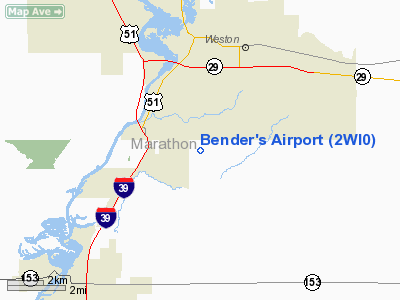
Location & QuickFacts
| FAA Information Effective: | 2008-09-25 |
| Airport Identifier: | 2WI0 |
| Airport Status: | Operational |
| Longitude/Latitude: | 089-36-00.4360W/44-51-09.8870N
-89.600121/44.852746 (Estimated) |
| Elevation: | 1197 ft / 364.85 m (Estimated) |
| Land: | 0 acres |
| From nearest city: | 3 nautical miles SE of Rothschild, WI |
| Location: | Marathon County, WI |
| Magnetic Variation: | 00W (1985) |
Owner & Manager
| Ownership: | Privately owned |
| Owner: | Felix S. Bender
RICHARD A. BENDER, CO-OWNER. |
| Address: | Po Box C
Schofield, WI 54476 |
| Phone number: | 715-359-4201 |
| Address: |
|
Airport Operations and Facilities
| Airport Use: | Private |
| Wind indicator: | Yes |
| Segmented Circle: | No |
| Control Tower: | No |
| Landing fee charge: | No |
| Sectional chart: | Green Bay |
| Region: | AGL - Great Lakes |
| Boundary ARTCC: | ZMP - Minneapolis |
| Tie-in FSS: | GRB - Green Bay |
| FSS on Airport: | No |
| FSS Toll Free: | 1-800-WX-BRIEF |
Airport Services
| Airframe Repair: | NONE |
| Power Plant Repair: | NONE |
Runway Information
Runway 09/27
| Dimension: | 3500 x 150 ft / 1066.8 x 45.7 m |
| Surface: | TURF, |
| |
Runway 09 |
Runway 27 |
| Traffic Pattern: | Left | Left |
|
Radio Navigation Aids
| ID |
Type |
Name |
Ch |
Freq |
Var |
Dist |
| FZK | NDB | Wausau | | 243.00 | 01E | 4.6 nm |
| RRL | NDB | Merrill | | 257.00 | 01W | 21.3 nm |
| AIG | NDB | Antigo | | 347.00 | 02W | 27.7 nm |
| MFI | NDB | Marshfield | | 391.00 | 00E | 28.1 nm |
| ISW | NDB | Wisconsin Rapids | | 215.00 | 01W | 31.1 nm |
| MDZ | NDB | Medford | | 335.00 | 00E | 33.7 nm |
| CLI | NDB | Clintonville | | 209.00 | 02W | 39.6 nm |
| PCZ | NDB | Waupaca | | 382.00 | 01W | 40.1 nm |
| VIQ | NDB | Neillsville | | 368.00 | 01W | 42.9 nm |
| AUW | VORTAC | Wausau | 053X | 111.60 | 02E | 0.7 nm |
| STE | VORTAC | Stevens Point | 043X | 110.60 | 01W | 18.8 nm |
| RHI | VORTAC | Rhinelander | 029X | 109.20 | 02E | 47.3 nm |
Remarks
Images and information placed above are from
http://www.airport-data.com/airport/2WI0/
We thank them for the data!
| General Info
|
| Country |
United States
|
| State |
WISCONSIN
|
| FAA ID |
2WI0
|
| Latitude |
44-51-09.887N
|
| Longitude |
089-36-00.436W
|
| Elevation |
1197 feet
|
| Near City |
ROTHSCHILD
|
We don't guarantee the information is fresh and accurate. The data may
be wrong or outdated.
For more up-to-date information please refer to other sources.
|
|


