 |
|
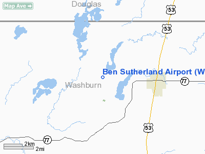
Location & QuickFacts
| FAA Information Effective: | 2008-09-25 |
| Airport Identifier: | WI33 |
| Airport Status: | Operational |
| Longitude/Latitude: | 091-54-08.6620W/46-06-12.7960N
-91.902406/46.103554 (Estimated) |
| Elevation: | 1056 ft / 321.87 m (Estimated) |
| Land: | 20 acres |
| From nearest city: | 3 nautical miles W of Minong, WI |
| Location: | Washburn County, WI |
| Magnetic Variation: | 02E (1985) |
Owner & Manager
| Ownership: | Privately owned |
| Owner: | Byron Bright |
| Address: | 1866 Chandler Ave
St Charles, IL 60174 |
| Phone number: | 708-513-1432 |
| Manager: | Byron Bright |
| Address: | Rt 1 Box 329
Mining, WI |
| Phone number: | 715-466-2563 |
Airport Operations and Facilities
| Airport Use: | Private |
| Wind indicator: | Yes |
| Segmented Circle: | No |
| Control Tower: | No |
| Landing fee charge: | No |
| Sectional chart: | Green Bay |
| Region: | AGL - Great Lakes |
| Traffic Pattern Alt: | 800 ft |
| Boundary ARTCC: | ZMP - Minneapolis |
| Tie-in FSS: | GRB - Green Bay |
| FSS on Airport: | No |
| FSS Toll Free: | 1-800-WX-BRIEF |
Airport Services
| Airframe Repair: | NONE |
| Power Plant Repair: | NONE |
| Bottled Oxygen: | NONE |
| Bulk Oxygen: | NONE |
Runway Information
Runway 18/36
| Dimension: | 2076 x 100 ft / 632.8 x 30.5 m |
| Surface: | TURF, Poor Condition
SOFT SPOTS N END OF RY. |
| |
Runway 18 |
Runway 36 |
| Longitude: | 091-54-08.6600W | 091-54-08.6600W |
| Latitude: | 46-06-23.7900N | 46-06-01.7900N |
| Elevation: | 1056.00 ft | 1056.00 ft |
| Traffic Pattern: | Left | Left |
| Runway End Identifier: | No | No |
| Centerline Lights: | No | No |
| Touchdown Lights: | No | No |
| Obstruction: | 45 ft trees, 83 ft left of centerline
+50' TREES 80' LEFT OF EXTNDD CNTRLN. | 60 ft trees, 0.0 ft from runway, 80 ft left of centerline
+50' TREES 70' LEFT OF EXTNDD CNTRLN; +20' TREES 70' RIGHT OF EXTNDD CNTRLN. |
|
Radio Navigation Aids
| ID |
Type |
Name |
Ch |
Freq |
Var |
Dist |
| OLG | NDB | Solon Springs | | 388.00 | 01E | 13.4 nm |
| SLY | NDB | Seeley | | 344.00 | 01E | 21.6 nm |
| SSQ | NDB | Shell Lake | | 212.00 | 01E | 22.6 nm |
| BXR | NDB | Big Doctor | | 203.00 | 02E | 25.8 nm |
| UBE | NDB | Cumberland | | 375.00 | 01E | 35.9 nm |
| SUW | NDB | Bong | | 260.00 | 01E | 36.3 nm |
| MZH | NDB | Moose Lake | | 362.00 | 02E | 41.9 nm |
| COQ | NDB | Cloquet | | 335.00 | 03E | 43.5 nm |
| DL | NDB | Pykla | | 379.00 | 02E | 48.4 nm |
| ENY | NDB | Kennedy | | 254.00 | 02E | 49.1 nm |
| LKI | TACAN | Lakeside | 011X | | 05E | 46.1 nm |
| HYR | VOR/DME | Hayward | 081X | 113.40 | 03E | 19.7 nm |
| RZN | VOR/DME | Siren | 031X | 109.40 | 02E | 26.1 nm |
| RPD | VOR/DME | Rice Lake | 037X | 110.00 | 01E | 41.7 nm |
| ASX | VOR/DME | Ashland | 039X | 110.20 | 02E | 48.9 nm |
| DLH | VORTAC | Duluth | 073X | 112.60 | 05E | 43.8 nm |
Remarks
- RY 18/36 320' STWY S END & 370' STWY N END.
- RY 18/36 CLSD WINTER MONTHS.
- STWY S END HAS SOFT SPOTS.
Images and information placed above are from
http://www.airport-data.com/airport/WI33/
We thank them for the data!
| General Info
|
| Country |
United States
|
| State |
WISCONSIN
|
| FAA ID |
WI33
|
| Latitude |
46-06-12.796N
|
| Longitude |
091-54-08.662W
|
| Elevation |
1056 feet
|
| Near City |
MINONG
|
We don't guarantee the information is fresh and accurate. The data may
be wrong or outdated.
For more up-to-date information please refer to other sources.
|
|


