 |
|
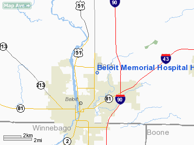
Beloit Memorial Hospital Heliport |
Location & QuickFacts
| FAA Information Effective: | 2008-09-25 |
| Airport Identifier: | WI38 |
| Airport Status: | Operational |
| Longitude/Latitude: | 089-00-27.3950W/42-32-54.0510N
-89.007610/42.548347 (Estimated) |
| Elevation: | 810 ft / 246.89 m (Estimated) |
| Land: | 0 acres |
| From nearest city: | 0 nautical miles N of Beloit, WI |
| Location: | Rock County, WI |
| Magnetic Variation: | 00E (1985) |
Owner & Manager
| Ownership: | Privately owned |
| Owner: | Beloit Memorial Hospital |
| Address: | 1969 West Hart Rd
Beloit, WI 53511 |
| Phone number: | 608-364-5107 |
| Manager: | Philip Larson |
| Address: | 1969 West Hart Rd
Beloit, WI 53511 |
| Phone number: | 608-364-5107 |
Airport Operations and Facilities
| Airport Use: | Private
MEDICAL |
| Wind indicator: | Yes |
| Segmented Circle: | No |
| Control Tower: | No |
| Lighting Schedule: | DUSK-DAWN |
| Beacon Color: | Clear-Green-Yellow (heliport) |
| Sectional chart: | Chicago |
| Region: | AGL - Great Lakes |
| Boundary ARTCC: | ZAU - Chicago |
| Tie-in FSS: | GRB - Green Bay |
| FSS Toll Free: | 1-800-WX-BRIEF |
Runway Information
Helipad H1
| Dimension: | 30 x 30 ft / 9.1 x 9.1 m |
| Surface: | ASPH, |
| |
Runway H1 |
Runway |
| Traffic Pattern: | Left | Left |
|
Radio Navigation Aids
| ID |
Type |
Name |
Ch |
Freq |
Var |
Dist |
| JVL | NDB | Janesville | | 375.00 | 03E | 4.3 nm |
| LVV | NDB | Lake Lawn | | 404.00 | 00W | 20.4 nm |
| FEP | NDB | Freeport | | 335.00 | 00E | 31.5 nm |
| MS | NDB | Monah | | 400.00 | 00E | 34.3 nm |
| DKB | NDB | Dekalb | | 209.00 | 02W | 39.3 nm |
| RYV | NDB | Rock River | | 371.00 | 01W | 39.6 nm |
| UES | NDB | Waukesha | | 359.00 | 01W | 45.3 nm |
| GM | NDB | Teels | | 242.00 | 02W | 47.9 nm |
| RA | NDB | Paser | | 206.00 | 00E | 49.7 nm |
| JVL | VOR/DME | Janesville | 090X | 114.30 | 03E | 4.4 nm |
| RFD | VOR/DME | Rockford | 045X | 110.80 | 01E | 21.2 nm |
| BUU | VOR/DME | Burbun | 092X | 114.50 | 01W | 32.3 nm |
| PLL | VOR/DME | Polo | 049X | 111.20 | 03E | 41.9 nm |
| ENW | VOR/DME | Kenosha | 029X | 109.20 | 02W | 47.7 nm |
| DPA | VOR/DME | Dupage | 021X | 108.40 | 02E | 49.2 nm |
| MSN | VORTAC | Madison | 023X | 108.60 | 03E | 38.7 nm |
| BAE | VORTAC | Badger | 111X | 116.40 | 02E | 46.7 nm |
Remarks
- FILED FOR RECORD PURPOSES ONLY.
Images and information placed above are from
http://www.airport-data.com/airport/WI38/
We thank them for the data!
| General Info
|
| Country |
United States
|
| State |
WISCONSIN
|
| FAA ID |
WI38
|
| Latitude |
42-32-54.051N
|
| Longitude |
089-00-27.395W
|
| Elevation |
810 feet
|
| Near City |
BELOIT
|
We don't guarantee the information is fresh and accurate. The data may
be wrong or outdated.
For more up-to-date information please refer to other sources.
|
|


