 |
|
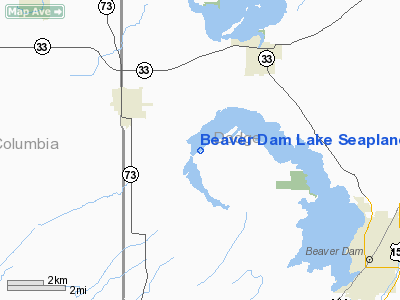
Beaver Dam Lake Seaplane Base Airport |
Location & QuickFacts
| FAA Information Effective: | 2008-09-25 |
| Airport Identifier: | 1WI5 |
| Airport Status: | Operational |
| Longitude/Latitude: | 088-57-09.3950W/43-30-53.9550N
-88.952610/43.514987 (Estimated) |
| Elevation: | 871 ft / 265.48 m (Estimated) |
| Land: | 0 acres |
| From nearest city: | 3 nautical miles SE of Randolph, WI |
| Location: | Dodge County, WI |
| Magnetic Variation: | 00W (1985) |
Owner & Manager
| Ownership: | Privately owned |
| Owner: | Michael A. Burback |
| Address: | W11056 Glen Rd
Beaver Dam, WI 53916 |
| Phone number: | 414-326-3158
IN BEAVER DAM ONE 414-326-3158. |
| Manager: | Michael A. Burback |
| Address: | W11056 Glen Rd
Beaver Dam, WI 53916 |
| Phone number: | 414-326-3158 |
Airport Operations and Facilities
| Airport Use: | Private |
| Wind indicator: | Yes |
| Segmented Circle: | No |
| Control Tower: | No |
| Landing fee charge: | No |
| Sectional chart: | Chicago |
| Region: | AGL - Great Lakes |
| Boundary ARTCC: | ZAU - Chicago |
| Tie-in FSS: | GRB - Green Bay |
| FSS on Airport: | No |
| FSS Toll Free: | 1-800-WX-BRIEF |
Airport Services
| Airframe Repair: | NONE |
| Power Plant Repair: | NONE |
Runway Information
Runway 05/23
| Dimension: | 10000 x 1000 ft / 3048.0 x 304.8 m |
| Surface: | WATER, |
| |
Runway 05 |
Runway 23 |
| Traffic Pattern: | Left | Left |
|
Runway 09/27
| Dimension: | 5000 x 1000 ft / 1524.0 x 304.8 m |
| Surface: | WATER, |
| |
Runway 09 |
Runway 27 |
| Traffic Pattern: | Left | Left |
|
Runway 18/36
| Dimension: | 5000 x 1000 ft / 1524.0 x 304.8 m |
| Surface: | WATER, |
| |
Runway 18 |
Runway 36 |
| Traffic Pattern: | Left | Left |
|
Radio Navigation Aids
| ID |
Type |
Name |
Ch |
Freq |
Var |
Dist |
| UNU | NDB | Juneau | | 344.00 | 01W | 12.1 nm |
| RYV | NDB | Rock River | | 371.00 | 01W | 22.8 nm |
| HXF | NDB | Hartford | | 200.00 | 00E | 26.3 nm |
| MS | NDB | Monah | | 400.00 | 00E | 32.2 nm |
| LLE | NDB | Kettle Moraine | | 329.00 | 01W | 36.4 nm |
| UES | NDB | Waukesha | | 359.00 | 01W | 42.2 nm |
| AQ | NDB | Kooky | | 407.00 | 02W | 48.5 nm |
| PCZ | NDB | Waupaca | | 382.00 | 01W | 49.2 nm |
| BJB | VOR | West Bend | | 109.80 | 01W | 36.5 nm |
| LJT | VOR/DME | Timmerman | 072X | 112.50 | 02W | 46.9 nm |
| MSN | VORTAC | Madison | 023X | 108.60 | 03E | 28.0 nm |
| OSH | VORTAC | Oshkosh | 055X | 111.80 | 02E | 33.4 nm |
| DLL | VORTAC | Dells | 117X | 117.00 | 03E | 35.4 nm |
| BAE | VORTAC | Badger | 111X | 116.40 | 02E | 37.8 nm |
Remarks
- OWNER INDICATES PILOTS LAND AT OWN RISK OR EMERGENCY.
- CONCRETE RAMP UP ONTO SHORE; TIE DOWNS ON SHORE.
Images and information placed above are from
http://www.airport-data.com/airport/1WI5/
We thank them for the data!
| General Info
|
| Country |
United States
|
| State |
WISCONSIN
|
| FAA ID |
1WI5
|
| Latitude |
43-30-53.955N
|
| Longitude |
088-57-09.395W
|
| Elevation |
871 feet
|
| Near City |
RANDOLPH
|
We don't guarantee the information is fresh and accurate. The data may
be wrong or outdated.
For more up-to-date information please refer to other sources.
|
|


