 |
|
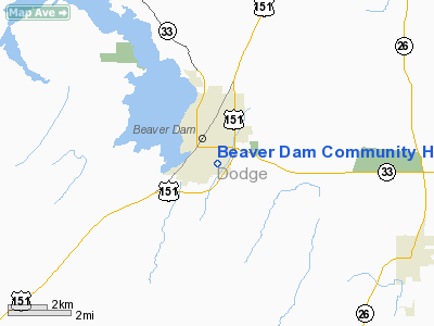
Beaver Dam Community Hospital Heliport |
Location & QuickFacts
| FAA Information Effective: | 2008-09-25 |
| Airport Identifier: | WS70 |
| Airport Status: | Operational |
| Longitude/Latitude: | 088-49-36.0800W/43-26-56.1700N
-88.826689/43.448936 (Estimated) |
| Elevation: | 870 ft / 265.18 m (Estimated) |
| Land: | 0 acres |
| From nearest city: | 0 nautical miles N of Beaver Dam, WI |
| Location: | Dodge County, WI |
| Magnetic Variation: | 01W (1995) |
Owner & Manager
| Ownership: | Privately owned |
| Owner: | Beaver Dam Community Hospital |
| Address: | 707 S. University Ave
Beaver Dam, WI 53916 |
| Phone number: | 920-887-4000 |
| Manager: | Beaver Dam Community Hospital |
| Address: | 707 S. University Ave
Beaver Dam, WI 53916 |
| Phone number: | 920-887-4000 |
Airport Operations and Facilities
| Airport Use: | Private
MEDICAL USE. |
| Segmented Circle: | No |
| Control Tower: | No |
| Sectional chart: | Chicago |
| Region: | AGL - Great Lakes |
| Boundary ARTCC: | ZAU - Chicago |
| Tie-in FSS: | GRB - Green Bay |
| FSS on Airport: | No |
| FSS Toll Free: | 1-800-WX-BRIEF |
Runway Information
Helipad H1
| Dimension: | 60 x 60 ft / 18.3 x 18.3 m |
| Surface: | ASPH, |
| |
Runway H1 |
Runway |
| Traffic Pattern: | Left | Left |
|
Radio Navigation Aids
| ID |
Type |
Name |
Ch |
Freq |
Var |
Dist |
| UNU | NDB | Juneau | | 344.00 | 01W | 5.6 nm |
| RYV | NDB | Rock River | | 371.00 | 01W | 17.1 nm |
| HXF | NDB | Hartford | | 200.00 | 00E | 19.7 nm |
| LLE | NDB | Kettle Moraine | | 329.00 | 01W | 30.6 nm |
| MS | NDB | Monah | | 400.00 | 00E | 32.5 nm |
| UES | NDB | Waukesha | | 359.00 | 01W | 35.5 nm |
| LVV | NDB | Lake Lawn | | 404.00 | 00W | 46.2 nm |
| GM | NDB | Teels | | 242.00 | 02W | 47.3 nm |
| BL | NDB | Yanks | | 260.00 | 02W | 47.7 nm |
| AQ | NDB | Kooky | | 407.00 | 02W | 49.7 nm |
| BJB | VOR | West Bend | | 109.80 | 01W | 30.7 nm |
| LJT | VOR/DME | Timmerman | 072X | 112.50 | 02W | 40.1 nm |
| FAH | VOR/DME | Falls | 37X | 110.00 | 02W | 46.7 nm |
| MSN | VORTAC | Madison | 023X | 108.60 | 03E | 28.9 nm |
| BAE | VORTAC | Badger | 111X | 116.40 | 02E | 31.0 nm |
| OSH | VORTAC | Oshkosh | 055X | 111.80 | 02E | 34.6 nm |
| DLL | VORTAC | Dells | 117X | 117.00 | 03E | 41.3 nm |
Remarks
- PRVDD APCH/DEP ON 360/180 AND 210/030; AREA IS MKD; NON-OBSTRUCTING WIND INDICATOR IS MAINTAINED.
Images and information placed above are from
http://www.airport-data.com/airport/WS70/
We thank them for the data!
| General Info
|
| Country |
United States
|
| State |
WISCONSIN
|
| FAA ID |
WS70
|
| Latitude |
43-26-56.170N
|
| Longitude |
088-49-36.080W
|
| Elevation |
870 feet
|
| Near City |
BEAVER DAM
|
We don't guarantee the information is fresh and accurate. The data may
be wrong or outdated.
For more up-to-date information please refer to other sources.
|
|


