 |
|
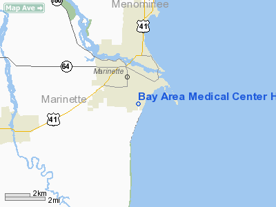
Bay Area Medical Center Heliport |
Location & QuickFacts
| FAA Information Effective: | 2008-09-25 |
| Airport Identifier: | 4WN6 |
| Airport Status: | Operational |
| Longitude/Latitude: | 087-37-05.4800W/45-04-22.1600N
-87.618189/45.072822 (Estimated) |
| Elevation: | 608 ft / 185.32 m (Estimated) |
| Land: | 1 acres |
| From nearest city: | 1 nautical miles S of Marinette, WI |
| Location: | Marinette County, WI |
| Magnetic Variation: | () |
Owner & Manager
| Ownership: | Privately owned |
| Owner: | Bay Area Medical Center |
| Address: | 3100 Shore Dr
Marinette, WI 54143 |
| Phone number: | 715-735-4200 |
| Manager: | David Tanner |
| Address: | 3100 Shore Dr
Marinette, WI 54143 |
| Phone number: | 715-735-4200 |
Airport Operations and Facilities
| Airport Use: | Private
MEDICAL USE. |
| Wind indicator: | Yes |
| Control Tower: | No |
| Sectional chart: | Green Bay |
| Region: | AGL - Great Lakes |
| Boundary ARTCC: | ZMP - Minneapolis |
| Tie-in FSS: | GRB - Green Bay |
| FSS Toll Free: | 1-800-WX-BRIEF |
Runway Information
Helipad H1
| Dimension: | 50 x 50 ft / 15.2 x 15.2 m |
| Surface: | ASPH, |
| |
Runway H1 |
Runway |
| Traffic Pattern: | Left | Left |
|
Radio Navigation Aids
| ID |
Type |
Name |
Ch |
Freq |
Var |
Dist |
| SUE | NDB | Sturgeon Bay | | 414.00 | 03W | 16.4 nm |
| OCQ | NDB | Oconto | | 388.00 | 03W | 17.2 nm |
| SG | NDB | Depre | | 332.00 | 02W | 46.1 nm |
| MNM | VOR/DME | Menominee | 033X | 109.60 | 00E | 6.6 nm |
| ESC | VOR/DME | Escanaba | 045X | 110.80 | 00E | 45.0 nm |
| IMT | VOR/DME | Iron Mountain | 049X | 111.20 | 02W | 49.3 nm |
| GRB | VORTAC | Green Bay | 102X | 115.50 | 01E | 39.7 nm |
Remarks
- PRVDD APCH/DEP FM 095 OR 185, AREA IS MKD, WIND INDICATOR MAINTAINED, CREATE SECURITY MEASURES.
Images and information placed above are from
http://www.airport-data.com/airport/4WN6/
We thank them for the data!
|
|


