 |
|
Location & QuickFacts
| FAA Information Effective: | 2008-09-25 |
| Airport Identifier: | WS55 |
| Airport Status: | Operational |
| Longitude/Latitude: | 088-44-43.3750W/42-31-03.0580N
-88.745382/42.517516 (Estimated) |
| Elevation: | 977 ft / 297.79 m (Estimated) |
| Land: | 83 acres |
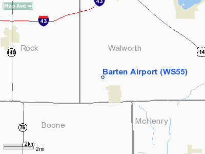
| From nearest city: | 2 nautical miles SE of Sharon, WI |
| Location: | Walworth County, WI |
| Magnetic Variation: | 00W (1985) |
Owner & Manager
| Ownership: | Privately owned |
| Owner: | Michael G Barten |
| Address: | N882 Salt Box Rd Rt 1
Sharon, WI 53585 |
| Phone number: | 414-736-9313 |
| Manager: | Michael G Barten |
| Address: | N882 Salt Box Rd Rt 1
Sharon, WI 53585 |
| Phone number: | 414-736-9313 |
Airport Operations and Facilities
| Airport Use: | Private
PERSONAL. |
| Wind indicator: | Yes |
| Segmented Circle: | No |
| Control Tower: | No |
| Sectional chart: | Chicago |
| Region: | AGL - Great Lakes |
| Boundary ARTCC: | ZAU - Chicago |
| Tie-in FSS: | GRB - Green Bay |
| FSS Toll Free: | 1-800-WX-BRIEF |
Airport Services
Runway Information
Runway 18/36
| Dimension: | 2650 x 100 ft / 807.7 x 30.5 m |
| Surface: | TURF, |
| |
Runway 18 |
Runway 36 |
| Traffic Pattern: | Right | Left |
| Displaced threshold: | 1000.00 ft | 0.00 ft |
| Obstruction: | 50 ft plines, 75.0 ft from runway | |
|
Radio Navigation Aids
| ID |
Type |
Name |
Ch |
Freq |
Var |
Dist |
| LVV | NDB | Lake Lawn | | 404.00 | 00W | 12.8 nm |
| JVL | NDB | Janesville | | 375.00 | 03E | 14.4 nm |
| DKB | NDB | Dekalb | | 209.00 | 02W | 35.1 nm |
| RA | NDB | Paser | | 206.00 | 00E | 38.7 nm |
| UES | NDB | Waukesha | | 359.00 | 01W | 38.9 nm |
| GM | NDB | Teels | | 242.00 | 02W | 39.0 nm |
| RYV | NDB | Rock River | | 371.00 | 01W | 39.4 nm |
| FEP | NDB | Freeport | | 335.00 | 00E | 40.7 nm |
| MS | NDB | Monah | | 400.00 | 00E | 42.1 nm |
| ME | NDB | Deana | | 350.00 | 00E | 46.0 nm |
| JVL | VOR/DME | Janesville | 090X | 114.30 | 03E | 16.1 nm |
| BUU | VOR/DME | Burbun | 092X | 114.50 | 01W | 22.2 nm |
| RFD | VOR/DME | Rockford | 045X | 110.80 | 01E | 26.7 nm |
| ENW | VOR/DME | Kenosha | 029X | 109.20 | 02W | 36.4 nm |
| OBK | VOR/DME | Northbrook | 077X | 113.00 | 02W | 39.5 nm |
| DPA | VOR/DME | Dupage | 021X | 108.40 | 02E | 41.6 nm |
| HRK | VOR/DME | Horlick | 124X | 117.70 | 02W | 43.7 nm |
| LJT | VOR/DME | Timmerman | 072X | 112.50 | 02W | 47.4 nm |
| PLL | VOR/DME | Polo | 049X | 111.20 | 03E | 48.0 nm |
| ORD | VOR/DME | Chicago O'hare | 086X | 113.90 | 02E | 49.1 nm |
| BAE | VORTAC | Badger | 111X | 116.40 | 02E | 41.4 nm |
| MSN | VORTAC | Madison | 023X | 108.60 | 03E | 45.9 nm |
| MKE | VOT | Milwaukee | | 109.00 | | 45.5 nm |
| ORD | VOT | Chicago O'hare Intl | | 112.00 | | 49.2 nm |
Images and information placed above are from
http://www.airport-data.com/airport/WS55/
We thank them for the data!
| General Info
|
| Country |
United States
|
| State |
WISCONSIN
|
| FAA ID |
WS55
|
| Latitude |
42-31-03.058N
|
| Longitude |
088-44-43.375W
|
| Elevation |
977 feet
|
| Near City |
SHARON
|
We don't guarantee the information is fresh and accurate. The data may
be wrong or outdated.
For more up-to-date information please refer to other sources.
|
|


