|
|
Austin Straubel Intl Airport |
| Austin Straubel International Airport |
 |
| IATA: GRB – ICAO: KGRB – FAA LID: GRB |
| Summary |
| Airport type |
Public |
| Owner |
Brown County |
| Serves |
Green Bay, Wisconsin |
| Location |
Ashwaubenon, Wisconsin |
| Elevation AMSL |
695 ft / 212 m |
| Coordinates |
44°29′05″N 088°07′47″W / 44.48472°N 88.12972°W / 44.48472; -88.12972 |
| Website |
co.brown.wi.us/... |
| Runways |
| Direction |
Length |
Surface |
| ft |
m |
| 6/24 |
7,700 |
2,347 |
Concrete |
| 18/36 |
8,701 |
2,652 |
Concrete |
| Statistics (2007) |
| Aircraft operations |
83,258 |
| Based aircraft |
131 |
| Source: Federal Aviation Administration |
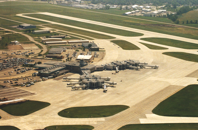
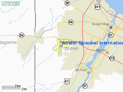
Austin Straubel International Airport (IATA: GRB, ICAO: KGRB, FAA LID: GRB) is a county-owned public-use airport in Brown County, Wisconsin, United States. The airport is located seven nautical miles (13 km) southwest of the central business district of Green Bay, in the village of Ashwaubenon. It sits on portions of land encompassing Green Bay and the Oneida Nation of Wisconsin's Indian reservation. It has two runways and is used for commercial air travel and general aviation. There are two concourses with six gates each, the second concourse was completed in December 2005. Also located onsite is one restaurant and four car rental companies. History
The airport is named for Lt. Col. Austin Straubel, the first aviator from Brown County to lose his life in his country's service on February 3, 1942, after having served for thirteen years in the United States Army Air Corps.
Facilities
Austin Straubel International Airport has two fixed base operators: Executive Air and Titletown. Both offer full service during operating hours. The airport covers 2,441 acres (988 ha) and has two runways:
- Runway 18/36: 8,700 x 150 ft (2,652 x 46 m.), Surface: Concrete, ILS equipped.
- Runway 6/24: 7,699 x 150 ft (2,347 x 46 m.), Surface: Concrete, ILS/DME equipped.
Airlines and destinations
Austin Straubel International Airport is serviced by a total of 7 airlines that fly under one of 4 banners. Mesa Airlines and ExpressJet operate flights for United Express while Pinnacle Airlines, Mesaba Airlines and Compass Airlines operate flights for Delta Connection. Chautauqua Airlines operates flights for Midwest Connect and American Eagle offers streamline service to Chicago-O'Hare.
| Airlines |
Destinations |
Concourse |
| American Eagle |
Chicago-O'Hare, Marquette |
A |
| Continental Express operated by ExpressJet Airlines |
Cleveland, Newark |
A |
| Delta Air Lines |
Atlanta, Detroit, Minneapolis/St. Paul [seasonal] |
B |
| Delta Connection operated by Pinnacle Airlines |
Cincinnati/Northern Kentucky, Detroit, Minneapolis/St. Paul |
B |
| Delta Connection operated by Mesaba Airlines |
Detroit, Minneapolis/St. Paul |
B |
| Delta Connection operated by Compass Airlines |
Detroit, Minneapolis/St. Paul |
B |
| Frontier Airlines operated by Republic Airlines |
Denver [seasonal] |
B |
| Midwest Connect operated by Chautauqua Airlines |
Milwaukee |
A |
| United Express operated by ExpressJet |
Chicago-O'Hare |
A |
| United Express operated by Mesa Airlines |
Chicago-O'Hare |
A |
Incidents and accidents
- On June 29, 1972 a Convair CV-580 flying as, North Central Airlines flight 290 bound for Oshkosh, Milwaukee and Chicago collided midair with a Air Wisconsin turboprop plane over Lake Winnebago. 8 people died as a result of this accident, 5 from the North Central flight and 3 from the Air Wisconsin plane.
- On April 2, 2001 a Cessna 501 I/SP en route to Fort Myers, Florida crashed into a Morning Glory Dairy warehouse immediately after takeoff from Runway 18, killing the sole occupant of the aircraft.
The above content comes from Wikipedia and is published under free licenses – click here to read more.
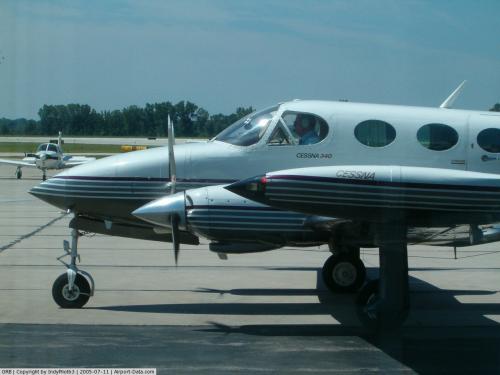 |
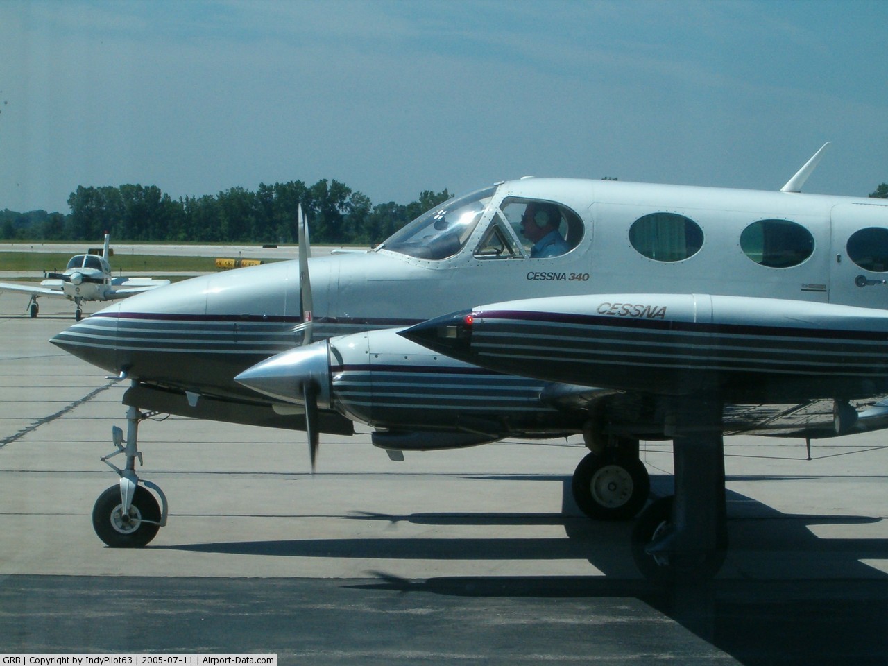
(Click on the photo to enlarge) |
Location & QuickFacts
| FAA Information Effective: | 2008-09-25 |
| Airport Identifier: | GRB |
| Airport Status: | Operational |
| Longitude/Latitude: | 088-07-46.9600W/44-29-04.6730N
-88.129711/44.484631 (Estimated) |
| Elevation: | 695 ft / 211.84 m (Surveyed) |
| Land: | 2441 acres |
| From nearest city: | 7 nautical miles SW of Green Bay, WI |
| Location: | Brown County, WI |
| Magnetic Variation: | 02W (1985) |
Owner & Manager
| Ownership: | Publicly owned |
| Owner: | Brown County |
| Address: | 2077 Airport Drive
Green Bay, WI 54313-5596 |
| Phone number: | 920-498-4800 |
| Manager: | Thomas Miller |
| Address: | 2077 Airport Drive
Green Bay, WI 54313-5596 |
| Phone number: | 920-498-4800 |
Airport Operations and Facilities
| Airport Use: | Open to public |
| Wind indicator: | Yes |
| Segmented Circle: | No |
| Control Tower: | Yes |
| Lighting Schedule: | DUSK-DAWN
WHEN ATCT CLSD THE PREFERRED RY IS PRESET ON LOW OR MED INTST; TO INCR INTST & ACTVT HIRL RYS 06/24; 18/36; MALSR RYS 36, 06, REIL RY 18 & PAPI RY 18 - CTAF. |
| Beacon Color: | Clear-Green (lighted land airport) |
| Sectional chart: | Green Bay |
| Region: | AGL - Great Lakes |
| Boundary ARTCC: | ZMP - Minneapolis |
| Tie-in FSS: | GRB - Green Bay |
| FSS on Airport: | No |
| FSS Toll Free: | 1-800-WX-BRIEF |
| NOTAMs Facility: | GRB (NOTAM-d service avaliable) |
| Certification type/date: | I C S 05/1973
ARFF INDEX D AVBL WITH PRIOR PERMISSION CALL AMGR AT 920-498-4820. |
| Federal Agreements: | NGY |
Airport Communications
| CTAF: | 118.700 |
| Unicom: | 122.950 |
Airport Services
| Fuel available: | 100LLA |
| Airframe Repair: | MAJOR |
| Power Plant Repair: | MAJOR |
| Bottled Oxygen: | HIGH |
| Bulk Oxygen: | HIGH |
Runway Information
Runway 06/24
| Dimension: | 7700 x 150 ft / 2347.0 x 45.7 m |
| Surface: | CONC, Fair Condition |
| Surface Treatment: | Saw-cut or plastic Grooved |
| Weight Limit: | Single wheel: 90000 lbs.
Dual wheel: 160000 lbs.
Dual tandem wheel: 260000 lbs. |
| Edge Lights: | High |
| |
Runway 06 |
Runway 24 |
| Longitude: | 088-08-16.9600W | 088-06-45.0500W |
| Latitude: | 44-28-56.7900N | 44-29-34.9000N |
| Elevation: | 692.00 ft | 682.00 ft |
| Alignment: | 60 | 127 |
| ILS Type: | ILS/DME
| |
| Traffic Pattern: | Left | Left |
| Markings: | Precision instrument, Fair Condition | Precision instrument, Good Condition |
| Crossing Height: | 38.00 ft | 48.00 ft |
| VASI: | 4-light PAPI on left side | 4-box on left side |
| Visual Glide Angle: | 3.00° | 3.00° |
| RVR Equipment: | touchdown | |
| Approach lights: | MALSR | |
| Runway End Identifier: | No | No |
| Centerline Lights: | No | No |
| Touchdown Lights: | No | No |
|
Runway 18/36
| Dimension: | 8701 x 150 ft / 2652.1 x 45.7 m |
| Surface: | CONC, Good Condition |
| Surface Treatment: | Saw-cut or plastic Grooved |
| Weight Limit: | Single wheel: 95000 lbs.
Dual wheel: 165000 lbs.
Dual tandem wheel: 275000 lbs. |
| Edge Lights: | High |
| |
Runway 18 |
Runway 36 |
| Longitude: | 088-08-01.1500W | 088-08-01.0100W |
| Latitude: | 44-29-37.7400N | 44-28-11.8300N |
| Elevation: | 695.00 ft | 684.00 ft |
| Alignment: | 127 | 127 |
| ILS Type: | | ILS
|
| Traffic Pattern: | Right | Left |
| Markings: | Precision instrument, Good Condition | Precision instrument, Good Condition |
| Crossing Height: | 54.00 ft | 50.00 ft |
| Displaced threshold: | 500.00 ft | 0.00 ft |
| VASI: | 4-light PAPI on right side | 4-light PAPI on left side |
| Visual Glide Angle: | 3.00° | 3.00° |
| RVR Equipment: | | touchdown |
| Approach lights: | | MALSR |
| Runway End Identifier: | Yes | No |
| Centerline Lights: | No | No |
| Touchdown Lights: | No | No |
| Obstruction: | 12 ft road, 580.0 ft from runway, 540 ft left of centerline, 31:1 slope to clear | , 50:1 slope to clear |
| Decleard distances: | Take off run available 8701.00 ft
Take off distance available 8701.00 ft
Actual stop distance available 8701.00 ft
Landing distance available 8201.00 ft
| Take off run available 8201.00 ft
Take off distance available 8201.00 ft
Actual stop distance available 8201.00 ft
Landing distance available 8701.00 ft
|
|
Radio Navigation Aids
| ID |
Type |
Name |
Ch |
Freq |
Var |
Dist |
| SG | NDB | Depre | | 332.00 | 02W | 5.2 nm |
| AQ | NDB | Kooky | | 407.00 | 02W | 19.9 nm |
| OCQ | NDB | Oconto | | 388.00 | 03W | 25.3 nm |
| CLI | NDB | Clintonville | | 209.00 | 02W | 27.1 nm |
| SUE | NDB | Sturgeon Bay | | 414.00 | 03W | 36.9 nm |
| PCZ | NDB | Waupaca | | 382.00 | 01W | 39.2 nm |
| MTW | VOR/DME | Manitowoc | 047X | 111.00 | 02W | 28.9 nm |
| FAH | VOR/DME | Falls | 37X | 110.00 | 02W | 44.7 nm |
| MNM | VOR/DME | Menominee | 033X | 109.60 | 00E | 46.6 nm |
| GRB | VORTAC | Green Bay | 102X | 115.50 | 01E | 5.1 nm |
| OSH | VORTAC | Oshkosh | 055X | 111.80 | 02E | 34.9 nm |
Remarks
- REQUEST VOLUNTARY COMPLIANCE IN AVOIDING NOISE SENSITIVE AREAS NORTH & EAST OF ARPT BETWEEN MIDNIGHT & 6 A.M.
- TWYS N & E NOT AVBL FOR ACR WITH MORE THAN 30 PSGR SEATS.
- DEER & BIRDS ON & INVOF ARPT.
Images and information placed above are from
http://www.airport-data.com/airport/GRB/
We thank them for the data!
| General Info
|
| Country |
United States
|
| State |
WISCONSIN
|
| FAA ID |
GRB
|
| Latitude |
44-29-06.264N
|
| Longitude |
088-07-46.524W
|
| Elevation |
695 feet
|
| Near City |
GREEN BAY
|
We don't guarantee the information is fresh and accurate. The data may
be wrong or outdated.
For more up-to-date information please refer to other sources.
|
|