 |
|
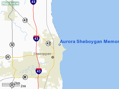
Aurora Sheboygan Memorial Medical Center Heliport |
Location & QuickFacts
| FAA Information Effective: | 2008-09-25 |
| Airport Identifier: | WS18 |
| Airport Status: | Operational |
| Longitude/Latitude: | 087-42-37.0000W/43-46-19.0000N
-87.710278/43.771944 (Estimated) |
| Elevation: | 749 ft / 228.30 m (Estimated) |
| Land: | 0 acres |
| From nearest city: | 0 nautical miles N of Sheboygan, WI |
| Location: | Sheboygan County, WI |
| Magnetic Variation: | 02W (1995) |
Owner & Manager
| Ownership: | Privately owned |
| Owner: | Aurora Health Care Central Inc |
| Address: | Aurora Sheboygan Meml Medical Ctr, 2629 N. 7th St
Sheboygan, WI 53083 |
| Phone number: | 920-451-5000 |
| Manager: | Anthony P. Sikora |
| Address: | Aurora Sheboygan Meml Medical Ctr, 2629 N. 7th St
Sheboygan, WI 53083 |
| Phone number: | 920-451-5921 |
Airport Operations and Facilities
| Airport Use: | Private
MEDICAL USE. |
| Segmented Circle: | No |
| Control Tower: | No |
| Sectional chart: | Chicago |
| Region: | AGL - Great Lakes |
| Boundary ARTCC: | ZAU - Chicago |
| Tie-in FSS: | GRB - Green Bay |
| FSS on Airport: | No |
| FSS Toll Free: | 1-800-WX-BRIEF |
Runway Information
Helipad H1
| Dimension: | 60 x 60 ft / 18.3 x 18.3 m |
| Surface: | ASPH, |
| |
Runway H1 |
Runway |
| Traffic Pattern: | Left | Left |
|
Radio Navigation Aids
| ID |
Type |
Name |
Ch |
Freq |
Var |
Dist |
| LLE | NDB | Kettle Moraine | | 329.00 | 01W | 27.6 nm |
| HXF | NDB | Hartford | | 200.00 | 00E | 39.3 nm |
| AQ | NDB | Kooky | | 407.00 | 02W | 40.0 nm |
| SG | NDB | Depre | | 332.00 | 02W | 41.8 nm |
| BL | NDB | Yanks | | 260.00 | 02W | 43.4 nm |
| UNU | NDB | Juneau | | 344.00 | 01W | 47.8 nm |
| UES | NDB | Waukesha | | 359.00 | 01W | 49.4 nm |
| BJB | VOR | West Bend | | 109.80 | 01W | 27.7 nm |
| FAH | VOR/DME | Falls | 37X | 110.00 | 02W | 6.0 nm |
| MTW | VOR/DME | Manitowoc | 047X | 111.00 | 02W | 21.5 nm |
| LJT | VOR/DME | Timmerman | 072X | 112.50 | 02W | 42.3 nm |
| OSH | VORTAC | Oshkosh | 055X | 111.80 | 02E | 38.9 nm |
| BAE | VORTAC | Badger | 111X | 116.40 | 02E | 46.7 nm |
Remarks
- PRVDD APCH/DEP ON 270 OR 090; AREA IS MKD; NON-OBSTRUCTING WIND INDICATOR IS MAINTAINED.
Images and information placed above are from
http://www.airport-data.com/airport/WS18/
We thank them for the data!
| General Info
|
| Country |
United States
|
| State |
WISCONSIN
|
| FAA ID |
WS18
|
| Latitude |
43-46-19.000N
|
| Longitude |
087-42-37.000W
|
| Elevation |
749 feet
|
| Near City |
SHEBOYGAN
|
We don't guarantee the information is fresh and accurate. The data may
be wrong or outdated.
For more up-to-date information please refer to other sources.
|
|


