 |
|
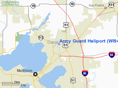
Location & QuickFacts
| FAA Information Effective: | 2008-09-25 |
| Airport Identifier: | WI94 |
| Airport Status: | Operational |
| Longitude/Latitude: | 089-20-27.4220W/43-07-35.9810N
-89.340951/43.126661 (Estimated) |
| Elevation: | 862 ft / 262.74 m (Estimated) |
| Land: | 5 acres |
| From nearest city: | 1 nautical miles N of Madison, WI |
| Location: | Dane County, WI |
| Magnetic Variation: | 00E (1985) |
Owner & Manager
| Ownership: | Publicly owned |
| Owner: | Wisconsin Arng |
| Address: | 1950 Pearson St
Madison, WI 53704-2517 |
| Phone number: | 608-241-6384 |
| Manager: | Commander Aasf 2 Wiarng |
| Address: | 1950 Pearson St
Madison, WI 53704-2517 |
| Phone number: | 608-241-6386 |
Airport Operations and Facilities
| Airport Use: | Private |
| Segmented Circle: | No |
| Control Tower: | No |
| Sectional chart: | Chicago |
| Region: | AGL - Great Lakes |
| Boundary ARTCC: | ZAU - Chicago |
| Tie-in FSS: | GRB - Green Bay |
| FSS on Airport: | No |
| FSS Toll Free: | 1-800-WX-BRIEF |
Runway Information
Helipad H1
| Dimension: | 100 x 100 ft / 30.5 x 30.5 m |
| Surface: | ASPH, |
| |
Runway H1 |
Runway |
| Traffic Pattern: | Left | Left |
|
Radio Navigation Aids
| ID |
Type |
Name |
Ch |
Freq |
Var |
Dist |
| MS | NDB | Monah | | 400.00 | 00E | 3.9 nm |
| RYV | NDB | Rock River | | 371.00 | 01W | 27.1 nm |
| UNU | NDB | Juneau | | 344.00 | 01W | 33.3 nm |
| JVL | NDB | Janesville | | 375.00 | 03E | 33.5 nm |
| MRJ | NDB | Mineral Point | | 365.00 | 00W | 41.5 nm |
| LVV | NDB | Lake Lawn | | 404.00 | 00W | 41.8 nm |
| HXF | NDB | Hartford | | 200.00 | 00E | 43.4 nm |
| UES | NDB | Waukesha | | 359.00 | 01W | 48.8 nm |
| JVL | VOR/DME | Janesville | 090X | 114.30 | 03E | 35.7 nm |
| LNR | VOR/DME | Lone Rock | 075X | 112.80 | 00E | 36.1 nm |
| MSN | VORTAC | Madison | 023X | 108.60 | 03E | 1.1 nm |
| DLL | VORTAC | Dells | 117X | 117.00 | 03E | 31.5 nm |
| BAE | VORTAC | Badger | 111X | 116.40 | 02E | 46.4 nm |
Remarks
- E111: PRVDD OPNS CONDUCTED UNDER CONTROL OF ATCT IN ACCORDANCE WITH CURRENT MSN ATCT & WISCONSIN ARNG LTR OF AGRMT.
Images and information placed above are from
http://www.airport-data.com/airport/WI94/
We thank them for the data!
| General Info
|
| Country |
United States
|
| State |
WISCONSIN
|
| FAA ID |
WI94
|
| Latitude |
43-07-35.981N
|
| Longitude |
089-20-27.422W
|
| Elevation |
862 feet
|
| Near City |
MADISON
|
We don't guarantee the information is fresh and accurate. The data may
be wrong or outdated.
For more up-to-date information please refer to other sources.
|
|


