 |
|
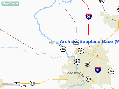
Archie's Seaplane Base Airport |
Location & QuickFacts
| FAA Information Effective: | 2008-09-25 |
| Airport Identifier: | WS01 |
| Airport Status: | Operational |
| Longitude/Latitude: | 089-04-15.4050W/42-44-15.0310N
-89.070946/42.737509 (Estimated) |
| Elevation: | 768 ft / 234.09 m (Estimated) |
| Land: | 0 acres |
| From nearest city: | 4 nautical miles NW of Janesville, WI |
| Location: | Rock County, WI |
| Magnetic Variation: | 00W (1985) |
Owner & Manager
| Ownership: | Privately owned |
| Owner: | Archie H. Henkelmann |
| Address: | 4654 N River Rd Rt 6
Janesville, WI 53545 |
| Phone number: | 608-752-5474 |
| Manager: | Archie H. Henkelmann |
| Address: | 4654 N River Rd Rt 6
Janesville, WI 53545 |
| Phone number: | 608-752-5474 |
Airport Operations and Facilities
| Airport Use: | Private |
| Wind indicator: | No |
| Segmented Circle: | No |
| Control Tower: | No |
| Landing fee charge: | No |
| Sectional chart: | Chicago |
| Region: | AGL - Great Lakes |
| Traffic Pattern Alt: | 1000 ft |
| Boundary ARTCC: | ZAU - Chicago |
| Tie-in FSS: | GRB - Green Bay |
| FSS on Airport: | No |
| FSS Toll Free: | 1-800-WX-BRIEF |
Airport Services
| Airframe Repair: | NONE |
| Power Plant Repair: | NONE |
| Bottled Oxygen: | NONE |
| Bulk Oxygen: | NONE |
Runway Information
Runway 12/30
| Dimension: | 7800 x 175 ft / 2377.4 x 53.3 m |
| Surface: | WATER, |
| |
Runway 12 |
Runway 30 |
| Traffic Pattern: | Left | Left |
| Displaced threshold: | 1000.00 ft | 1000.00 ft |
|
Radio Navigation Aids
| ID |
Type |
Name |
Ch |
Freq |
Var |
Dist |
| JVL | NDB | Janesville | | 375.00 | 03E | 7.5 nm |
| LVV | NDB | Lake Lawn | | 404.00 | 00W | 21.2 nm |
| MS | NDB | Monah | | 400.00 | 00E | 23.0 nm |
| RYV | NDB | Rock River | | 371.00 | 01W | 30.3 nm |
| FEP | NDB | Freeport | | 335.00 | 00E | 37.4 nm |
| UES | NDB | Waukesha | | 359.00 | 01W | 41.2 nm |
| UNU | NDB | Juneau | | 344.00 | 01W | 44.6 nm |
| GM | NDB | Teels | | 242.00 | 02W | 46.6 nm |
| HXF | NDB | Hartford | | 200.00 | 00E | 47.2 nm |
| JVL | VOR/DME | Janesville | 090X | 114.30 | 03E | 10.9 nm |
| RFD | VOR/DME | Rockford | 045X | 110.80 | 01E | 31.3 nm |
| BUU | VOR/DME | Burbun | 092X | 114.50 | 01W | 34.1 nm |
| MSN | VORTAC | Madison | 023X | 108.60 | 03E | 27.2 nm |
| BAE | VORTAC | Badger | 111X | 116.40 | 02E | 41.5 nm |
Images and information placed above are from
http://www.airport-data.com/airport/WS01/
We thank them for the data!
| General Info
|
| Country |
United States
|
| State |
WISCONSIN
|
| FAA ID |
WS01
|
| Latitude |
42-44-15.031N
|
| Longitude |
089-04-15.405W
|
| Elevation |
768 feet
|
| Near City |
JANESVILLE
|
We don't guarantee the information is fresh and accurate. The data may
be wrong or outdated.
For more up-to-date information please refer to other sources.
|
|


