 |
|
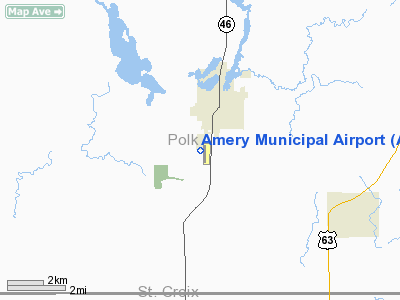
| Amery Municipal Airport |
| IATA: AHH – ICAO: KAHH – FAA LID: AHH |
| Summary |
| Airport type |
Public |
| Owner |
City of Amery, Wisconsin |
| Location |
Amery, Wisconsin |
| Elevation AMSL |
1,088 ft / 331.6 m |
| Coordinates |
45°16.869′N 092°22.524′W / 45.28115°N 92.3754°W / 45.28115; -92.3754Coordinates: 45°16.869′N 092°22.524′W / 45.28115°N 92.3754°W / 45.28115; -92.3754 |
| Runways |
| Direction |
Length |
Surface |
| ft |
m |
| 18/36 |
4,001 |
1,220 |
Asphalt |
| Statistics (2005) |
| Operations |
13,900 |
| Stats for 12 months ending August 10, 2005 |
Amery Municipal Airport (IATA: AHH, ICAO: KAHH, FAA LID: AHH) is a public airport located near Amery, Wisconsin. The airport was damaged by high winds in September 2005. Six planes were damaged and 5 hangers were destroyed. Facilities
- Runway 18/36 4001 x 75 ft. (1220 x 23 m), asphalt, VASI equipped
- AMERON (AHH) Non-directional beacon, 278 kHz is located on field
- The City of Amery provides fixed base operator services at the airport.
The above content comes from Wikipedia and is published under free licenses – click here to read more.
Location & QuickFacts
| FAA Information Effective: | 2008-09-25 |
| Airport Identifier: | AHH |
| Airport Status: | Operational |
| Longitude/Latitude: | 092-22-31.4120W/45-16-52.1340N
-92.375392/45.281148 (Estimated) |
| Elevation: | 1088 ft / 331.62 m (Surveyed) |
| Land: | 218 acres |
| From nearest city: | 2 nautical miles S of Amery, WI |
| Location: | Polk County, WI |
| Magnetic Variation: | 01E (2005) |
Owner & Manager
| Ownership: | Publicly owned |
| Owner: | City Of Amery |
| Address: | 118 Center Street
Amery, WI 54001 |
| Phone number: | 715-268-7486 |
| Manager: | Jay Griggs |
| Address: | 266 Red Pine Trail, 567a 95th St
Hudson, WI 54016 |
| Phone number: | 715-549-6136
ADDITIONAL PHONE NUMBERS 612-803-2318 & AMERY POLICE 715-268-7411. |
Airport Operations and Facilities
| Airport Use: | Open to public |
| Wind indicator: | Yes |
| Segmented Circle: | No |
| Control Tower: | No |
| Lighting Schedule: | SS-SR
MIRL RY 18/36 PRESET LOW TO INCREASE INTENSITY AND ACTIVATE VASI RY 18 & 36 & REIL RYS 18/36 - CTAF. |
| Beacon Color: | Clear-Green (lighted land airport) |
| Landing fee charge: | No |
| Sectional chart: | Green Bay |
| Region: | AGL - Great Lakes |
| Boundary ARTCC: | ZMP - Minneapolis |
| Tie-in FSS: | GRB - Green Bay |
| FSS on Airport: | No |
| FSS Toll Free: | 1-800-WX-BRIEF |
| NOTAMs Facility: | GRB (NOTAM-d service avaliable) |
| Federal Agreements: | N |
Airport Communications
| CTAF: | 122.800 |
| Unicom: | 122.800 |
Airport Services
| Fuel available: | 100LLA |
| Airframe Repair: | MAJOR |
| Power Plant Repair: | MAJOR |
| Bottled Oxygen: | NONE |
| Bulk Oxygen: | NONE |
Runway Information
Runway 18/36
| Dimension: | 4001 x 75 ft / 1219.5 x 22.9 m |
| Surface: | ASPH, Fair Condition |
| Weight Limit: | Single wheel: 12500 lbs. |
| Edge Lights: | Medium |
| |
Runway 18 |
Runway 36 |
| Longitude: | 092-22-32.2080W | 092-22-30.6180W |
| Latitude: | 45-17-11.8760N | 45-16-32.3920N |
| Elevation: | 1078.00 ft | 1088.00 ft |
| Alignment: | 127 | 127 |
| Traffic Pattern: | Left | Left |
| Markings: | Non-precision instrument, Fair Condition | Non-precision instrument, Fair Condition |
| Crossing Height: | 24.00 ft | 24.00 ft |
| VASI: | 2-box on left side | 2-box on left side |
| Visual Glide Angle: | 3.00° | 3.00° |
| Runway End Identifier: | Yes | Yes |
| Obstruction: | 19 ft trees, 580.0 ft from runway, 260 ft right of centerline, 20:1 slope to clear | 20 ft road, 610.0 ft from runway, 20:1 slope to clear |
|
Radio Navigation Aids
| ID |
Type |
Name |
Ch |
Freq |
Var |
Dist |
| AHH | NDB | Ameron | | 278.00 | 01E | 0.2 nm |
| RNH | NDB | New Richmond | | 257.00 | 02E | 10.5 nm |
| OEO | NDB | Osceola | | 233.00 | 01E | 13.3 nm |
| UBE | NDB | Cumberland | | 375.00 | 01E | 21.7 nm |
| BXR | NDB | Big Doctor | | 203.00 | 02E | 32.5 nm |
| SSQ | NDB | Shell Lake | | 212.00 | 01E | 33.0 nm |
| PPI | NDB | Hopey | | 400.00 | 03E | 34.4 nm |
| ROS | NDB | Rush City | | 282.00 | 02E | 35.0 nm |
| MS | NDB | Narco | | 266.00 | 02E | 40.9 nm |
| CBG | NDB | Cambridge | | 350.00 | 03E | 40.9 nm |
| RPD | VOR/DME | Rice Lake | 037X | 110.00 | 01E | 26.5 nm |
| RZN | VOR/DME | Siren | 031X | 109.40 | 02E | 32.4 nm |
| MSP | VOR/DME | Minneapolis | 100X | 115.30 | 02E | 43.2 nm |
| GEP | VORTAC | Gopher | 120X | 117.30 | 06E | 43.0 nm |
| EAU | VORTAC | Eau Claire | 076X | 112.90 | 04E | 44.5 nm |
| STP | VOT | St Paul | | 114.40 | | 35.5 nm |
| MSP | VOT | Minneapolis St Paul | | 111.00 | | 42.9 nm |
Remarks
- RY 36 SAFETY AREA VERY ROUGH.
- RADIO CONTROLLED ACFT ACTVTY INVOF ARPT.
- 100 FT CRANE 1500 FT SE OF AER 36 DALGH HRS ONLY.
Images and information placed above are from
http://www.airport-data.com/airport/AHH/
We thank them for the data!
| General Info
|
| Country |
United States
|
| State |
WISCONSIN
|
| FAA ID |
AHH
|
| Latitude |
45-16-52.134N
|
| Longitude |
092-22-31.412W
|
| Elevation |
1088 feet
|
| Near City |
AMERY
|
We don't guarantee the information is fresh and accurate. The data may
be wrong or outdated.
For more up-to-date information please refer to other sources.
|
|


