 |
|
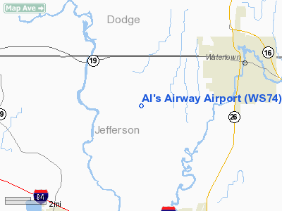
Location & QuickFacts
| FAA Information Effective: | 2008-09-25 |
| Airport Identifier: | WS74 |
| Airport Status: | Operational |
| Longitude/Latitude: | 088-49-28.3700W/43-09-46.9900N
-88.824547/43.163053 (Estimated) |
| Elevation: | 825 ft / 251.46 m (Estimated) |
| Land: | 0 acres |
| From nearest city: | 5 nautical miles E of Watertown, WI |
| Location: | Jefferson County, WI |
| Magnetic Variation: | 01W (1990) |
Owner & Manager
| Ownership: | Privately owned |
| Owner: | Allen F. Mulderink |
| Address: | B8713 West Road
Watertown, WI 53094 |
| Phone number: | 414-261-9116 |
| Manager: | Allen F. Mulderink |
| Address: | B8713 West Road
Watertown, WI 53094 |
| Phone number: | 414-261-9116 |
Airport Operations and Facilities
| Airport Use: | Private |
| Segmented Circle: | No |
| Control Tower: | No |
| Sectional chart: | Chicago |
| Region: | AGL - Great Lakes |
| Boundary ARTCC: | ZAU - Chicago |
| Tie-in FSS: | GRB - Green Bay |
| FSS Toll Free: | 1-800-WX-BRIEF |
Runway Information
Runway 01/19
| Dimension: | 1550 x 50 ft / 472.4 x 15.2 m |
| Surface: | TURF, |
| |
Runway 01 |
Runway 19 |
| Traffic Pattern: | Left | Left |
|
Radio Navigation Aids
| ID |
Type |
Name |
Ch |
Freq |
Var |
Dist |
| RYV | NDB | Rock River | | 371.00 | 01W | 4.4 nm |
| UNU | NDB | Juneau | | 344.00 | 01W | 16.9 nm |
| HXF | NDB | Hartford | | 200.00 | 00E | 21.8 nm |
| MS | NDB | Monah | | 400.00 | 00E | 23.7 nm |
| UES | NDB | Waukesha | | 359.00 | 01W | 26.8 nm |
| LVV | NDB | Lake Lawn | | 404.00 | 00W | 29.7 nm |
| JVL | NDB | Janesville | | 375.00 | 03E | 34.3 nm |
| LLE | NDB | Kettle Moraine | | 329.00 | 01W | 34.3 nm |
| GM | NDB | Teels | | 242.00 | 02W | 37.7 nm |
| BL | NDB | Yanks | | 260.00 | 02W | 42.0 nm |
| RA | NDB | Paser | | 206.00 | 00E | 49.9 nm |
| BJB | VOR | West Bend | | 109.80 | 01W | 34.3 nm |
| LJT | VOR/DME | Timmerman | 072X | 112.50 | 02W | 34.7 nm |
| BUU | VOR/DME | Burbun | 092X | 114.50 | 01W | 36.6 nm |
| JVL | VOR/DME | Janesville | 090X | 114.30 | 03E | 38.4 nm |
| MSN | VORTAC | Madison | 023X | 108.60 | 03E | 22.6 nm |
| BAE | VORTAC | Badger | 111X | 116.40 | 02E | 23.9 nm |
| DLL | VORTAC | Dells | 117X | 117.00 | 03E | 47.2 nm |
| MKE | VOT | Milwaukee | | 109.00 | | 42.8 nm |
Remarks
- (E111-1) & OBSTN IN RY APCH SLOPE SFC BE LOWERED OR REMOVED. OTHERWISE THE RY THR(S) BE DSPLCD & MKD TO PRVD A 20:1 APCH CLNC OVER OBSTN.
- PRVDD AREA 125 FT EITHER SIDEOF THE CNTRLN & 200 FT FM EITHER END OF THE RY END BE CLEAR OF OBSTN; RY END MUST BE MOVED 200 FT N TO CLEAR THE PU-USE ROAD ADJACENT TO THE S END OF RY;
Images and information placed above are from
http://www.airport-data.com/airport/WS74/
We thank them for the data!
| General Info
|
| Country |
United States
|
| State |
WISCONSIN
|
| FAA ID |
WS74
|
| Latitude |
43-09-46.990N
|
| Longitude |
088-49-28.370W
|
| Elevation |
825 feet
|
| Near City |
WATERTOWN
|
We don't guarantee the information is fresh and accurate. The data may
be wrong or outdated.
For more up-to-date information please refer to other sources.
|
|


