 |
|
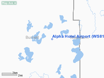
Location & QuickFacts
| FAA Information Effective: | 2008-09-25 |
| Airport Identifier: | WS81 |
| Airport Status: | Operational |
| Longitude/Latitude: | 092-06-30.6700W/45-56-52.8000N
-92.108519/45.948000 (Estimated) |
| Elevation: | 1000 ft / 304.80 m (Estimated) |
| Land: | 60 acres |
| From nearest city: | 12 nautical miles NE of Webster, WI |
| Location: | Burnett County, WI |
| Magnetic Variation: | 01E (1995) |
Owner & Manager
| Ownership: | Privately owned |
| Owner: | David J Littfin |
| Address: | 28579 County Rd
Webster, WI 54893 |
| Phone number: | 715-635-9414 |
| Manager: | David J Littfin |
| Address: | 28579 County Rd
Webster, WI 54893 |
| Phone number: | 715-635-9414 |
Airport Operations and Facilities
| Airport Use: | Private |
| Wind indicator: | Yes |
| Segmented Circle: | No |
| Control Tower: | No |
| Sectional chart: | Green Bay |
| Region: | AGL - Great Lakes |
| Boundary ARTCC: | ZMP - Minneapolis |
| Tie-in FSS: | GRB - Green Bay |
| FSS Toll Free: | 1-800-WX-BRIEF |
Runway Information
Runway 18/36
| Dimension: | 1500 x 100 ft / 457.2 x 30.5 m |
| Surface: | TURF, |
| |
Runway 18 |
Runway 36 |
| Traffic Pattern: | Left | Left |
|
Radio Navigation Aids
| ID |
Type |
Name |
Ch |
Freq |
Var |
Dist |
| BXR | NDB | Big Doctor | | 203.00 | 02E | 13.2 nm |
| SSQ | NDB | Shell Lake | | 212.00 | 01E | 15.4 nm |
| OLG | NDB | Solon Springs | | 388.00 | 01E | 25.4 nm |
| UBE | NDB | Cumberland | | 375.00 | 01E | 26.9 nm |
| SLY | NDB | Seeley | | 344.00 | 01E | 31.8 nm |
| ROS | NDB | Rush City | | 282.00 | 02E | 38.6 nm |
| MZH | NDB | Moose Lake | | 362.00 | 02E | 40.4 nm |
| AHH | NDB | Ameron | | 278.00 | 01E | 41.6 nm |
| SUW | NDB | Bong | | 260.00 | 01E | 44.7 nm |
| OEO | NDB | Osceola | | 233.00 | 01E | 45.4 nm |
| COQ | NDB | Cloquet | | 335.00 | 03E | 47.9 nm |
| JMR | NDB | Mora | | 327.00 | 03E | 48.6 nm |
| RZN | VOR/DME | Siren | 031X | 109.40 | 02E | 13.5 nm |
| HYR | VOR/DME | Hayward | 081X | 113.40 | 03E | 28.0 nm |
| RPD | VOR/DME | Rice Lake | 037X | 110.00 | 01E | 34.9 nm |
Remarks
- PRVDD CLEAR 20:1 APCH SLOPE; AREA 125 FT EITHER SIDE OF RY CNTRLNAND 200 FT RY ENDS IS CLEART OF OBSTNS; AREA 60 FT EITHER SIDE OF RY CNTRLN AND 240 FT OFF RY ENDS IS CLEAR OF RUTS.
Images and information placed above are from
http://www.airport-data.com/airport/WS81/
We thank them for the data!
| General Info
|
| Country |
United States
|
| State |
WISCONSIN
|
| FAA ID |
WS81
|
| Latitude |
45-56-52.800N
|
| Longitude |
092-06-30.670W
|
| Elevation |
1000 feet
|
| Near City |
WEBSTER
|
We don't guarantee the information is fresh and accurate. The data may
be wrong or outdated.
For more up-to-date information please refer to other sources.
|
|


