 |
|
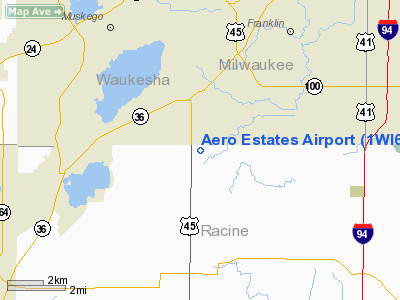
Location & QuickFacts
| FAA Information Effective: | 2008-09-25 |
| Airport Identifier: | 1WI6 |
| Airport Status: | Operational |
| Longitude/Latitude: | 088-03-50.3100W/42-50-25.0590N
-88.063975/42.840294 (Estimated) |
| Elevation: | 825 ft / 251.46 m (Estimated) |
| Land: | 0 acres |
| From nearest city: | 3 nautical miles NW of Raymond Township, WI |
| Location: | Racine County, WI |
| Magnetic Variation: | 01W (1985) |
Owner & Manager
| Ownership: | Privately owned |
| Owner: | Doris E. Carriveau |
| Address: | 218 Hwy 45
Franksville, WI 53126 |
| Phone number: | 414-425-6307 |
| Manager: | Vincent Carriveau |
| Address: | 216 Hwy 45
Franksville, WI 53126 |
| Phone number: | 414-529-2130 |
Airport Operations and Facilities
| Airport Use: | Private |
| Wind indicator: | Yes |
| Segmented Circle: | No |
| Control Tower: | No |
| Landing fee charge: | No |
| Sectional chart: | Chicago |
| Region: | AGL - Great Lakes |
| Boundary ARTCC: | ZAU - Chicago |
| Tie-in FSS: | GRB - Green Bay |
| FSS on Airport: | No |
| FSS Toll Free: | 1-800-WX-BRIEF |
Airport Services
| Airframe Repair: | MINOR |
| Power Plant Repair: | MINOR |
Runway Information
Runway E/W
| Dimension: | 3000 x 115 ft / 914.4 x 35.1 m |
| Surface: | TURF, |
| |
Runway E |
Runway W |
| Traffic Pattern: | Left | Left |
| Displaced threshold: | 500.00 ft | 0.00 ft |
| Obstruction: | 30 ft pline, 300.0 ft from runway | 30 ft pline, 300.0 ft from runway |
|
Radio Navigation Aids
| ID |
Type |
Name |
Ch |
Freq |
Var |
Dist |
| GM | NDB | Teels | | 242.00 | 02W | 4.3 nm |
| RA | NDB | Paser | | 206.00 | 00E | 11.9 nm |
| UES | NDB | Waukesha | | 359.00 | 01W | 14.4 nm |
| BL | NDB | Yanks | | 260.00 | 02W | 15.6 nm |
| LVV | NDB | Lake Lawn | | 404.00 | 00W | 24.9 nm |
| HXF | NDB | Hartford | | 200.00 | 00E | 33.8 nm |
| LLE | NDB | Kettle Moraine | | 329.00 | 01W | 35.3 nm |
| RYV | NDB | Rock River | | 371.00 | 01W | 35.3 nm |
| UNU | NDB | Juneau | | 344.00 | 01W | 45.1 nm |
| JVL | NDB | Janesville | | 375.00 | 03E | 45.2 nm |
| BJB | VOR | West Bend | | 109.80 | 01W | 35.1 nm |
| HRK | VOR/DME | Horlick | 124X | 117.70 | 02W | 12.0 nm |
| BUU | VOR/DME | Burbun | 092X | 114.50 | 01W | 13.9 nm |
| ENW | VOR/DME | Kenosha | 029X | 109.20 | 02W | 15.6 nm |
| LJT | VOR/DME | Timmerman | 072X | 112.50 | 02W | 16.2 nm |
| OBK | VOR/DME | Northbrook | 077X | 113.00 | 02W | 37.5 nm |
| JVL | VOR/DME | Janesville | 090X | 114.30 | 03E | 49.0 nm |
| BAE | VORTAC | Badger | 111X | 116.40 | 02E | 19.2 nm |
| MKE | VOT | Milwaukee | | 109.00 | | 9.8 nm |
Images and information placed above are from
http://www.airport-data.com/airport/1WI6/
We thank them for the data!
| General Info
|
| Country |
United States
|
| State |
WISCONSIN
|
| FAA ID |
1WI6
|
| Latitude |
42-50-25.059N
|
| Longitude |
088-03-50.310W
|
| Elevation |
825 feet
|
| Near City |
RAYMOND TOWNSHIP
|
We don't guarantee the information is fresh and accurate. The data may
be wrong or outdated.
For more up-to-date information please refer to other sources.
|
|


