|
|
Adams County Legion Field Airport |
Adams County Airport
Legion Field |
| IATA: none – ICAO: none – FAA LID: 63C |
| Summary |
| Airport type |
Public |
| Owner |
Adams County |
| Location |
Friendship / Adams, Wisconsin |
| Elevation AMSL |
976 ft / 297 m |
| Coordinates |
43°57′40″N 089°47′17″W / 43.96111°N 89.78806°W / 43.96111; -89.78806 |
| Runways |
| Direction |
Length |
Surface |
| ft |
m |
| 8/26 |
2,825 |
861 |
Turf |
| 15/33 |
3,400 |
1,036 |
Asphalt |
| Statistics (2008) |
| Aircraft operations |
7,070 |
| Based aircraft |
18 |
| Source: Federal Aviation Administration |
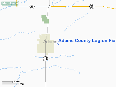
Adams County Airport (FAA LID: 63C), also known as Legion Field, is a county-owned public-use airport located in Adams County, Wisconsin, United States. The airport is one nautical mile (1.85 km) east of the village of Friendship and the city of Adams.
Facilities and aircraft
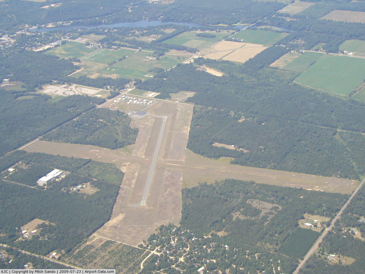
The airport covers an area of 380 acres (150 ha) at an elevation of 976 ft (297 m) above mean sea level. It has two runways: 15/33 is 3,400 by 60 ft (1,000 by 18 m) with an asphalt pavement; 8/26 is 2,825 by 100 ft (861 by 30 m) with a turf surface.
For the 12-month period ending August 12, 2008, the airport had 7,070 aircraft operations, an average of 19 per day: 99% general aviation, 1% air taxi and <1% military. At that time there were 18 aircraft based at this airport: 89% single-engine, 6% multi-engine and 6% ultralight.
The above content comes from Wikipedia and is published under free licenses – click here to read more.
 |
(Click on the photo to enlarge) |
Location & QuickFacts
| FAA Information Effective: | 2008-09-25 |
| Airport Identifier: | 63C |
| Airport Status: | Operational |
| Longitude/Latitude: | 089-47-16.9760W/43-57-40.2200N
-89.788049/43.961172 (Estimated) |
| Elevation: | 976 ft / 297.48 m (Surveyed) |
| Land: | 380 acres |
| From nearest city: | 1 nautical miles E of Friendship (adams), WI |
| Location: | Adams County, WI |
| Magnetic Variation: | 01W (1995) |
Owner & Manager
| Ownership: | Publicly owned |
| Owner: | Adams County |
| Address: | Po Box 278
Friendship, WI 53934 |
| Phone number: | 608-339-4200 |
| Manager: | Mike Scott |
| Address: | Po Box 819
Adams, WI 53910 |
| Phone number: | 608-339-3919 |
Airport Operations and Facilities
| Airport Use: | Open to public |
| Wind indicator: | Yes |
| Segmented Circle: | Yes |
| Control Tower: | No |
| Lighting Schedule: | DUSK-DAWN
ACTVT MIRL RY 15/33 - CTAF. |
| Beacon Color: | Clear-Green (lighted land airport) |
| Landing fee charge: | No |
| Sectional chart: | Chicago |
| Region: | AGL - Great Lakes |
| Boundary ARTCC: | ZAU - Chicago |
| Tie-in FSS: | GRB - Green Bay |
| FSS on Airport: | No |
| FSS Toll Free: | 1-800-WX-BRIEF |
| NOTAMs Facility: | GRB (NOTAM-d service avaliable) |
| Federal Agreements: | NGY |
Airport Communications
Airport Services
| Fuel available: | 100LL
FUEL AVBL 24 HRS WITH CREDIT CARD. |
| Airframe Repair: | NONE |
| Power Plant Repair: | NONE |
| Bottled Oxygen: | NONE |
| Bulk Oxygen: | NONE |
Runway Information
Runway 08/26
| Dimension: | 2825 x 100 ft / 861.1 x 30.5 m |
| Surface: | TURF, Fair Condition |
| |
Runway 08 |
Runway 26 |
| Longitude: | 089-47-33.2800W | 089-46-48.7200W |
| Latitude: | 43-57-36.9700N | 43-57-42.0300N |
| Traffic Pattern: | Left | Left |
| Obstruction: | 53 ft pole, 1400.0 ft from runway, 20 ft right of centerline, 26:1 slope to clear | 54 ft trees, 1250.0 ft from runway, 200 ft left of centerline, 23:1 slope to clear |
|
Runway 15/33
| Dimension: | 3400 x 60 ft / 1036.3 x 18.3 m |
| Surface: | ASPH, Good Condition |
| Weight Limit: | Single wheel: 12500 lbs. |
| Edge Lights: | Medium |
| |
Runway 15 |
Runway 33 |
| Longitude: | 089-47-33.4700W | 089-47-12.1700W |
| Latitude: | 43-57-55.8500N | 43-57-26.0000N |
| Elevation: | 968.00 ft | 976.00 ft |
| Alignment: | 127 | 127 |
| Traffic Pattern: | Left | Left |
| Markings: | Non-precision instrument, Fair Condition | Non-precision instrument, Fair Condition |
| Runway End Identifier: | No | No |
| Centerline Lights: | No | No |
| Touchdown Lights: | No | No |
| Obstruction: | 46 ft trees, 1400.0 ft from runway, 200 ft right of centerline, 26:1 slope to clear | 32 ft trees, 850.0 ft from runway, 300 ft right of centerline, 20:1 slope to clear |
|
Radio Navigation Aids
| ID |
Type |
Name |
Ch |
Freq |
Var |
Dist |
| ISW | NDB | Wisconsin Rapids | | 215.00 | 01W | 24.3 nm |
| HBW | NDB | Kickapoo | | 251.00 | 03E | 30.0 nm |
| CMY | NDB | Mccoy | | 412.00 | 00E | 37.0 nm |
| PCZ | NDB | Waupaca | | 382.00 | 01W | 40.1 nm |
| MFI | NDB | Marshfield | | 391.00 | 00E | 44.3 nm |
| VIQ | NDB | Neillsville | | 368.00 | 01W | 47.6 nm |
| BCK | NDB | Black River Falls | | 362.00 | 00E | 49.1 nm |
| VOK | TACAN | Volk | 041X | | 00E | 20.4 nm |
| LNR | VOR/DME | Lone Rock | 075X | 112.80 | 00E | 42.8 nm |
| DLL | VORTAC | Dells | 117X | 117.00 | 03E | 24.7 nm |
| STE | VORTAC | Stevens Point | 043X | 110.60 | 01W | 36.7 nm |
Remarks
- ULTRALIGHT ACTVTY ON & IN VCNTY OF ARPT.
- ACFT DEP RY 15 TURN TO A HEADING OF 180 AFT TAKEOFF.
Images and information placed above are from
http://www.airport-data.com/airport/63C/
We thank them for the data!
| General Info
|
| Country |
United States
|
| State |
WISCONSIN
|
| FAA ID |
63C
|
| Latitude |
43-57-40.220N
|
| Longitude |
089-47-16.976W
|
| Elevation |
976 feet
|
| Near City |
FRIENDSHIP (ADAMS)
|
We don't guarantee the information is fresh and accurate. The data may
be wrong or outdated.
For more up-to-date information please refer to other sources.
|
|