 |
|
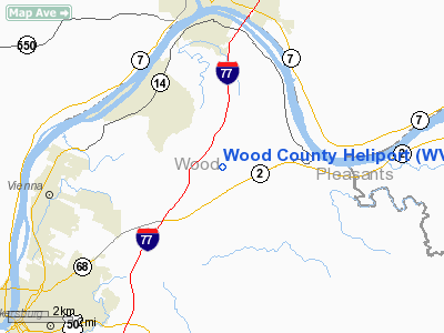
Location & QuickFacts
| FAA Information Effective: | 2008-09-25 |
| Airport Identifier: | WV73 |
| Airport Status: | Operational |
| Longitude/Latitude: | 081-26-34.4000W/39-20-17.3000N
-81.442889/39.338139 (Estimated) |
| Elevation: | 608 ft / 185.32 m (Estimated) |
| Land: | 0 acres |
| From nearest city: | 0 nautical miles N of Parkersburg, WV |
| Location: | Wood County, WV |
| Magnetic Variation: | 07W (1995) |
Owner & Manager
| Ownership: | Publicly owned |
| Owner: | City Of Parkersburg |
| Address: | 800 Garfield Ave
Parkersburg, WV 26101 |
| Phone number: | 304-424-2204 |
| Manager: | Michael A King
OTHER CONTACT SHERRY JOHNSTON 304-424-2811 |
| Address: | 800 Garfield Ave
Parkersburg, WV 26101 |
| Phone number: | 304-424-2204 |
Airport Operations and Facilities
| Airport Use: | Private
MEDICAL USE. |
| Wind indicator: | Yes |
| Segmented Circle: | No |
| Control Tower: | No |
| Lighting Schedule: | 24 HRS |
| Beacon Color: | Clear-Green-Yellow (heliport) |
| Sectional chart: | Cincinnati |
| Region: | AEA - Eastern |
| Boundary ARTCC: | ZID - Indianapolis |
| Tie-in FSS: | EKN - Elkins |
| FSS Toll Free: | 1-800-WX-BRIEF |
Airport Communications
Runway Information
Helipad H1
| Dimension: | 60 x 60 ft / 18.3 x 18.3 m |
| Surface: | CONC, Good Condition |
| |
Runway H1 |
Runway |
| Traffic Pattern: | Left | Left |
|
Radio Navigation Aids
| ID |
Type |
Name |
Ch |
Freq |
Var |
Dist |
| PKB | FAN MARKER | Marietta Ohio | | | 03W | 3.1 nm |
| UGS | NDB | University | | 250.00 | 06W | 32.1 nm |
| HRA | NDB | Zanesville | | 204.00 | 06W | 40.7 nm |
| GAS | NDB | Gallipolis | | 420.00 | 07W | 45.2 nm |
| ZZV | VOR/DME | Zanesville | 051X | 111.40 | 06W | 41.8 nm |
| JPU | VORTAC | Parkersburg | 023X | 108.60 | 03W | 7.0 nm |
| HNN | VORTAC | Henderson | 106X | 115.90 | 03W | 44.4 nm |
Remarks
- PRVDD 12500 LBS MAX GWT; NO IFR OPNS; CLEAR 8:1 INGRESS/EGRESS; OBSTRUCTION LGTS ON PARKING LOT LGT POLES & LGTD WINDSOCK ON CORNER OF OBSTRUCTION LAUNDRY BLDG; REMOVAL & TOPPING OF OBSTRUCTING TREES ON DEP PATH.
Images and information placed above are from
http://www.airport-data.com/airport/WV73/
We thank them for the data!
| General Info
|
| Country |
United States
|
| State |
WEST VIRGINIA
|
| FAA ID |
WV73
|
| Latitude |
39-20-17.300N
|
| Longitude |
081-26-34.400W
|
| Elevation |
608 feet
|
| Near City |
PARKERSBURG
|
We don't guarantee the information is fresh and accurate. The data may
be wrong or outdated.
For more up-to-date information please refer to other sources.
|
|


