 |
|
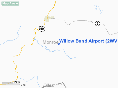
Location & QuickFacts
| FAA Information Effective: | 2008-09-25 |
| Airport Identifier: | 2WV5 |
| Airport Status: | Operational |
| Longitude/Latitude: | 080-31-05.9400W/37-32-48.0000N
-80.518317/37.546667 (Estimated) |
| Elevation: | 2150 ft / 655.32 m (Estimated) |
| Land: | 400 acres |
| From nearest city: | 4 nautical miles S of Union, WV |
| Location: | Monroe County, WV |
| Magnetic Variation: | () |
Owner & Manager
| Ownership: | Privately owned |
| Owner: | Frank Talbot |
| Address: | H C 76, Box 16
Union, WV 24983 |
| Phone number: | 304-772-3579 |
| Manager: | Frank Talbot |
| Address: | H C 76, Box 16
Union, WV 24983 |
| Phone number: | 304-772-3579 |
Airport Operations and Facilities
| Airport Use: | Private |
| Wind indicator: | Yes |
| Control Tower: | No |
| Sectional chart: | Cincinnati |
| Region: | AEA - Eastern |
| Boundary ARTCC: | ZID - Indianapolis |
| Tie-in FSS: | EKN - Elkins |
| FSS Toll Free: | 1-800-WX-BRIEF |
Runway Information
Runway 03/21
| Dimension: | 1540 x 40 ft / 469.4 x 12.2 m |
| Surface: | TURF, |
| |
Runway 03 |
Runway 21 |
| Traffic Pattern: | Left | Left |
|
Radio Navigation Aids
| ID |
Type |
Name |
Ch |
Freq |
Var |
Dist |
| LW | NDB | Bushi | | 346.00 | 06W | 14.4 nm |
| TEC | NDB | Tech | | 368.00 | 06W | 21.0 nm |
| CNQ | NDB | Callahan | | 379.00 | 05W | 24.3 nm |
| VIT | NDB | Vinton | | 277.00 | 06W | 36.7 nm |
| IJZ | NDB | Nicholas | | 272.00 | 05W | 42.3 nm |
| HLX | NDB | Hillsville | | 269.00 | 06W | 49.3 nm |
| ODR | VOR | Woodrum | | 114.90 | 06W | 29.0 nm |
| RNL | VOR | Rainelle | | 116.60 | 04W | 29.2 nm |
| LWB | VOR/DME | Greenbrier | 107Y | 116.05 | 08W | 20.0 nm |
| ROA | VORTAC | Roanoke | 031X | 109.40 | 04W | 24.6 nm |
| PSK | VORTAC | Pulaski | 115X | 116.80 | 06W | 29.1 nm |
| BKW | VORTAC | Beckley | 124X | 117.70 | 06W | 32.0 nm |
| BLF | VORTAC | Bluefield | 037X | 110.00 | 03W | 35.3 nm |
Images and information placed above are from
http://www.airport-data.com/airport/2WV5/
We thank them for the data!
|
|


