 |
|
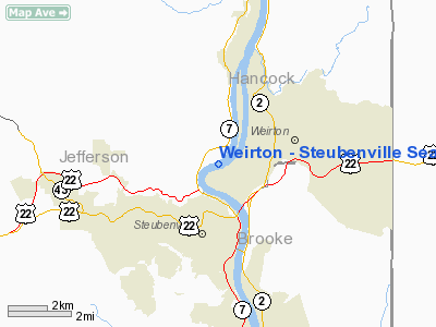
Weirton - Steubenville Seaplane Base Airport |
Location & QuickFacts
| FAA Information Effective: | 2008-09-25 |
| Airport Identifier: | WV42 |
| Airport Status: | Operational |
| Longitude/Latitude: | 080-37-19.2660W/40-23-52.2440N
-80.622018/40.397846 (Estimated) |
| Elevation: | 644 ft / 196.29 m (Estimated) |
| Land: | 57 acres |
| From nearest city: | 2 nautical miles S of Weirton, WV |
| Location: | Hancock County, WV |
| Magnetic Variation: | 07W (1985) |
Owner & Manager
| Ownership: | Privately owned |
| Owner: | Jones Air, Inc |
| Address: | 523 S. Wadesboro Blvd.
Mt. Gilead, NC 27306 |
| Phone number: | 704-985-4714 |
| Manager: | David E. Jones |
| Address: | 523 S. Wadesboro Blvd
Mt. Gilead, NC 27306 |
| Phone number: | 704-985-4714 |
Airport Operations and Facilities
| Airport Use: | Private |
| Wind indicator: | No |
| Segmented Circle: | No |
| Control Tower: | No |
| Landing fee charge: | No |
| Sectional chart: | Detroit |
| Region: | AEA - Eastern |
| Boundary ARTCC: | ZOB - Cleveland |
| Tie-in FSS: | EKN - Elkins |
| FSS on Airport: | No |
| FSS Toll Free: | 1-800-WX-BRIEF |
Runway Information
Runway 06/24
| Dimension: | 5000 x 500 ft / 1524.0 x 152.4 m |
| Surface: | WATER, |
| |
Runway 06 |
Runway 24 |
| Traffic Pattern: | Left | Left |
|
Radio Navigation Aids
| ID |
Type |
Name |
Ch |
Freq |
Var |
Dist |
| CFX | NDB | Cadiz | | 239.00 | 07W | 20.4 nm |
| TSO | NDB | Tolson | | 395.00 | 07W | 23.1 nm |
| PNU | NDB | Washington County | | 255.00 | 08W | 26.0 nm |
| MKP | NDB | Mc Keesport | | 287.00 | 07W | 38.6 nm |
| UCP | NDB | Castle | | 272.00 | 09W | 38.7 nm |
| HBD | NDB | Hubbard | | 408.00 | 08W | 45.6 nm |
| HLG | VOR/DME | Wheeling | 059X | 112.20 | 07W | 8.6 nm |
| AIR | VOR/DME | Bellaire | 118X | 117.10 | 07W | 24.6 nm |
| AGC | VOR/DME | Allegheny | 037X | 110.00 | 09W | 27.6 nm |
| CTW | VOR/DME | Newcomerstown | 055X | 111.80 | 07W | 40.5 nm |
| BSV | VOR/DME | Briggs | 071X | 112.40 | 04W | 42.3 nm |
| MMJ | VORTAC | Montour | 057X | 112.00 | 08W | 20.3 nm |
| EWC | VORTAC | Ellwood City | 105X | 115.80 | 08W | 31.8 nm |
| CAK | VOT | Akron/canton Regional | | 110.60 | | 48.7 nm |
Images and information placed above are from
http://www.airport-data.com/airport/WV42/
We thank them for the data!
| General Info
|
| Country |
United States
|
| State |
WEST VIRGINIA
|
| FAA ID |
WV42
|
| Latitude |
40-23-52.244N
|
| Longitude |
080-37-19.266W
|
| Elevation |
644 feet
|
| Near City |
WEIRTON
|
We don't guarantee the information is fresh and accurate. The data may
be wrong or outdated.
For more up-to-date information please refer to other sources.
|
|


