 |
|
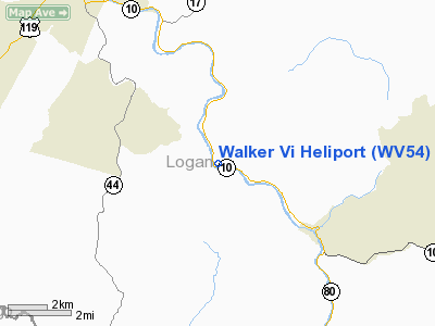
Location & QuickFacts
| FAA Information Effective: | 2008-09-25 |
| Airport Identifier: | WV54 |
| Airport Status: | Operational |
| Longitude/Latitude: | 081-55-58.0000W/37-46-19.0000N
-81.932778/37.771944 (Estimated) |
| Elevation: | 700 ft / 213.36 m (Estimated) |
| Land: | 0 acres |
| From nearest city: | 0 nautical miles N of Rita, WV |
| Location: | Logan County, WV |
| Magnetic Variation: | 05W (1990) |
Owner & Manager
| Ownership: | Privately owned |
| Owner: | Cecil I Walker Machinery Co. |
| Address: | P.o. Box 2427
Charleston, WV 25329 |
| Phone number: | 304-949-6400 |
| Manager: | Chris Hughes |
| Address: | P.o. Box 2427
Charleston, WV 25329 |
| Phone number: | 304-949-6400 |
Airport Operations and Facilities
| Airport Use: | Private |
| Wind indicator: | Yes |
| Segmented Circle: | No |
| Control Tower: | No |
| Sectional chart: | Cincinnati |
| Region: | AEA - Eastern |
| Boundary ARTCC: | ZID - Indianapolis |
| Tie-in FSS: | EKN - Elkins |
| FSS on Airport: | No |
| FSS Toll Free: | 1-800-WX-BRIEF |
Runway Information
Helipad H1
| Dimension: | 20 x 20 ft / 6.1 x 6.1 m |
| Surface: | CONC, |
| |
Runway H1 |
Runway |
| Traffic Pattern: | Left | Left |
|
Radio Navigation Aids
| ID |
Type |
Name |
Ch |
Freq |
Var |
Dist |
| GTC | NDB | Guyandot | | 293.00 | 03W | 1.3 nm |
| HVQ | VORTAC | Charleston | 121X | 117.40 | 03W | 35.6 nm |
| BKW | VORTAC | Beckley | 124X | 117.70 | 06W | 38.5 nm |
| BLF | VORTAC | Bluefield | 037X | 110.00 | 03W | 45.0 nm |
| CRW | VOT | Charleston Kanawha | | 108.80 | | 39.5 nm |
Remarks
- PROVDD LARGEST CLASS OF HELICOPTER IS 12500 MGW OR LESS; DALGT OPNS ONLY; IFR OPNS ARE NOT CONDUCTED; YOU ASSURE ADEQUATE CONTROL OF VEHICULAR TFC & PEDESTRIAN ACTIVITY DURING OPNS; YOU ARE AWARE OF FIXED WING ACFT UTILIZING GRASS AIRFIELD LESS THAN A MILE FM YOUR HELIPORT.
Images and information placed above are from
http://www.airport-data.com/airport/WV54/
We thank them for the data!
| General Info
|
| Country |
United States
|
| State |
WEST VIRGINIA
|
| FAA ID |
WV54
|
| Latitude |
37-46-19.000N
|
| Longitude |
081-55-58.000W
|
| Elevation |
700 feet
|
| Near City |
RITA
|
We don't guarantee the information is fresh and accurate. The data may
be wrong or outdated.
For more up-to-date information please refer to other sources.
|
|


