 |
|
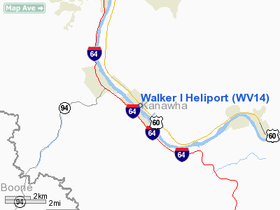
Location & QuickFacts
| FAA Information Effective: | 2008-09-25 |
| Airport Identifier: | WV14 |
| Airport Status: | Operational |
| Longitude/Latitude: | 081-31-58.4250W/38-13-40.3660N
-81.532896/38.227879 (Estimated) |
| Elevation: | 590 ft / 179.83 m (Estimated) |
| Land: | 1 acres |
| From nearest city: | 0 nautical miles N of Belle, WV |
| Location: | Kanawha County, WV |
| Magnetic Variation: | 06W (1990) |
Owner & Manager
| Ownership: | Privately owned |
| Owner: | Cecil I Walker Machinery Co |
| Address: | P O Box 2427
Charleston, WV 25329 |
| Phone number: | 304-949-6400 |
| Manager: | Chris Hughes |
| Address: | P O Box 2427
Charleston, WV 25329 |
| Phone number: | 304-949-6400 |
Airport Operations and Facilities
| Airport Use: | Private
PRIVATE USE HELIPORT - PRIOR PERMISSION REQUIRED. |
| Wind indicator: | Yes |
| Segmented Circle: | No |
| Control Tower: | No |
| Lighting Schedule: | PHONE REQ
FOR PERIMETER LGTS CALL 304-949-6400. |
| Sectional chart: | Cincinnati |
| Region: | AEA - Eastern |
| Boundary ARTCC: | ZID - Indianapolis |
| Tie-in FSS: | EKN - Elkins |
| FSS Toll Free: | 1-800-WX-BRIEF |
Runway Information
Helipad H1
| Dimension: | 26 x 26 ft / 7.9 x 7.9 m
CIRCULAR PAD. |
| Surface: | CONC, |
| |
Runway H1 |
Runway |
| Traffic Pattern: | Left | Left |
|
Radio Navigation Aids
| ID |
Type |
Name |
Ch |
Freq |
Var |
Dist |
| IJZ | NDB | Nicholas | | 272.00 | 05W | 29.1 nm |
| GTC | NDB | Guyandot | | 293.00 | 03W | 32.2 nm |
| GAS | NDB | Gallipolis | | 420.00 | 07W | 46.9 nm |
| JTM | NDB | Braxton | | 234.00 | 06W | 49.8 nm |
| RNL | VOR | Rainelle | | 116.60 | 04W | 37.6 nm |
| HVQ | VORTAC | Charleston | 121X | 117.40 | 03W | 13.4 nm |
| BKW | VORTAC | Beckley | 124X | 117.70 | 06W | 33.2 nm |
| HNN | VORTAC | Henderson | 106X | 115.90 | 03W | 39.2 nm |
| CRW | VOT | Charleston Kanawha | | 108.80 | | 9.2 nm |
Remarks
- PRVDD NO IFR OPNS CONDUCTED AT ARPT; PROCEDURES AND ESTABLISHED TO MINIMIZE THE IMPACT OF ACFT NOISE OVER NEAR BY RESIDENTS; AND HELICOPTERS UTILIZING THIS HELIPORT BE RESTRICTED TO THOSE WEIGHING 12,500 LBS.
Images and information placed above are from
http://www.airport-data.com/airport/WV14/
We thank them for the data!
| General Info
|
| Country |
United States
|
| State |
WEST VIRGINIA
|
| FAA ID |
WV14
|
| Latitude |
38-13-40.366N
|
| Longitude |
081-31-58.425W
|
| Elevation |
590 feet
|
| Near City |
BELLE
|
We don't guarantee the information is fresh and accurate. The data may
be wrong or outdated.
For more up-to-date information please refer to other sources.
|
|


