 |
|
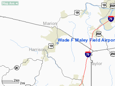
Wade F Maley Field Airport |
Location & QuickFacts
| FAA Information Effective: | 2008-09-25 |
| Airport Identifier: | 6W0 |
| Airport Status: | Operational |
| Longitude/Latitude: | 080-16-36.3080W/39-24-25.3100N
-80.276752/39.407031 (Estimated) |
| Elevation: | 962 ft / 293.22 m (Estimated) |
| Land: | 10 acres |
| From nearest city: | 1 nautical miles NE of Shinnston, WV |
| Location: | Harrison County, WV |
| Magnetic Variation: | 07W (1985) |
Owner & Manager
| Ownership: | Privately owned |
| Owner: | Woody Maley |
| Address: | Rt 3 Box 157
Shinnston, WV 26431 |
| Phone number: | 304-592-2426 |
| Manager: | Woody Maley |
| Address: | Rt 2 Box 155
Shinnston, WV 26431 |
| Phone number: | 304-592-2426
ALTERNATE #: (304) 592-2400. |
Airport Operations and Facilities
| Airport Use: | Open to public |
| Wind indicator: | Yes |
| Segmented Circle: | No |
| Control Tower: | No |
| Landing fee charge: | No |
| Sectional chart: | Cincinnati |
| Region: | AEA - Eastern |
| Boundary ARTCC: | ZOB - Cleveland |
| Tie-in FSS: | EKN - Elkins |
| FSS on Airport: | No |
| FSS Toll Free: | 1-800-WX-BRIEF |
| NOTAMs Facility: | EKN (NOTAM-d service avaliable) |
Airport Communications
Airport Services
Runway Information
Runway 05/23
| Dimension: | 2265 x 45 ft / 690.4 x 13.7 m |
| Surface: | TURF, Good Condition |
| |
Runway 05 |
Runway 23 |
| Traffic Pattern: | Left | Right |
| Obstruction: | 4 ft pole, 120 ft left of centerline | 25 ft gnd, 0.0 ft from runway, 120 ft right of centerline |
|
Radio Navigation Aids
| ID |
Type |
Name |
Ch |
Freq |
Var |
Dist |
| RQY | NDB | Randolph County | | 284.00 | 07W | 36.5 nm |
| VV | NDB | Camor | | 299.00 | 08W | 37.7 nm |
| PNU | NDB | Washington County | | 255.00 | 08W | 44.6 nm |
| JTM | NDB | Braxton | | 234.00 | 06W | 46.8 nm |
| CKB | VOR/DME | Clarksburg | 073X | 112.60 | 04W | 9.3 nm |
| AIR | VOR/DME | Bellaire | 118X | 117.10 | 07W | 44.4 nm |
| MGW | VORTAC | Morgantown | 053X | 111.60 | 05W | 21.3 nm |
| EKN | VORTAC | Elkins | 089X | 114.20 | 07W | 30.7 nm |
Remarks
- TELEPHONE IN TRAILER USED AS TERMINAL.
- 15 FT DROP-OFF 45 FT FM CNTRLN FULL LENGTH BOTH SIDES RY.
- APPROACH RWY 23 FROM NW; DEPART RWY 05 TO NW DUE TO RIDGE NE OF ARPT.
- DEER ON & INVOF ARPT.
- UNLIMITED VEHICLE ACCESS TO ARPT.
- RY 23 15 FT DROP-OFF 10 FT FM THLD 0B.
- RY 05 20 FT DROP-OFF 15 FT FM THLD 0B.
- RY 05/23 +20 FT POLE MIDDLE OF RY 75 FT L&R OF CNTRLN.
- 400 FT RIDGE/TREES 1100 FT FM THLD RY 23 0B.
- HIGH TERRAIN ALL QUADRANTS.
Images and information placed above are from
http://www.airport-data.com/airport/6W0/
We thank them for the data!
| General Info
|
| Country |
United States
|
| State |
WEST VIRGINIA
|
| FAA ID |
6W0
|
| Latitude |
39-24-25.310N
|
| Longitude |
080-16-36.308W
|
| Elevation |
962 feet
|
| Near City |
SHINNSTON
|
We don't guarantee the information is fresh and accurate. The data may
be wrong or outdated.
For more up-to-date information please refer to other sources.
|
|


