 |
|
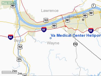
Va Medical Center Heliport |
Location & QuickFacts
| FAA Information Effective: | 2008-09-25 |
| Airport Identifier: | 3WV2 |
| Airport Status: | Operational |
| Longitude/Latitude: | 082-31-00.0000W/38-22-40.0000N
-82.516667/38.377778 (Estimated) |
| Elevation: | 885 ft / 269.75 m (Estimated) |
| Land: | 100 acres |
| From nearest city: | 2 nautical miles N of Huntington, WV |
| Location: | Wayne County, WV |
| Magnetic Variation: | () |
Owner & Manager
| Ownership: | Privately owned |
| Owner: | Dept Of Veterans Affairs |
| Address: | Va Medical Center, 1540 Spring Valley Dr
Huntington, WV 25704 |
| Phone number: | 304-429-6755 |
| Manager: | Chief, Faclity And Plant Mgmt |
| Address: | Va Medical Center, 1540 Spring Valley Dr
Huntington, WV 25704 |
| Phone number: | 304-429-6755
ARPT MGR PHONE EXTN 2374. |
Airport Operations and Facilities
| Airport Use: | Private |
| Wind indicator: | Yes |
| Segmented Circle: | Yes |
| Control Tower: | No |
| Sectional chart: | Cincinnati |
| Region: | AEA - Eastern |
| Boundary ARTCC: | ZID - Indianapolis |
| Tie-in FSS: | EKN - Elkins |
| FSS Toll Free: | 1-800-WX-BRIEF |
Runway Information
Helipad H1
| Dimension: | 48 x 48 ft / 14.6 x 14.6 m |
| Surface: | ASPH, |
| |
Runway H1 |
Runway |
| Traffic Pattern: | Left | Left |
|
Radio Navigation Aids
| ID |
Type |
Name |
Ch |
Freq |
Var |
Dist |
| AJY | FAN MARKER | Ashland | | | 03W | 17.0 nm |
| PMH | NDB | Portsmouth | | 373.00 | 04W | 28.8 nm |
| GAS | NDB | Gallipolis | | 420.00 | 07W | 32.1 nm |
| GTC | NDB | Guyandot | | 293.00 | 03W | 45.9 nm |
| ECB | VORTAC | Newcombe | 041X | 110.40 | 02W | 22.8 nm |
| YRK | VORTAC | York | 075X | 112.80 | 05W | 27.0 nm |
| HNN | VORTAC | Henderson | 106X | 115.90 | 03W | 32.3 nm |
| HVQ | VORTAC | Charleston | 121X | 117.40 | 03W | 35.2 nm |
| CRW | VOT | Charleston Kanawha | | 108.80 | | 43.5 nm |
Remarks
- 185 FT TWR 58 FT E; 49 FT BLDG 89 FT SW; 30 FT PLINES 110 FT NE; 15 FT POLE 160 FT N; AND 89 FT POLE 650 FT NW.
- PRVDD A CLEAR 8:1 INGRESS/EGRESS; OPER IN A MANNER TO MINIMIZE NOISE; VEHICULAR TFC AROUND SITE CONTROLLED; IF NGT TIME OPNS, A LGTD WINDSOCK IS USED AND PERIMETER LGTS INSTALLED.
Images and information placed above are from
http://www.airport-data.com/airport/3WV2/
We thank them for the data!
| General Info
|
| Country |
United States
|
| State |
WEST VIRGINIA
|
| FAA ID |
WV05
|
| Latitude |
39-24-57.358N
|
| Longitude |
077-54-47.988W
|
| Elevation |
496 feet
|
| Near City |
MARTINSBURG
|
We don't guarantee the information is fresh and accurate. The data may
be wrong or outdated.
For more up-to-date information please refer to other sources.
|
|


