 |
|
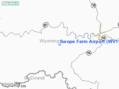
Location & QuickFacts
| FAA Information Effective: | 2008-09-25 |
| Airport Identifier: | WV11 |
| Airport Status: | Operational |
| Longitude/Latitude: | 081-37-09.3900W/37-33-59.4030N
-81.619275/37.566501 (Estimated) |
| Elevation: | 1802 ft / 549.25 m (Surveyed) |
| Land: | 0 acres |
| From nearest city: | 2 nautical miles E of Fan Rock, WV |
| Location: | Wyoming County, WV |
| Magnetic Variation: | 05W (1985) |
Owner & Manager
| Ownership: | Privately owned |
| Owner: | Swope Construction |
| Address: | Chandler Swope, 1325 Bluefield Ave
Bluefield, WV 24701 |
| Phone number: | 304-325-8146 |
| Manager: | Chandler Swope |
| Address: | 1325 Bluefield Ave
Bluefield, WV 24701 |
| Phone number: | 304-325-8146 |
Airport Operations and Facilities
| Airport Use: | Private |
| Wind indicator: | Yes |
| Segmented Circle: | No |
| Control Tower: | No |
| Lighting Schedule: | RDO-CTL
ACTVT LIRL RY 07/25 & ROTG BCN - 122.9. |
| Beacon Color: | Clear-Green (lighted land airport) |
| Landing fee charge: | No |
| Sectional chart: | Cincinnati |
| Region: | AEA - Eastern |
| Boundary ARTCC: | ZID - Indianapolis |
| Tie-in FSS: | EKN - Elkins |
| FSS on Airport: | No |
| FSS Toll Free: | 1-800-WX-BRIEF |
Runway Information
Runway 07/25
| Dimension: | 1250 x 30 ft / 381.0 x 9.1 m |
| Surface: | ASPH, |
| Edge Lights: | Low |
| |
Runway 07 |
Runway 25 |
| Traffic Pattern: | Left | Left |
|
Radio Navigation Aids
| ID |
Type |
Name |
Ch |
Freq |
Var |
Dist |
| GTC | NDB | Guyandot | | 293.00 | 03W | 18.9 nm |
| MK | NDB | Suzze | | 335.00 | 06W | 42.8 nm |
| IJZ | NDB | Nicholas | | 272.00 | 05W | 49.4 nm |
| RNL | VOR | Rainelle | | 116.60 | 04W | 45.8 nm |
| GZG | VOR/DME | Glade Spring | 039X | 110.20 | 02W | 49.7 nm |
| BLF | VORTAC | Bluefield | 037X | 110.00 | 03W | 25.6 nm |
| BKW | VORTAC | Beckley | 124X | 117.70 | 06W | 26.9 nm |
| HVQ | VORTAC | Charleston | 121X | 117.40 | 03W | 47.6 nm |
| CRW | VOT | Charleston Kanawha | | 108.80 | | 48.5 nm |
Images and information placed above are from
http://www.airport-data.com/airport/WV11/
We thank them for the data!
| General Info
|
| Country |
United States
|
| State |
WEST VIRGINIA
|
| FAA ID |
WV11
|
| Latitude |
37-33-59.403N
|
| Longitude |
081-37-09.390W
|
| Elevation |
1802 feet
|
| Near City |
FAN ROCK
|
We don't guarantee the information is fresh and accurate. The data may
be wrong or outdated.
For more up-to-date information please refer to other sources.
|
|


