 |
|
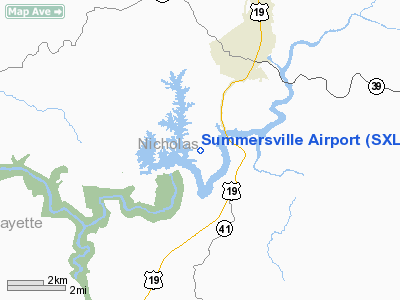
Location & QuickFacts
| FAA Information Effective: | 2008-09-25 |
| Airport Identifier: | SXL |
| Airport Status: | Operational |
| Longitude/Latitude: | 080-52-14.9000W/38-13-53.9000N
-80.870806/38.231639 (Estimated) |
| Elevation: | 1820 ft / 554.74 m (Surveyed) |
| Land: | 43 acres |
| From nearest city: | 3 nautical miles S of Summersville, WV |
| Location: | Nicholas County, WV |
| Magnetic Variation: | 07W (2000) |
Owner & Manager
| Ownership: | Publicly owned |
| Owner: | Usace
U.S. ARMY CORPS OF ENGINEERS. |
| Address: | Lea Bodmer, Realty Specialist, 502 Eigth St
Huntington, WV 25701 |
| Phone number: | 304-399-5928 |
| Manager: | Gerald Rader Ii
AND NICHOLAS CO ARPT AUTH. |
| Address: | 602 Lincoln St
Summersville, WV 26651 |
| Phone number: | 304-872-3660 |
Airport Operations and Facilities
| Airport Use: | Open to public |
| Wind indicator: | Yes |
| Segmented Circle: | No |
| Control Tower: | No |
| Lighting Schedule: | DUSK-DAWN
ACTVT MIRL RY 04-22 - CTAF. |
| Beacon Color: | Clear-Green (lighted land airport) |
| Landing fee charge: | No |
| Sectional chart: | Cincinnati |
| Region: | AEA - Eastern |
| Boundary ARTCC: | ZID - Indianapolis |
| Tie-in FSS: | EKN - Elkins |
| FSS on Airport: | No |
| FSS Toll Free: | 1-800-WX-BRIEF |
| NOTAMs Facility: | EKN (NOTAM-d service avaliable) |
| Federal Agreements: | N |
Airport Communications
| CTAF: | 122.800 |
| Unicom: | 122.800 |
Airport Services
| Fuel available: | 100LLA
FUEL AVAILABLE AFT HRS BY PRIOR ARRANGEMENT CALL 304-872-3660. |
| Airframe Repair: | NONE |
| Power Plant Repair: | NONE |
| Bottled Oxygen: | NONE |
| Bulk Oxygen: | NONE |
Runway Information
Runway 04/22
| Dimension: | 3015 x 50 ft / 919.0 x 15.2 m |
| Surface: | ASPH, Good Condition |
| Edge Lights: | Medium |
| |
Runway 04 |
Runway 22 |
| Longitude: | 080-52-26.2291W | 080-52-03.5944W |
| Latitude: | 38-13-41.9360N | 38-14-05.7917N |
| Elevation: | 1808.00 ft | 1820.00 ft |
| Alignment: | 37 | 127 |
| ILS Type: | SDF
| |
| Traffic Pattern: | Left | Left |
| Markings: | Non-precision instrument, Poor Condition
RYW 04 MARKINGS BADLY FADED | Non-precision instrument, Poor Condition
RWY 22 MARKINGS BADLY FADED |
| VASI: | | 2-box on left side
VASI OTS INDEFLY. |
| Runway End Identifier: | Yes
& 22 REIL OTS INDEFLY. | Yes |
| Obstruction: | 35 ft trees, 200.0 ft from runway, 135 ft right of centerline
RY 04 HAS + 35 FT TREES 160 FT FM THLD 110 FT L. | 35 ft trees, 200.0 ft from runway, 220 ft right of centerline
RY 22 HAS +15 FT KNOLL WITH BRUSH 0-100 FT FM THLD 100 FT R; 10 FT BRUSH 110 FT FM THLD 125 FT L TO 125 FT R. |
|
Radio Navigation Aids
| ID |
Type |
Name |
Ch |
Freq |
Var |
Dist |
| IJZ | NDB | Nicholas | | 272.00 | 05W | 4.1 nm |
| JTM | NDB | Braxton | | 234.00 | 06W | 29.2 nm |
| LW | NDB | Bushi | | 346.00 | 06W | 33.1 nm |
| RNL | VOR | Rainelle | | 116.60 | 04W | 15.7 nm |
| LWB | VOR/DME | Greenbrier | 107Y | 116.05 | 08W | 31.7 nm |
| BKW | VORTAC | Beckley | 124X | 117.70 | 06W | 29.7 nm |
| HVQ | VORTAC | Charleston | 121X | 117.40 | 03W | 43.0 nm |
| CRW | VOT | Charleston Kanawha | | 108.80 | | 35.1 nm |
Remarks
- DEER ON & INVOF ARPT.
- RY 04 50 FT DROP-OFF 160 FT FM THLD 0B.
- RY 22 30 FT DROP-OFF 120 FT FM THLD 0B.
- RY 4/22 TREES PENETRATING FINAL APPROACH SURFACES
Images and information placed above are from
http://www.airport-data.com/airport/SXL/
We thank them for the data!
| General Info
|
| Country |
United States
|
| State |
WEST VIRGINIA
|
| FAA ID |
SXL
|
| Latitude |
38-13-53.900N
|
| Longitude |
080-52-14.900W
|
| Elevation |
1820 feet
|
| Near City |
SUMMERSVILLE
|
We don't guarantee the information is fresh and accurate. The data may
be wrong or outdated.
For more up-to-date information please refer to other sources.
|
|


