 |
|
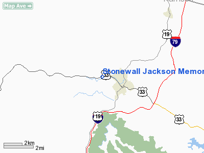
Stonewall Jackson Memorial Hospital Heliport |
Location & QuickFacts
| FAA Information Effective: | 2008-09-25 |
| Airport Identifier: | WV75 |
| Airport Status: | Operational |
| Longitude/Latitude: | 080-29-31.3700W/39-02-53.3700N
-80.492047/39.048158 (Estimated) |
| Elevation: | 101 ft / 30.78 m (Estimated) |
| Land: | 0 acres |
| From nearest city: | 0 nautical miles N of Weston, WV |
| Location: | Lewis County, WV |
| Magnetic Variation: | 07W (1995) |
Owner & Manager
| Ownership: | Privately owned |
| Owner: | Stonewall Jackson Mem Hosp |
| Address: | Rt 4 Box 10
Weston, WV 26452 |
| Phone number: | 304-269-8000 |
| Manager: | Rusty Simpson |
| Address: | Rt 4 Box 10
Weston, WV 26452 |
| Phone number: | 304-269-8000 |
Airport Operations and Facilities
| Airport Use: | Private
MEDICAL USE. |
| Wind indicator: | Yes |
| Segmented Circle: | No |
| Control Tower: | No |
| Lighting Schedule: | PHONE REQ
FOR PERIMETER LGTS CALL 304-269-8000. |
| Sectional chart: | Cincinnati |
| Region: | AEA - Eastern |
| Boundary ARTCC: | ZID - Indianapolis |
| Tie-in FSS: | EKN - Elkins |
| FSS Toll Free: | 1-800-WX-BRIEF |
Runway Information
Helipad H1
| Dimension: | 30 x 30 ft / 9.1 x 9.1 m |
| Surface: | CONC, Good Condition |
| |
Runway H1 |
Runway |
| Traffic Pattern: | Left | Left |
|
Radio Navigation Aids
| ID |
Type |
Name |
Ch |
Freq |
Var |
Dist |
| PKB | FAN MARKER | Marietta Ohio | | | 03W | 47.5 nm |
| JTM | NDB | Braxton | | 234.00 | 06W | 23.0 nm |
| RQY | NDB | Randolph County | | 284.00 | 07W | 31.0 nm |
| CKB | VOR/DME | Clarksburg | 073X | 112.60 | 04W | 16.2 nm |
| EKN | VORTAC | Elkins | 089X | 114.20 | 07W | 20.0 nm |
| MGW | VORTAC | Morgantown | 053X | 111.60 | 05W | 42.4 nm |
| JPU | VORTAC | Parkersburg | 023X | 108.60 | 03W | 47.4 nm |
Remarks
- PRVDD MAX GROSS WEIGHT UNDER 12500 LBS; IFR OPNS NOT CONDUCTED; LGTD WINDSOCK INSTALLED; INGRESS/EGRESS MARKED ON PAD; PLINES PROPERLY MARKED; HOSPITAL SECURITY CONTROL VEHICLE TFC DURING HELICOPTER OPNS ALONG WITH FLOW OF PEDESTRIAN TFC.
Images and information placed above are from
http://www.airport-data.com/airport/WV75/
We thank them for the data!
| General Info
|
| Country |
United States
|
| State |
WEST VIRGINIA
|
| FAA ID |
WV75
|
| Latitude |
39-02-53.370N
|
| Longitude |
080-29-31.370W
|
| Elevation |
101 feet
|
| Near City |
WESTON
|
We don't guarantee the information is fresh and accurate. The data may
be wrong or outdated.
For more up-to-date information please refer to other sources.
|
|


