 |
|
Location & QuickFacts
| FAA Information Effective: | 2008-09-25 |
| Airport Identifier: | WV07 |
| Airport Status: | Operational |
| Longitude/Latitude: | 081-45-34.4580W/38-22-57.3390N
-81.759572/38.382594 (Estimated) |
| Elevation: | 650 ft / 198.12 m (Estimated) |
| Land: | 0 acres |
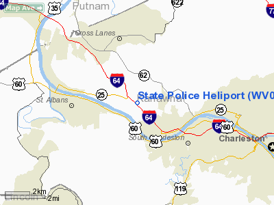
| From nearest city: | 5 nautical miles W of Charleston, WV |
| Location: | Kanawha County, WV |
| Magnetic Variation: | 06W (1985) |
Owner & Manager
| Ownership: | Publicly owned |
| Owner: | Wv Dept Of Public Safety |
| Address: | Po Box 307
Institute, WV 25112 |
| Phone number: | 304-344-9420 |
| Manager: | Lt. Wayne Childress |
| Address: | 300 Eagle Mt. Rd
Charleston, WV 25311 |
| Phone number: | 304-344-9420 |
Airport Operations and Facilities
| Airport Use: | Private |
| Wind indicator: | Yes |
| Segmented Circle: | No |
| Control Tower: | No |
| Lighting Schedule: | RDO-CTL
FOR HELIPAD PERIMETER LIGHTS & ROTG BCN - 7 CLICKS ON 123.02. |
| Beacon Color: | Clear-Green-Yellow (heliport) |
| Landing fee charge: | No |
| Sectional chart: | Cincinnati |
| Region: | AEA - Eastern |
| Boundary ARTCC: | ZID - Indianapolis |
| Tie-in FSS: | EKN - Elkins |
| FSS on Airport: | No |
| FSS Toll Free: | 1-800-WX-BRIEF |
Runway Information
Helipad H1
| Dimension: | 80 x 50 ft / 24.4 x 15.2 m |
| Surface: | CONC, |
| |
Runway H1 |
Runway |
| Traffic Pattern: | Left | Left |
|
Radio Navigation Aids
| ID |
Type |
Name |
Ch |
Freq |
Var |
Dist |
| AJY | FAN MARKER | Ashland | | | 03W | 49.8 nm |
| GAS | NDB | Gallipolis | | 420.00 | 07W | 33.0 nm |
| GTC | NDB | Guyandot | | 293.00 | 03W | 36.8 nm |
| IJZ | NDB | Nicholas | | 272.00 | 05W | 41.5 nm |
| HVQ | VORTAC | Charleston | 121X | 117.40 | 03W | 2.0 nm |
| HNN | VORTAC | Henderson | 106X | 115.90 | 03W | 25.6 nm |
| BKW | VORTAC | Beckley | 124X | 117.70 | 06W | 47.1 nm |
| CRW | VOT | Charleston Kanawha | | 108.80 | | 7.9 nm |
Images and information placed above are from
http://www.airport-data.com/airport/WV07/
We thank them for the data!
| General Info
|
| Country |
United States
|
| State |
WEST VIRGINIA
|
| FAA ID |
WV07
|
| Latitude |
38-22-57.339N
|
| Longitude |
081-45-34.458W
|
| Elevation |
650 feet
|
| Near City |
CHARLESTON
|
We don't guarantee the information is fresh and accurate. The data may
be wrong or outdated.
For more up-to-date information please refer to other sources.
|
|


