 |
|
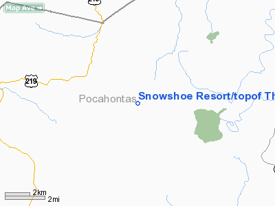
Snowshoe Resort/topof The World Heliport |
Location & QuickFacts
| FAA Information Effective: | 2008-09-25 |
| Airport Identifier: | 14WV |
| Airport Status: | Operational |
| Longitude/Latitude: | 079-59-45.0000W/38-24-02.0000N
-79.995833/38.400556 (Estimated) |
| Elevation: | 4792 ft / 1460.60 m (Estimated) |
| Land: | 0 acres |
| From nearest city: | 3 nautical miles NW of Linwood, WV |
| Location: | Pocahontas County, WV |
| Magnetic Variation: | () |
Owner & Manager
| Ownership: | Privately owned |
| Owner: | Snowshoe Resort Inc |
| Address: | #1 Snowshoe Dr.
Snowshoe, WV 26209 |
| Phone number: | 304-572-5610 |
| Manager: | Jim Hass |
| Address: | #1 Snowshoe Dr.
Snowshoe, WV 26209 |
| Phone number: | 304-572-5610 |
Airport Operations and Facilities
| Airport Use: | Private |
| Wind indicator: | Yes |
| Segmented Circle: | No |
| Control Tower: | No |
| Sectional chart: | Cincinnati |
| Region: | AEA - Eastern |
| Boundary ARTCC: | ZDC - Washington |
| Tie-in FSS: | EKN - Elkins |
| FSS Toll Free: | 1-800-WX-BRIEF |
Runway Information
Helipad H1
| Dimension: | 30 x 30 ft / 9.1 x 9.1 m |
| Surface: | CONC, Good Condition |
| |
Runway H1 |
Runway |
| Traffic Pattern: | Left | Left |
|
Radio Navigation Aids
| ID |
Type |
Name |
Ch |
Freq |
Var |
Dist |
| RQY | NDB | Randolph County | | 284.00 | 07W | 30.3 nm |
| JTM | NDB | Braxton | | 234.00 | 06W | 35.3 nm |
| LW | NDB | Bushi | | 346.00 | 06W | 43.4 nm |
| IJZ | NDB | Nicholas | | 272.00 | 05W | 45.7 nm |
| VBW | NDB | Bridgewater | | 241.00 | 07W | 48.8 nm |
| RNL | VOR | Rainelle | | 116.60 | 04W | 46.0 nm |
| LWB | VOR/DME | Greenbrier | 107Y | 116.05 | 08W | 37.3 nm |
| EKN | VORTAC | Elkins | 089X | 114.20 | 07W | 31.3 nm |
Remarks
- PRUDD ACCUATE INGRESS/EGRESS ROUTE AND CLEAR 8:1 SLOPE; APPROPRIATE MKGS ON PAD AND LGTD WINSOCK INSTALLED IF NIGHT OPNS; AND VEHICULAR TFC CONTROLLED AROUND SITE DURING OPNS.
Images and information placed above are from
http://www.airport-data.com/airport/14WV/
We thank them for the data!
|
|


