 |
|
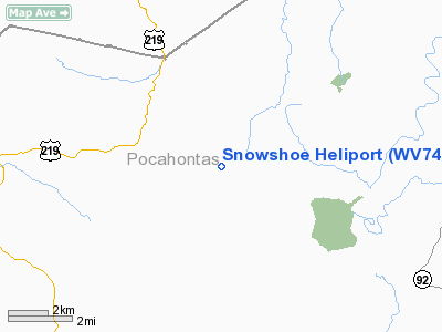
Location & QuickFacts
| FAA Information Effective: | 2008-09-25 |
| Airport Identifier: | WV74 |
| Airport Status: | Operational |
| Longitude/Latitude: | 079-59-43.2400W/38-24-37.4200N
-79.995344/38.410394 (Estimated) |
| Elevation: | 4700 ft / 1432.56 m (Estimated) |
| Land: | 0 acres |
| From nearest city: | 0 nautical miles N of Snowshoe, WV |
| Location: | Pocahontas County, WV |
| Magnetic Variation: | 08W (1995) |
Owner & Manager
| Ownership: | Privately owned |
| Owner: | Snowshoe Resort Inc |
| Address: | 1 Snowshoe Dr
Snowshoe, WV 26209 |
| Phone number: | 304-572-1000 |
| Manager: | Greg Thomas |
| Address: | 1 Snowshoe Dr
Snowshoe, WV 26209 |
| Phone number: | 304-572-1000 |
Airport Operations and Facilities
| Airport Use: | Private |
| Wind indicator: | Yes |
| Segmented Circle: | No |
| Control Tower: | No |
| Lighting Schedule: | PHONE REQ
FOR PERIMETER LGTS CALL 304-572-1000. |
| Sectional chart: | Cincinnati |
| Region: | AEA - Eastern |
| Boundary ARTCC: | ZDC - Washington |
| Tie-in FSS: | EKN - Elkins |
| FSS Toll Free: | 1-800-WX-BRIEF |
Runway Information
Helipad H1
| Dimension: | 50 x 50 ft / 15.2 x 15.2 m |
| Surface: | ASPH, Good Condition |
| |
Runway H1 |
Runway |
| Traffic Pattern: | Left | Left |
|
Radio Navigation Aids
| ID |
Type |
Name |
Ch |
Freq |
Var |
Dist |
| RQY | NDB | Randolph County | | 284.00 | 07W | 29.8 nm |
| JTM | NDB | Braxton | | 234.00 | 06W | 35.0 nm |
| LW | NDB | Bushi | | 346.00 | 06W | 43.9 nm |
| IJZ | NDB | Nicholas | | 272.00 | 05W | 45.9 nm |
| VBW | NDB | Bridgewater | | 241.00 | 07W | 48.8 nm |
| RNL | VOR | Rainelle | | 116.60 | 04W | 46.4 nm |
| LWB | VOR/DME | Greenbrier | 107Y | 116.05 | 08W | 37.8 nm |
| EKN | VORTAC | Elkins | 089X | 114.20 | 07W | 30.7 nm |
Remarks
- PRVDD MAX GWT UNDER 14500 LBS; NOTIFY PILOTS THAT EVERS MOA NEARBY; METAL BLANKETS PLACED ON PAD WHEN ICING PRESENT.
Images and information placed above are from
http://www.airport-data.com/airport/WV74/
We thank them for the data!
| General Info
|
| Country |
United States
|
| State |
WEST VIRGINIA
|
| FAA ID |
WV74
|
| Latitude |
38-24-37.420N
|
| Longitude |
079-59-43.240W
|
| Elevation |
4700 feet
|
| Near City |
SNOWSHOE
|
We don't guarantee the information is fresh and accurate. The data may
be wrong or outdated.
For more up-to-date information please refer to other sources.
|
|


