 |
|
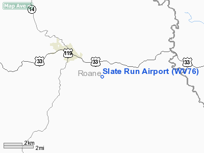
Location & QuickFacts
| FAA Information Effective: | 2008-09-25 |
| Airport Identifier: | WV76 |
| Airport Status: | Operational |
| Longitude/Latitude: | 081-18-37.4290W/38-46-39.3190N
-81.310397/38.777589 (Estimated) |
| Elevation: | 1000 ft / 304.80 m (Estimated) |
| Land: | 79 acres |
| From nearest city: | 3 nautical miles SE of Spencer, WV |
| Location: | Roane County, WV |
| Magnetic Variation: | 06W (1985) |
Owner & Manager
| Ownership: | Privately owned |
| Owner: | Roane County Flying Club |
| Address: | Po Box 336
Spencer, WV 25276 |
| Manager: | Randell Board
GARY HARPER 114 GUNNINGHAM LN WALTON WV 25286 - 304-577-6992 |
| Address: | Charleston Rd
Spencer, WV 25276 |
| Phone number: | 304-927-4065 |
Airport Operations and Facilities
| Airport Use: | Private |
| Wind indicator: | Yes |
| Segmented Circle: | No |
| Control Tower: | No |
| Lighting Schedule: | DUSK-DAWN |
| Beacon Color: | Clear-Green (lighted land airport)
ROTG BCN OTS INDEFLY. |
| Landing fee charge: | No |
| Sectional chart: | Cincinnati |
| Region: | AEA - Eastern |
| Boundary ARTCC: | ZID - Indianapolis |
| Tie-in FSS: | EKN - Elkins |
| FSS on Airport: | No |
| FSS Toll Free: | 1-800-WX-BRIEF |
Airport Communications
Airport Services
Runway Information
Runway 16/34
| Dimension: | 1730 x 30 ft / 527.3 x 9.1 m |
| Surface: | ASPH, Good Condition |
| Edge Lights: | Non-standard lighting system
NSTD LIRL; RY 34 THR LGTS NOT CENTERED; RY 16/34 EDGE LGTS LCTD 25 FT OUTWARD FM RY EDGE. |
| |
Runway 16 |
Runway 34 |
| Traffic Pattern: | Left | Left |
| Markings: | Basic, Good Condition | Basic, Good Condition |
| VASI: | nonstandard system
NSTD PVASI CENTERED AT THR. | 2-box on left side
& 16 VASI OTS INDEFLY. |
| Obstruction: | 63 ft trees, 200.0 ft from runway, 110 ft left of centerline
TREES LCTD 90' LEFT OF CNTRLN ABEAM THR.
+55' TREES 25' FM THR 90' L; +30' TREES 55' FM THR 120' R. | 94 ft ridge, 1800.0 ft from runway, 35 ft right of centerline, 17:1 slope to clear |
|
Radio Navigation Aids
| ID |
Type |
Name |
Ch |
Freq |
Var |
Dist |
| PKB | FAN MARKER | Marietta Ohio | | | 03W | 36.8 nm |
| JTM | NDB | Braxton | | 234.00 | 06W | 31.4 nm |
| GAS | NDB | Gallipolis | | 420.00 | 07W | 40.0 nm |
| IJZ | NDB | Nicholas | | 272.00 | 05W | 40.6 nm |
| UGS | NDB | University | | 250.00 | 06W | 47.8 nm |
| HNN | VORTAC | Henderson | 106X | 115.90 | 03W | 33.6 nm |
| HVQ | VORTAC | Charleston | 121X | 117.40 | 03W | 33.6 nm |
| JPU | VORTAC | Parkersburg | 023X | 108.60 | 03W | 40.0 nm |
| CRW | VOT | Charleston Kanawha | | 108.80 | | 27.7 nm |
Remarks
- REFLECTIVE PANELS LCTD AT BOTH ENDS OF RWY.
- PLINE-M ON APCH TO RWY 16.
- DEER ON & INVOF ARPT.
- COMPATIBLE TFC PATTERNS WHEN ROANE COUNTY ARPT CONSTD.
Images and information placed above are from
http://www.airport-data.com/airport/WV76/
We thank them for the data!
| General Info
|
| Country |
United States
|
| State |
WEST VIRGINIA
|
| FAA ID |
WV76
|
| Latitude |
38-46-39.319N
|
| Longitude |
081-18-37.429W
|
| Elevation |
1000 feet
|
| Near City |
SPENCER
|
We don't guarantee the information is fresh and accurate. The data may
be wrong or outdated.
For more up-to-date information please refer to other sources.
|
|


