 |
|
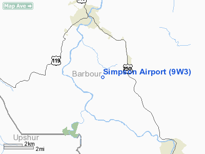
Location & QuickFacts
| FAA Information Effective: | 2008-09-25 |
| Airport Identifier: | 9W3 |
| Airport Status: | Operational |
| Longitude/Latitude: | 080-01-33.2840W/39-05-36.3570N
-80.025912/39.093432 (Estimated) |
| Elevation: | 1960 ft / 597.41 m (Estimated) |
| Land: | 89 acres |
| From nearest city: | 3 nautical miles S of Philippi, WV |
| Location: | Barbour County, WV |
| Magnetic Variation: | 07W (1985) |
Owner & Manager
| Ownership: | Privately owned |
| Owner: | Linda Coleman & Barbara Allen |
| Address: | Rt4, Airport Rd
Philippi, WV 26416 |
| Phone number: | 304-457-2323 |
| Manager: | Linda Coleman |
| Address: | Rt4, Airport Rd
Philippi, WV 26416 |
| Phone number: | 304-457-2323 |
Airport Operations and Facilities
| Airport Use: | Open to public |
| Wind indicator: | Yes |
| Segmented Circle: | No |
| Control Tower: | No |
| Landing fee charge: | No |
| Sectional chart: | Cincinnati |
| Region: | AEA - Eastern |
| Boundary ARTCC: | ZDC - Washington |
| Tie-in FSS: | EKN - Elkins |
| FSS on Airport: | No |
| FSS Toll Free: | 1-800-WX-BRIEF |
| NOTAMs Facility: | EKN (NOTAM-d service avaliable) |
Airport Communications
Airport Services
| Bottled Oxygen: | NONE |
| Bulk Oxygen: | NONE |
Runway Information
Runway 01/19
| Dimension: | 1500 x 100 ft / 457.2 x 30.5 m |
| Surface: | TURF, Fair Condition
SFC GOOD BUT ROLLING. |
| |
Runway 01 |
Runway 19 |
| Traffic Pattern: | Left | Left |
| Runway End Identifier: | No | No |
| Centerline Lights: | No | No |
| Touchdown Lights: | No | No |
| Obstruction: | 15 ft road | 35 ft trees, 0.0 ft from runway |
|
Radio Navigation Aids
| ID |
Type |
Name |
Ch |
Freq |
Var |
Dist |
| RQY | NDB | Randolph County | | 284.00 | 07W | 14.3 nm |
| JTM | NDB | Braxton | | 234.00 | 06W | 38.2 nm |
| VV | NDB | Camor | | 299.00 | 08W | 49.2 nm |
| CKB | VOR/DME | Clarksburg | 073X | 112.60 | 04W | 14.8 nm |
| ESL | VOR/DME | Kessel | 045X | 110.80 | 06W | 49.0 nm |
| EKN | VORTAC | Elkins | 089X | 114.20 | 07W | 11.3 nm |
| MGW | VORTAC | Morgantown | 053X | 111.60 | 05W | 28.9 nm |
Remarks
- RY 19 +25 FT BRUSH 50 FT FROM THLD LEFT TO RIGHT.
- UNLIMITED VEHICLE ACCESS TO ARPT.
- DEER ON & INVOF ARPT.
- RY 19 HAS 50 FT DROP-OFF 75 FT FM THLD 0B.
- RWY 01 75 FT TREE O FT AND 106 FT R FROM THRESHOLD
- RY 01 HAS 15 FT PUBLIC ROAD AT RY END.
- EXISTED PRIOR TO 1959.
Images and information placed above are from
http://www.airport-data.com/airport/9W3/
We thank them for the data!
| General Info
|
| Country |
United States
|
| State |
WEST VIRGINIA
|
| FAA ID |
9W3
|
| Latitude |
39-05-36.357N
|
| Longitude |
080-01-33.284W
|
| Elevation |
1960 feet
|
| Near City |
PHILIPPI
|
We don't guarantee the information is fresh and accurate. The data may
be wrong or outdated.
For more up-to-date information please refer to other sources.
|
|


