 |
|
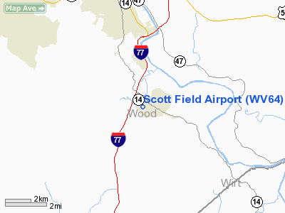
Location & QuickFacts
| FAA Information Effective: | 2008-09-25 |
| Airport Identifier: | WV64 |
| Airport Status: | Operational |
| Longitude/Latitude: | 081-31-25.4420W/39-10-41.2760N
-81.523734/39.178132 (Estimated) |
| Elevation: | 662 ft / 201.78 m (Estimated) |
| Land: | 6 acres |
| From nearest city: | 1 nautical miles SE of Mineral Wells, WV |
| Location: | Wood County, WV |
| Magnetic Variation: | 06W (1985) |
Owner & Manager
| Ownership: | Privately owned |
| Owner: | Ada Scott |
| Address: | Po Box 39
Mineral Wells, WV 26150 |
| Phone number: | 304-489-1936 |
| Manager: | Bob Scott |
| Address: | Po Box 39
Mineral Wells, WV 26150 |
| Phone number: | 304-489-1881 |
Airport Operations and Facilities
| Airport Use: | Private |
| Wind indicator: | Yes |
| Segmented Circle: | No |
| Control Tower: | No |
| Landing fee charge: | No |
| Sectional chart: | Cincinnati |
| Region: | AEA - Eastern |
| Boundary ARTCC: | ZID - Indianapolis |
| Tie-in FSS: | EKN - Elkins |
| FSS on Airport: | No |
| FSS Toll Free: | 1-800-WX-BRIEF |
Airport Services
| Airframe Repair: | NONE |
| Power Plant Repair: | NONE |
Runway Information
Runway 04/22
| Dimension: | 2020 x 100 ft / 615.7 x 30.5 m |
| Surface: | TURF, Good Condition |
| |
Runway 04 |
Runway 22 |
| Traffic Pattern: | Left | Left |
| Obstruction: | 15 ft brush, 45 ft left of centerline | 35 ft tower, 0.0 ft from runway, 80 ft left of centerline |
|
Radio Navigation Aids
| ID |
Type |
Name |
Ch |
Freq |
Var |
Dist |
| PKB | FAN MARKER | Marietta Ohio | | | 03W | 13.4 nm |
| UGS | NDB | University | | 250.00 | 06W | 28.4 nm |
| GAS | NDB | Gallipolis | | 420.00 | 07W | 36.3 nm |
| HRA | NDB | Zanesville | | 204.00 | 06W | 47.5 nm |
| ZZV | VOR/DME | Zanesville | 051X | 111.40 | 06W | 48.9 nm |
| JPU | VORTAC | Parkersburg | 023X | 108.60 | 03W | 17.3 nm |
| HNN | VORTAC | Henderson | 106X | 115.90 | 03W | 34.7 nm |
| CRW | VOT | Charleston Kanawha | | 108.80 | | 48.5 nm |
Remarks
- DEER ON & INVOF ARPT.
- ULTRALGT ACTIVITY ON & INVOF APT.
Images and information placed above are from
http://www.airport-data.com/airport/WV64/
We thank them for the data!
| General Info
|
| Country |
United States
|
| State |
WEST VIRGINIA
|
| FAA ID |
WV64
|
| Latitude |
39-10-41.276N
|
| Longitude |
081-31-25.442W
|
| Elevation |
662 feet
|
| Near City |
MINERAL WELLS
|
We don't guarantee the information is fresh and accurate. The data may
be wrong or outdated.
For more up-to-date information please refer to other sources.
|
|


