 |
|
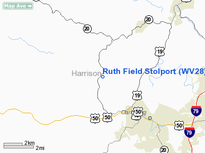
Ruth Field Stolport Airport |
Location & QuickFacts
| FAA Information Effective: | 2008-09-25 |
| Airport Identifier: | WV28 |
| Airport Status: | Operational |
| Longitude/Latitude: | 080-23-48.3260W/39-19-28.3170N
-80.396757/39.324533 (Estimated) |
| Elevation: | 1200 ft / 365.76 m (Estimated) |
| Land: | 40 acres |
| From nearest city: | 4 nautical miles NW of Clarksburg, WV |
| Location: | Harrison County, WV |
| Magnetic Variation: | 07W (1990) |
Owner & Manager
| Ownership: | Privately owned |
| Owner: | E Rogers |
| Address: | Rt 4 Box 285
Clarksburg, WV 26301 |
| Phone number: | 304-783-4866 |
| Manager: | E Rogers |
| Address: | Rt 4 Box 285
Clarksburg, WV 26301 |
| Phone number: | 304-783-4866 |
Airport Operations and Facilities
| Airport Use: | Private |
| Wind indicator: | Yes |
| Segmented Circle: | No |
| Control Tower: | No |
| Sectional chart: | Cincinnati |
| Region: | AEA - Eastern |
| Boundary ARTCC: | ZOB - Cleveland |
| Tie-in FSS: | EKN - Elkins |
| FSS Toll Free: | 1-800-WX-BRIEF |
Runway Information
Runway 04/22
| Dimension: | 1315 x 60 ft / 400.8 x 18.3 m |
| Surface: | TURF, |
| |
Runway 04 |
Runway 22 |
| Traffic Pattern: | Left | Left |
| Obstruction: | 100 ft plines, 2100.0 ft from runway | 100 ft plines, 2000.0 ft from runway |
|
Radio Navigation Aids
| ID |
Type |
Name |
Ch |
Freq |
Var |
Dist |
| PKB | FAN MARKER | Marietta Ohio | | | 03W | 47.4 nm |
| RQY | NDB | Randolph County | | 284.00 | 07W | 36.0 nm |
| JTM | NDB | Braxton | | 234.00 | 06W | 40.2 nm |
| VV | NDB | Camor | | 299.00 | 08W | 45.1 nm |
| CKB | VOR/DME | Clarksburg | 073X | 112.60 | 04W | 7.4 nm |
| AIR | VOR/DME | Bellaire | 118X | 117.10 | 07W | 45.9 nm |
| EKN | VORTAC | Elkins | 089X | 114.20 | 07W | 28.3 nm |
| MGW | VORTAC | Morgantown | 053X | 111.60 | 05W | 28.5 nm |
| JPU | VORTAC | Parkersburg | 023X | 108.60 | 03W | 46.0 nm |
Remarks
- 448' TWR 900' SE OF RY.
- TAKEOFF AND LANDINGS FOR STOL TYPE ACFT ONLY.
- PRVDD USE CAUTION WHEN OPERS INVOF TWR LCTD 900'SE OF PROPOSED LNDG AREA; USE CAUTION INVOF PLINES LCTD E & S OF LNDG AREA; AND EXERCISE CARE TO MINIMIE NOISE LEVELS OF ACFT OPERG FROM YOUR ARPT DUE TO CHURCHES AND SCHOOLS WITHIN A 2 MI RADIUS.
Images and information placed above are from
http://www.airport-data.com/airport/WV28/
We thank them for the data!
| General Info
|
| Country |
United States
|
| State |
WEST VIRGINIA
|
| FAA ID |
WV28
|
| Latitude |
39-19-28.317N
|
| Longitude |
080-23-48.326W
|
| Elevation |
1200 feet
|
| Near City |
CLARKSBURG
|
We don't guarantee the information is fresh and accurate. The data may
be wrong or outdated.
For more up-to-date information please refer to other sources.
|
|


