 |
|
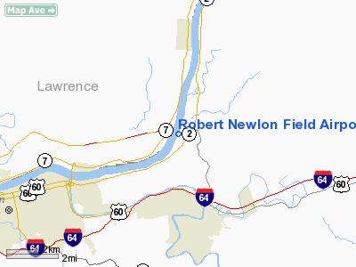
Robert Newlon Field Airport |
Location & QuickFacts
| FAA Information Effective: | 2008-09-25 |
| Airport Identifier: | I41 |
| Airport Status: | Operational |
| Longitude/Latitude: | 082-18-49.5360W/38-27-25.3040N
-82.313760/38.457029 (Estimated) |
| Elevation: | 550 ft / 167.64 m (Estimated) |
| Land: | 260 acres |
| From nearest city: | 6 nautical miles NE of Huntington, WV |
| Location: | Cabell County, WV |
| Magnetic Variation: | 05W (1985) |
Owner & Manager
| Ownership: | Publicly owned |
| Owner: | Cabell County Commission |
| Address: | Suite 300 Cabell Co Cthouse
Huntington, WV 25705 |
| Phone number: | 304-526-8634 |
| Manager: | Carl Baley |
| Address: | 45 Sutzer Dr.
Barbersville, WV 25504 |
| Phone number: | 304-733-4152 |
Airport Operations and Facilities
| Airport Use: | Open to public |
| Wind indicator: | Yes |
| Segmented Circle: | No |
| Control Tower: | No |
| Landing fee charge: | No |
| Sectional chart: | Cincinnati |
| Region: | AEA - Eastern |
| Boundary ARTCC: | ZID - Indianapolis |
| Tie-in FSS: | EKN - Elkins |
| FSS on Airport: | No |
| FSS Toll Free: | 1-800-WX-BRIEF |
| NOTAMs Facility: | EKN (NOTAM-d service avaliable) |
Airport Communications
Airport Services
| Airframe Repair: | NONE |
| Power Plant Repair: | NONE |
Runway Information
Runway 02/20
| Dimension: | 2300 x 75 ft / 701.0 x 22.9 m |
| Surface: | TURF, Good Condition |
| |
Runway 02 |
Runway 20 |
| Traffic Pattern: | Left | Right |
| Obstruction: | 26 ft tree, 21.0 ft from runway, 45 ft right of centerline | 57 ft tree, 319.0 ft from runway, 130 ft right of centerline, 5:1 slope to clear |
|
Radio Navigation Aids
| ID |
Type |
Name |
Ch |
Freq |
Var |
Dist |
| AJY | FAN MARKER | Ashland | | | 03W | 23.4 nm |
| GAS | NDB | Gallipolis | | 420.00 | 07W | 23.7 nm |
| PMH | NDB | Portsmouth | | 373.00 | 04W | 31.7 nm |
| GTC | NDB | Guyandot | | 293.00 | 03W | 44.9 nm |
| UGS | NDB | University | | 250.00 | 06W | 48.9 nm |
| HNN | VORTAC | Henderson | 106X | 115.90 | 03W | 22.4 nm |
| HVQ | VORTAC | Charleston | 121X | 117.40 | 03W | 26.4 nm |
| YRK | VORTAC | York | 075X | 112.80 | 05W | 33.2 nm |
| ECB | VORTAC | Newcombe | 041X | 110.40 | 02W | 33.4 nm |
| CRW | VOT | Charleston Kanawha | | 108.80 | | 34.3 nm |
Remarks
- ACFT PARKED IN PRIMARY SURFACE.
- DITCH AT END OF RY 02 BEING USED AS A DUMP.
- +80 FT TREES 25 FT L FM THLD TO 1600 FT; 10 FT BRUSH 25 FT CLUMPS WEST SIDE RY.
Images and information placed above are from
http://www.airport-data.com/airport/I41/
We thank them for the data!
| General Info
|
| Country |
United States
|
| State |
WEST VIRGINIA
|
| FAA ID |
I41
|
| Latitude |
38-27-25.304N
|
| Longitude |
082-18-49.536W
|
| Elevation |
550 feet
|
| Near City |
HUNTINGTON
|
We don't guarantee the information is fresh and accurate. The data may
be wrong or outdated.
For more up-to-date information please refer to other sources.
|
|


