 |
|
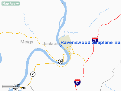
Ravenswood Seaplane Base Airport |
Location & QuickFacts
| FAA Information Effective: | 2008-09-25 |
| Airport Identifier: | WV39 |
| Airport Status: | Operational |
| Longitude/Latitude: | 081-46-23.4740W/38-57-07.2900N
-81.773187/38.952025 (Estimated) |
| Elevation: | 560 ft / 170.69 m (Surveyed) |
| Land: | 57 acres |
| From nearest city: | 1 nautical miles W of Ravenswood, WV |
| Location: | Jackson County, WV |
| Magnetic Variation: | 06W (1985) |
Owner & Manager
| Ownership: | Privately owned |
| Owner: | Jones Air, Inc |
| Address: | 523 S. Wadesboro Blvd
Mt. Gilead, NC 27306 |
| Phone number: | 704-985-4714 |
| Manager: | David E. Jones |
| Address: | 523 S. Wadesboro Blvd
Mt. Gilead, NC 27306 |
| Phone number: | 704-985-4714 |
Airport Operations and Facilities
| Airport Use: | Private |
| Wind indicator: | No |
| Segmented Circle: | No |
| Control Tower: | No |
| Landing fee charge: | No |
| Sectional chart: | Cincinnati |
| Region: | AEA - Eastern |
| Boundary ARTCC: | ZID - Indianapolis |
| Tie-in FSS: | EKN - Elkins |
| FSS on Airport: | No |
| FSS Toll Free: | 1-800-WX-BRIEF |
Runway Information
Runway 13W/31W
| Dimension: | 5000 x 500 ft / 1524.0 x 152.4 m |
| Surface: | WATER, |
| |
Runway 13W |
Runway 31W |
| Traffic Pattern: | Left | Left |
| Obstruction: | | 125 ft brdg, 3700.0 ft from runway |
|
Radio Navigation Aids
| ID |
Type |
Name |
Ch |
Freq |
Var |
Dist |
| PKB | FAN MARKER | Marietta Ohio | | | 03W | 30.9 nm |
| GAS | NDB | Gallipolis | | 420.00 | 07W | 19.5 nm |
| UGS | NDB | University | | 250.00 | 06W | 24.6 nm |
| HNN | VORTAC | Henderson | 106X | 115.90 | 03W | 16.8 nm |
| JPU | VORTAC | Parkersburg | 023X | 108.60 | 03W | 34.8 nm |
| HVQ | VORTAC | Charleston | 121X | 117.40 | 03W | 36.2 nm |
| CRW | VOT | Charleston Kanawha | | 108.80 | | 35.8 nm |
Images and information placed above are from
http://www.airport-data.com/airport/WV39/
We thank them for the data!
| General Info
|
| Country |
United States
|
| State |
WEST VIRGINIA
|
| FAA ID |
WV39
|
| Latitude |
38-57-07.290N
|
| Longitude |
081-46-23.474W
|
| Elevation |
560 feet
|
| Near City |
RAVENSWOOD
|
We don't guarantee the information is fresh and accurate. The data may
be wrong or outdated.
For more up-to-date information please refer to other sources.
|
|


