 |
|
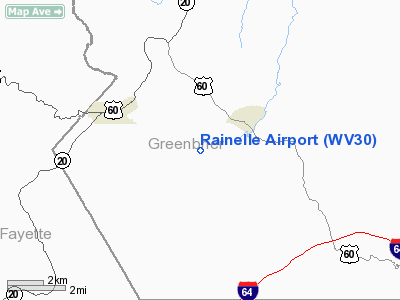
Location & QuickFacts
| FAA Information Effective: | 2008-09-25 |
| Airport Identifier: | WV30 |
| Airport Status: | Operational |
| Longitude/Latitude: | 080-42-59.3150W/37-56-55.4230N
-80.716476/37.948729 (Estimated) |
| Elevation: | 3446 ft / 1050.34 m (Surveyed) |
| Land: | 40 acres |
| From nearest city: | 3 nautical miles SE of Rainelle, WV |
| Location: | Greenbrier County, WV |
| Magnetic Variation: | 06W (1985) |
Owner & Manager
| Ownership: | Privately owned |
| Owner: | Rainelle Arpk Inc. |
| Address: | 209 3rd St Lilly Park
Rainelle, WV 25962 |
| Phone number: | 304-438-7221 |
| Manager: | Ralph D. Williams |
| Address: | 209 Thind Hill Park
Rainelle, WV 25962 |
| Phone number: | 304-438-7221 |
Airport Operations and Facilities
| Airport Use: | Private |
| Wind indicator: | Yes |
| Segmented Circle: | No |
| Control Tower: | No |
| Landing fee charge: | No |
| Sectional chart: | Cincinnati |
| Region: | AEA - Eastern |
| Boundary ARTCC: | ZDC - Washington |
| Tie-in FSS: | EKN - Elkins |
| FSS on Airport: | No |
| FSS Toll Free: | 1-800-WX-BRIEF |
Airport Services
| Airframe Repair: | NONE |
| Power Plant Repair: | NONE |
Runway Information
Runway 17/35
| Dimension: | 3300 x 75 ft / 1005.8 x 22.9 m |
| Surface: | TURF, Good Condition |
| |
Runway 17 |
Runway 35 |
| Traffic Pattern: | Left | Left |
| Obstruction: | 25 ft trees, 50 ft right of centerline, 1:1 slope to clear | 20 ft tree, 65 ft left of centerline, 1:1 slope to clear |
|
Radio Navigation Aids
| ID |
Type |
Name |
Ch |
Freq |
Var |
Dist |
| LW | NDB | Bushi | | 346.00 | 06W | 15.5 nm |
| IJZ | NDB | Nicholas | | 272.00 | 05W | 16.7 nm |
| JTM | NDB | Braxton | | 234.00 | 06W | 44.4 nm |
| TEC | NDB | Tech | | 368.00 | 06W | 46.9 nm |
| CNQ | NDB | Callahan | | 379.00 | 05W | 49.1 nm |
| RNL | VOR | Rainelle | | 116.60 | 04W | 4.6 nm |
| LWB | VOR/DME | Greenbrier | 107Y | 116.05 | 08W | 16.2 nm |
| BKW | VORTAC | Beckley | 124X | 117.70 | 06W | 21.8 nm |
| BLF | VORTAC | Bluefield | 037X | 110.00 | 03W | 44.8 nm |
| ROA | VORTAC | Roanoke | 031X | 109.40 | 04W | 47.6 nm |
| CRW | VOT | Charleston Kanawha | | 108.80 | | 48.7 nm |
Images and information placed above are from
http://www.airport-data.com/airport/WV30/
We thank them for the data!
| General Info
|
| Country |
United States
|
| State |
WEST VIRGINIA
|
| FAA ID |
WV30
|
| Latitude |
37-56-55.423N
|
| Longitude |
080-42-59.315W
|
| Elevation |
3446 feet
|
| Near City |
RAINELLE
|
We don't guarantee the information is fresh and accurate. The data may
be wrong or outdated.
For more up-to-date information please refer to other sources.
|
|


