 |
|
Location & QuickFacts
| FAA Information Effective: | 2008-09-25 |
| Airport Identifier: | WV31 |
| Airport Status: | Operational |
| Longitude/Latitude: | 080-26-12.2700W/37-50-01.4350N
-80.436742/37.833732 (Estimated) |
| Elevation: | 2320 ft / 707.14 m (Estimated) |
| Land: | 0 acres |
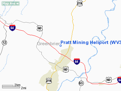
| From nearest city: | 2 nautical miles NE of Lewisburg, WV |
| Location: | Greenbrier County, WV |
| Magnetic Variation: | 06W (1985) |
Owner & Manager
| Ownership: | Privately owned |
| Owner: | L. W. Hamilton |
| Address: | Box 930 - Merry Hill
Lewisburg, WV 24901 |
| Phone number: | 304-645-2419 |
| Manager: | L. W. Hamilton |
| Address: | Box 930 - Merry Hill
Lewisburg, WV 24901 |
| Phone number: | 304-645-2419 |
Airport Operations and Facilities
| Airport Use: | Private |
| Wind indicator: | No |
| Segmented Circle: | No |
| Control Tower: | No |
| Landing fee charge: | No |
| Sectional chart: | Cincinnati |
| Region: | AEA - Eastern |
| Boundary ARTCC: | ZDC - Washington |
| Tie-in FSS: | EKN - Elkins |
| FSS on Airport: | No |
| FSS Toll Free: | 1-800-WX-BRIEF |
Runway Information
Helipad H1
| Dimension: | 120 x 60 ft / 36.6 x 18.3 m |
| Surface: | ASPH, |
| |
Runway H1 |
Runway |
| Traffic Pattern: | Left | Left |
|
Radio Navigation Aids
| ID |
Type |
Name |
Ch |
Freq |
Var |
Dist |
| LW | NDB | Bushi | | 346.00 | 06W | 3.4 nm |
| IJZ | NDB | Nicholas | | 272.00 | 05W | 30.7 nm |
| CNQ | NDB | Callahan | | 379.00 | 05W | 36.9 nm |
| TEC | NDB | Tech | | 368.00 | 06W | 37.6 nm |
| VIT | NDB | Vinton | | 277.00 | 06W | 46.2 nm |
| RNL | VOR | Rainelle | | 116.60 | 04W | 19.5 nm |
| ODR | VOR | Woodrum | | 114.90 | 06W | 37.6 nm |
| LWB | VOR/DME | Greenbrier | 107Y | 116.05 | 08W | 2.8 nm |
| BKW | VORTAC | Beckley | 124X | 117.70 | 06W | 32.8 nm |
| ROA | VORTAC | Roanoke | 031X | 109.40 | 04W | 34.2 nm |
| PSK | VORTAC | Pulaski | 115X | 116.80 | 06W | 46.7 nm |
| BLF | VORTAC | Bluefield | 037X | 110.00 | 03W | 48.0 nm |
Remarks
- PRVDD TWO-WAY RADIO COM IS MAINTAINED WITH GREENBRIER VALLEY ARPT; LEWISBURG FOR EGRESS/INGRESS.
Images and information placed above are from
http://www.airport-data.com/airport/WV31/
We thank them for the data!
| General Info
|
| Country |
United States
|
| State |
WEST VIRGINIA
|
| FAA ID |
WV31
|
| Latitude |
37-50-01.435N
|
| Longitude |
080-26-12.270W
|
| Elevation |
2320 feet
|
| Near City |
LEWISBURG
|
We don't guarantee the information is fresh and accurate. The data may
be wrong or outdated.
For more up-to-date information please refer to other sources.
|
|


