 |
|
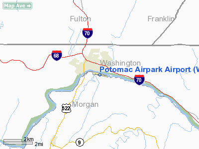
Location & QuickFacts
| FAA Information Effective: | 2008-09-25 |
| Airport Identifier: | W35 |
| Airport Status: | Operational |
| Longitude/Latitude: | 078-09-57.9000W/39-41-33.4000N
-78.166083/39.692611 (Estimated) |
| Elevation: | 412 ft / 125.58 m (Surveyed) |
| Land: | 0 acres |
| From nearest city: | 4 nautical miles N of Berkeley Springs, WV |
| Location: | Morgan County, WV |
| Magnetic Variation: | 10W (2000) |
Owner & Manager
| Ownership: | Privately owned |
| Owner: | Us Riverbottom Llc |
| Address: | 14637 Tollgate Ridge Road
Hancock, MD 21750 |
| Phone number: | 717-294-6186 |
| Manager: | Melinda B. Golden |
| Address: | 14637 Toll Gate Ridge Road
Hancock, MD 21750 |
| Phone number: | 717-294-6186
PHONE AT ARPT 304-258-8283. |
Airport Operations and Facilities
| Airport Use: | Open to public |
| Wind indicator: | Yes |
| Segmented Circle: | No |
| Control Tower: | No |
| Lighting Schedule: | DUSK-DAWN |
| Landing fee charge: | No |
| Sectional chart: | Washington |
| Region: | AEA - Eastern |
| Boundary ARTCC: | ZDC - Washington |
| Tie-in FSS: | EKN - Elkins |
| FSS on Airport: | No |
| FSS Toll Free: | 1-800-WX-BRIEF |
| NOTAMs Facility: | EKN (NOTAM-d service avaliable) |
Airport Communications
Airport Services
| Airframe Repair: | NONE |
| Power Plant Repair: | NONE |
| Bottled Oxygen: | NONE |
| Bulk Oxygen: | NONE |
Runway Information
Runway 11/29
| Dimension: | 4985 x 70 ft / 1519.4 x 21.3 m |
| Surface: | ASPH, Poor Condition
PAVEMENT CRACKS, UNEVEN SURFACE AND SOME LOOSE AGGREGATE. |
| Edge Lights: | Medium |
| |
Runway 11 |
Runway 29 |
| Longitude: | 078-10-29.3400W | 078-09-26.4720W |
| Latitude: | 39-41-37.5450N | 39-41-29.2630N |
| Elevation: | 410.00 ft | 411.00 ft |
| Alignment: | 100 | 127 |
| Traffic Pattern: | Left | Right |
| Markings: | Non-precision instrument, Fair Condition
RY 11/29 MARKINGS FADED. | Non-precision instrument, Fair Condition |
| VASI: | tri-color on left side | tri-color on right side |
| Runway End Identifier: | Yes
REIL RY 11 OTS INDEFLY. | Yes
RY 29 REIL OTS INDEFLY. |
| Centerline Lights: | No | No |
| Touchdown Lights: | No | No |
| Obstruction: | 80 ft trees, 200.0 ft from runway, 250 ft right of centerline
30 FT PLINES 150-200 FT FM THLD ACROSS PRIMARY SFC; 25 FT TREES 0-200 FT FM THLD 110 FT L; 80 FT TREES 200 FT FM THLD 250 FT R. | 35 ft trees, 200.0 ft from runway, 110 ft right of centerline
15 FT TREES AT THLD 103 FT R TO 26 FT FM THLD; 6-8 FT BRUSH 31 FT FM THLD 75 FT L TO 0 FT FM THLD 110 FT R. |
|
Radio Navigation Aids
| ID |
Type |
Name |
Ch |
Freq |
Var |
Dist |
| CBE | NDB | Cumberland | | 317.00 | 07W | 27.0 nm |
| TZ | NDB | Cogan | | 364.00 | 10W | 36.7 nm |
| SYS | NDB | Stoystown | | 209.00 | 08W | 41.9 nm |
| GDX | NDB | Goodwin Lake | | 227.00 | 08W | 47.0 nm |
| HGR | VOR | Hagerstown | | 109.80 | 07W | 14.4 nm |
| AOO | VOR | Altoona | | 108.80 | 07W | 38.6 nm |
| FDK | VOR | Frederick | | 109.00 | 08W | 40.3 nm |
| GRV | VOR/DME | Grantsville | 070X | 112.30 | 06W | 41.1 nm |
| ESL | VOR/DME | Kessel | 045X | 110.80 | 06W | 47.4 nm |
| THS | VORTAC | St Thomas | 097X | 115.00 | 07W | 17.5 nm |
| MRB | VORTAC | Martinsburg | 058X | 112.10 | 07W | 23.6 nm |
| JST | VORTAC | Johnstown | 077X | 113.00 | 06W | 48.5 nm |
Remarks
- NO ACFT OVER 18500 LBS GWT.
- ARPT CLSD NIGHTS.
- PRIOR TO 1959.
Images and information placed above are from
http://www.airport-data.com/airport/W35/
We thank them for the data!
| General Info
|
| Country |
United States
|
| State |
WEST VIRGINIA
|
| FAA ID |
W35
|
| Latitude |
39-41-33.400N
|
| Longitude |
078-09-57.900W
|
| Elevation |
412 feet
|
| Near City |
BERKELEY SPRINGS
|
We don't guarantee the information is fresh and accurate. The data may
be wrong or outdated.
For more up-to-date information please refer to other sources.
|
|


