 |
|
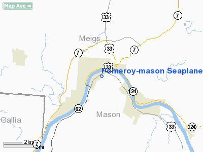
Pomeroy-mason Seaplane Base Airport |
Location & QuickFacts
| FAA Information Effective: | 2008-09-25 |
| Airport Identifier: | WV35 |
| Airport Status: | Operational |
| Longitude/Latitude: | 082-01-24.5050W/39-01-20.2810N
-82.023474/39.022300 (Estimated) |
| Elevation: | 538 ft / 163.98 m (Estimated) |
| Land: | 0 acres |
| From nearest city: | 1 nautical miles N of Mason, WV |
| Location: | Mason County, WV |
| Magnetic Variation: | 05W (1985) |
Owner & Manager
| Ownership: | Privately owned |
| Owner: | Jones Air, Inc. |
| Address: | 523 S. Wadesboro Blvd.
Mt. Gilead, NC 27306 |
| Phone number: | 704-985-4714 |
| Manager: | David E. Jones |
| Address: | 523 S. Wadesboro Blvd.
Mt. Gilead, NC 27306 |
| Phone number: | 704-985-4714 |
Airport Operations and Facilities
| Airport Use: | Private |
| Wind indicator: | No |
| Segmented Circle: | No |
| Control Tower: | No |
| Landing fee charge: | No |
| Sectional chart: | Cincinnati |
| Region: | AEA - Eastern |
| Boundary ARTCC: | ZID - Indianapolis |
| Tie-in FSS: | EKN - Elkins |
| FSS on Airport: | No |
| FSS Toll Free: | 1-800-WX-BRIEF |
Runway Information
Runway 09W/27W
| Dimension: | 5000 x 500 ft / 1524.0 x 152.4 m |
| Surface: | WATER, |
| |
Runway 09W |
Runway 27W |
| Traffic Pattern: | Left | Left |
| Obstruction: | 135 ft brdg, 5800.0 ft from runway | |
|
Radio Navigation Aids
| ID |
Type |
Name |
Ch |
Freq |
Var |
Dist |
| PKB | FAN MARKER | Marietta Ohio | | | 03W | 35.8 nm |
| AJY | FAN MARKER | Ashland | | | 03W | 45.7 nm |
| GAS | NDB | Gallipolis | | 420.00 | 07W | 13.1 nm |
| UGS | NDB | University | | 250.00 | 06W | 14.9 nm |
| PMH | NDB | Portsmouth | | 373.00 | 04W | 41.1 nm |
| EOP | NDB | Waverly | | 385.00 | 06W | 43.3 nm |
| HNN | VORTAC | Henderson | 106X | 115.90 | 03W | 16.1 nm |
| JPU | VORTAC | Parkersburg | 023X | 108.60 | 03W | 39.3 nm |
| HVQ | VORTAC | Charleston | 121X | 117.40 | 03W | 42.1 nm |
| CRW | VOT | Charleston Kanawha | | 108.80 | | 43.9 nm |
Images and information placed above are from
http://www.airport-data.com/airport/WV35/
We thank them for the data!
| General Info
|
| Country |
United States
|
| State |
WEST VIRGINIA
|
| FAA ID |
WV35
|
| Latitude |
39-01-20.281N
|
| Longitude |
082-01-24.505W
|
| Elevation |
538 feet
|
| Near City |
MASON
|
We don't guarantee the information is fresh and accurate. The data may
be wrong or outdated.
For more up-to-date information please refer to other sources.
|
|


