 |
|
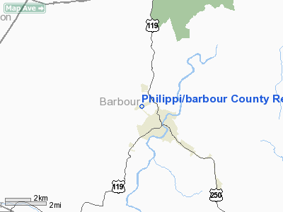
Philippi/barbour County Rgnl Airport |
Location & QuickFacts
| FAA Information Effective: | 2008-09-25 |
| Airport Identifier: | 79D |
| Airport Status: | Operational |
| Longitude/Latitude: | 080-03-45.2900W/39-09-58.3480N
-80.062581/39.166208 (Estimated) |
| Elevation: | 1780 ft / 542.54 m (Estimated) |
| Land: | 78 acres |
| From nearest city: | 2 nautical miles NW of Philippi, WV |
| Location: | Barbour County, WV |
| Magnetic Variation: | 07W (1985) |
Owner & Manager
| Ownership: | Publicly owned |
| Address: | 124 N. Main Street
Philippi, WV 26416 |
| Phone number: | 304-457-1225 |
| Manager: | John Prusa |
| Address: | Route #3 Box 284-14
Philippi, WV 26416 |
| Phone number: | 304-457-4372 |
Airport Operations and Facilities
| Airport Use: | Open to public |
| Wind indicator: | Yes |
| Segmented Circle: | Yes |
| Control Tower: | No |
| Lighting Schedule: | DUSK-DAWN
ACTIVATE MIRL RY 08/26, PAPI RYS 08 & 26 & REIL RY RY 08 - CTAF. |
| Beacon Color: | Clear-Green (lighted land airport) |
| Landing fee charge: | No |
| Sectional chart: | Cincinnati |
| Region: | AEA - Eastern |
| Boundary ARTCC: | ZDC - Washington |
| Tie-in FSS: | EKN - Elkins |
| FSS on Airport: | No |
| FSS Toll Free: | 1-800-WX-BRIEF |
| NOTAMs Facility: | EKN (NOTAM-d service avaliable) |
| Federal Agreements: | N |
Airport Communications
Airport Services
| Airframe Repair: | NONE |
| Power Plant Repair: | NONE |
| Bottled Oxygen: | NONE |
| Bulk Oxygen: | NONE |
Runway Information
Runway 08/26
| Dimension: | 3275 x 60 ft / 998.2 x 18.3 m |
| Surface: | ASPH, |
| Edge Lights: | Medium |
| |
Runway 08 |
Runway 26 |
| Traffic Pattern: | Left | Left |
| Markings: | Basic, Good Condition | Basic, Good Condition |
| Crossing Height: | 20.00 ft | 20.00 ft |
| Displaced threshold: | 0.00 ft | 225.00 ft |
| VASI: | 2-light PAPI on left side | 2-light PAPI on left side |
| Visual Glide Angle: | 3.00° | 3.00° |
| Runway End Identifier: | Yes
REIL RY 08 OMNI DIRECTIONAL. | No |
| Obstruction: | 19 ft tree, 200.0 ft from runway, 135 ft left of centerline
10 TO 20 FOOT TREES 0 FEET FROM RUNWAY END 125 FEET LEFT. | 20 ft tree, 200.0 ft from runway, 140 ft left of centerline
20 FOOT TREE 130 FEET FROM RUNWAY END 140 RIGHT OF CENTERLINE. |
|
Radio Navigation Aids
| ID |
Type |
Name |
Ch |
Freq |
Var |
Dist |
| RQY | NDB | Randolph County | | 284.00 | 07W | 18.9 nm |
| JTM | NDB | Braxton | | 234.00 | 06W | 39.9 nm |
| VV | NDB | Camor | | 299.00 | 08W | 45.5 nm |
| CKB | VOR/DME | Clarksburg | 073X | 112.60 | 04W | 10.9 nm |
| EKN | VORTAC | Elkins | 089X | 114.20 | 07W | 15.2 nm |
| MGW | VORTAC | Morgantown | 053X | 111.60 | 05W | 25.3 nm |
Remarks
- RY 26 500 FT DROPOFF 50 FT FM THLD 0B.
- RY 08 150 FT DROPOFF 112 FT FM THLD 0B.
- PRVDD TREES OFF THE APCH END OF RY 26 ARE REMOVED OR TRIMMED TO REMAIN BLO 20:1 APCH SURFACE.
Images and information placed above are from
http://www.airport-data.com/airport/79D/
We thank them for the data!
| General Info
|
| Country |
United States
|
| State |
WEST VIRGINIA
|
| FAA ID |
79D
|
| Latitude |
39-09-58.348N
|
| Longitude |
080-03-45.290W
|
| Elevation |
1780 feet
|
| Near City |
PHILIPPI
|
We don't guarantee the information is fresh and accurate. The data may
be wrong or outdated.
For more up-to-date information please refer to other sources.
|
|


