 |
|
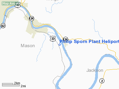
Philip Sporn Plant Heliport |
Location & QuickFacts
| FAA Information Effective: | 2008-09-25 |
| Airport Identifier: | WV72 |
| Airport Status: | Operational |
| Longitude/Latitude: | 081-55-26.5000W/38-57-49.8000N
-81.924028/38.963833 (Estimated) |
| Elevation: | 601 ft / 183.18 m (Estimated) |
| Land: | 0 acres |
| From nearest city: | 2 nautical miles SE of New Haven, WV |
| Location: | Mason County, WV |
| Magnetic Variation: | 06W (1995) |
Owner & Manager
| Ownership: | Privately owned |
| Owner: | Philip Sporn Plant |
| Address: | Po Box 389
New Haven, WV 25265-0389 |
| Phone number: | 304-882-2126 |
| Manager: | Richard L. Gail |
| Address: | Philip Sporn Plant
Po Box 389 |
| Phone number: | 304-882-2126 |
Airport Operations and Facilities
| Airport Use: | Private
MEDICAL USE. |
| Wind indicator: | Yes |
| Segmented Circle: | No |
| Control Tower: | No |
| Lighting Schedule: | 24 HRS |
| Sectional chart: | Cincinnati |
| Region: | AEA - Eastern |
| Boundary ARTCC: | ZID - Indianapolis |
| Tie-in FSS: | EKN - Elkins |
| FSS Toll Free: | 1-800-WX-BRIEF |
Runway Information
Helipad H1
| Dimension: | 50 x 50 ft / 15.2 x 15.2 m |
| Surface: | ASPH-CONC, Good Condition |
| |
Runway H1 |
Runway |
| Traffic Pattern: | Left | Left |
|
Radio Navigation Aids
| ID |
Type |
Name |
Ch |
Freq |
Var |
Dist |
| PKB | FAN MARKER | Marietta Ohio | | | 03W | 34.7 nm |
| AJY | FAN MARKER | Ashland | | | 03W | 47.6 nm |
| GAS | NDB | Gallipolis | | 420.00 | 07W | 13.6 nm |
| UGS | NDB | University | | 250.00 | 06W | 20.0 nm |
| PMH | NDB | Portsmouth | | 373.00 | 04W | 44.5 nm |
| EOP | NDB | Waverly | | 385.00 | 06W | 48.6 nm |
| HNN | VORTAC | Henderson | 106X | 115.90 | 03W | 13.5 nm |
| HVQ | VORTAC | Charleston | 121X | 117.40 | 03W | 37.6 nm |
| JPU | VORTAC | Parkersburg | 023X | 108.60 | 03W | 38.4 nm |
| CRW | VOT | Charleston Kanawha | | 108.80 | | 38.8 nm |
Remarks
- PRVDD NO IFR OPNS; CLEAR 8:1 INGRESS/EGRESS & APPROPRIATE INGRESS/EGRESS MARKINGS ON PAD.
Images and information placed above are from
http://www.airport-data.com/airport/WV72/
We thank them for the data!
| General Info
|
| Country |
United States
|
| State |
WEST VIRGINIA
|
| FAA ID |
WV72
|
| Latitude |
38-57-49.800N
|
| Longitude |
081-55-26.500W
|
| Elevation |
601 feet
|
| Near City |
NEW HAVEN
|
We don't guarantee the information is fresh and accurate. The data may
be wrong or outdated.
For more up-to-date information please refer to other sources.
|
|


