 |
|
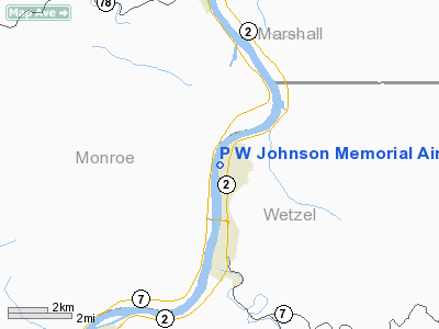
P W Johnson Memorial Airport |
Location & QuickFacts
| FAA Information Effective: | 2008-09-25 |
| Airport Identifier: | 75D |
| Airport Status: | Operational |
| Longitude/Latitude: | 080-51-44.3510W/39-41-02.2750N
-80.862320/39.683965 (Estimated) |
| Elevation: | 632 ft / 192.63 m (Surveyed) |
| Land: | 20 acres |
| From nearest city: | 2 nautical miles N of New Martinsville, WV |
| Location: | Wetzel County, WV |
| Magnetic Variation: | 07W (1985) |
Owner & Manager
| Ownership: | Publicly owned |
| Owner: | City Of New Martinsville |
| Address: | 626 James Street
New Martinsville, WV 26155 |
| Phone number: | 304-455-9100 |
| Manager: | Ronald L. Schupbach |
| Address: | 626 James Street
New Martinsville, WV 26155 |
| Phone number: | 304-455-5252
ALSO 304-447-4343 |
Airport Operations and Facilities
| Airport Use: | Open to public |
| Wind indicator: | Yes |
| Segmented Circle: | No |
| Control Tower: | No |
| Lighting Schedule: | RDO-CTL
ACTVT LIRL RY 01/19; ROTG BCN - CTAF. |
| Beacon Color: | Clear-Green (lighted land airport) |
| Landing fee charge: | No |
| Sectional chart: | Cincinnati |
| Region: | AEA - Eastern |
| Traffic Pattern Alt: | 1800 ft |
| Boundary ARTCC: | ZOB - Cleveland |
| Tie-in FSS: | EKN - Elkins |
| FSS on Airport: | No |
| FSS Toll Free: | 1-800-WX-BRIEF |
| NOTAMs Facility: | EKN (NOTAM-d service avaliable) |
Airport Communications
Airport Services
| Bottled Oxygen: | NONE |
| Bulk Oxygen: | NONE |
Runway Information
Runway 01/19
| Dimension: | 2100 x 73 ft / 640.1 x 22.3 m |
| Surface: | TURF, Good Condition
SOFT WHEN WET; MUD COVERS SOME AREAS. |
| Edge Lights: | Low |
| |
Runway 01 |
Runway 19 |
| Traffic Pattern: | Left | Left |
| VASI: | nonstandard system | |
| Obstruction: | 30 ft pole, 150.0 ft from runway, 92 ft right of centerline, 5:1 slope to clear
ALSO + 15 FT BRUSH, 0 FT DSTC, 110 FT L. | 60 ft trees, 75.0 ft from runway, 160 ft left of centerline, 1:1 slope to clear |
|
Radio Navigation Aids
| ID |
Type |
Name |
Ch |
Freq |
Var |
Dist |
| PKB | FAN MARKER | Marietta Ohio | | | 03W | 31.3 nm |
| CFX | NDB | Cadiz | | 239.00 | 07W | 33.9 nm |
| PNU | NDB | Washington County | | 255.00 | 08W | 42.5 nm |
| AIR | VOR/DME | Bellaire | 118X | 117.10 | 07W | 20.1 nm |
| HLG | VOR/DME | Wheeling | 059X | 112.20 | 07W | 37.2 nm |
| CKB | VOR/DME | Clarksburg | 073X | 112.60 | 04W | 37.8 nm |
| CTW | VOR/DME | Newcomerstown | 055X | 111.80 | 07W | 43.3 nm |
| JPU | VORTAC | Parkersburg | 023X | 108.60 | 03W | 27.9 nm |
| MGW | VORTAC | Morgantown | 053X | 111.60 | 05W | 47.0 nm |
Remarks
- ULTRALGTS ON & INVOF ARPT.
- DIRT SERVICE ROAD FOR ARPT USE ONLY; CROSSES RY 01 END 0-45 FT OUT.
- DITCH ON W SIDE OF RY IN FRONT OF HANGERS. USE RY EXITS MARKED BY TIRES OR LGTS.
- BIRDS ON AND INVOF ARPT.
- 1700 FT MSL TWR, 0.58 MI NW OF RY 19 END.
- RY 19 HAS RISING TERRAIN IN N APCH.
- EXISTED PRIOR TO 1959.
Images and information placed above are from
http://www.airport-data.com/airport/75D/
We thank them for the data!
| General Info
|
| Country |
United States
|
| State |
WEST VIRGINIA
|
| FAA ID |
75D
|
| Latitude |
39-41-02.275N
|
| Longitude |
080-51-44.351W
|
| Elevation |
632 feet
|
| Near City |
NEW MARTINSVILLE
|
We don't guarantee the information is fresh and accurate. The data may
be wrong or outdated.
For more up-to-date information please refer to other sources.
|
|


