 |
|
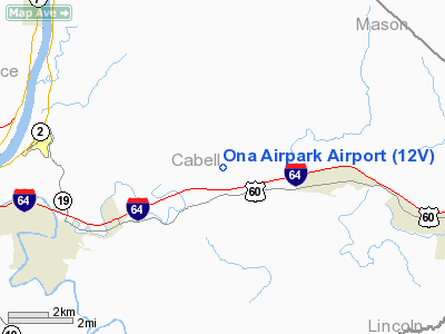
Location & QuickFacts
| FAA Information Effective: | 2008-09-25 |
| Airport Identifier: | 12V |
| Airport Status: | Operational |
| Longitude/Latitude: | 082-12-02.8000W/38-26-27.2000N
-82.200778/38.440889 (Estimated) |
| Elevation: | 572 ft / 174.35 m (Surveyed) |
| Land: | 120 acres |
| From nearest city: | 4 nautical miles W of Milton, WV |
| Location: | Cabell County, WV |
| Magnetic Variation: | 06W (2000) |
Owner & Manager
| Ownership: | Privately owned |
| Owner: | Ona Land Management Services, Llc |
| Address: | 1500 Nw 62nd St #509
Ft. Lauderdale, FL 33309 |
| Phone number: | 954-328-7646 |
| Manager: | Bill & Lynn Bauer |
| Address: | 1500 Nw 62nd St #509
Ft. Lauderdale, FL 33309 |
| Phone number: | 954-328-7646 |
Airport Operations and Facilities
| Airport Use: | Open to public |
| Wind indicator: | Yes |
| Segmented Circle: | No |
| Control Tower: | No |
| Lighting Schedule: | DUSK-DAWN |
| Landing fee charge: | No |
| Sectional chart: | Cincinnati |
| Region: | AEA - Eastern |
| Boundary ARTCC: | ZID - Indianapolis |
| Tie-in FSS: | EKN - Elkins |
| FSS Toll Free: | 1-800-WX-BRIEF |
| NOTAMs Facility: | EKN (NOTAM-d service avaliable) |
Airport Communications
| CTAF: | 122.800 |
| Unicom: | 122.800 |
Airport Services
| Fuel available: | 100LL
AFTER HOUR FUELING BY PRIOR ARRANGEMENT 304-743-4523. |
| Airframe Repair: | MINOR |
| Power Plant Repair: | MINOR |
Runway Information
Runway 07/25
| Dimension: | 3154 x 40 ft / 961.3 x 12.2 m |
| Surface: | ASPH, Good Condition |
| Edge Lights: | Non-standard lighting system
NSTD LIRL; DSPLCD THLD LGTS 360 DEG GREEN LGTS ONE EACH SIDE OF RY. |
| |
Runway 07 |
Runway 25 |
| Longitude: | 082-12-19.8080W | 082-11-45.7380W |
| Latitude: | 38-26-19.2290N | 38-26-35.1610N |
| Elevation: | 567.00 ft | 569.00 ft |
| Alignment: | 59 | 127 |
| Traffic Pattern: | Left | Left |
| Markings: | Basic, Good Condition | Basic, Good Condition |
| Displaced threshold: | 134.00 ft
07/25 DSPLCD THLDS NGTS ONLY. | 129.00 ft |
| Obstruction: | 94 ft trees, 935.0 ft from runway, 47 ft left of centerline, 7:1 slope to clear
+88 FT TREE DIST 1000 FT 160 FT L 20:1 BASED ON DSPLCD THLD.
APCH RATIO 9:1 TO DSPLCD THLD. | 144 ft tree, 731.0 ft from runway, 54 ft right of centerline, 3:1 slope to clear
+300 FT HILL DIST 5000 FT R TO L 20:1 BASED ON DSPLCD THLD.
4 FT SIGN 3 FT & 25 FT LEFT; 8 FT BRUSH 200 FT FM RY END 103 FT LEFT. |
|
Radio Navigation Aids
| ID |
Type |
Name |
Ch |
Freq |
Var |
Dist |
| AJY | FAN MARKER | Ashland | | | 03W | 28.8 nm |
| GAS | NDB | Gallipolis | | 420.00 | 07W | 23.7 nm |
| PMH | NDB | Portsmouth | | 373.00 | 04W | 36.5 nm |
| GTC | NDB | Guyandot | | 293.00 | 03W | 41.9 nm |
| UGS | NDB | University | | 250.00 | 06W | 49.2 nm |
| HNN | VORTAC | Henderson | 106X | 115.90 | 03W | 20.5 nm |
| HVQ | VORTAC | Charleston | 121X | 117.40 | 03W | 21.0 nm |
| ECB | VORTAC | Newcombe | 041X | 110.40 | 02W | 37.5 nm |
| YRK | VORTAC | York | 075X | 112.80 | 05W | 38.5 nm |
| CRW | VOT | Charleston Kanawha | | 108.80 | | 28.9 nm |
Remarks
- ACCESS ROAD CROSSES RY.
- BALLOON PORT 2 MI E.
- NOISE ABATEMENT PROCEDURES IN EFFECT; DEP RY 25 SHOULD HEAD 240 DEGS & DEP RY 07 SHOULD HEAD 090 DEGS TO 1600 FT ALTITUDE.
- RY EXIT TO RAMP HAS DEPRESSION MARKED BY CONE.
- 90 FT POLE 1000 FT EAST OF APCH END RY 07; 90 FT POLE 1300 FT EAST APCH END RY 07.
- (A52-09) +300 HILL 5000' ON EXTDD CNTRLN.
Images and information placed above are from
http://www.airport-data.com/airport/12V/
We thank them for the data!
| General Info
|
| Country |
United States
|
| State |
WEST VIRGINIA
|
| FAA ID |
12V
|
| Latitude |
38-26-27.200N
|
| Longitude |
082-12-02.800W
|
| Elevation |
572 feet
|
| Near City |
MILTON
|
We don't guarantee the information is fresh and accurate. The data may
be wrong or outdated.
For more up-to-date information please refer to other sources.
|
|


