 |
|
North Central West Virginia Airport |
Coordinates: 39°17′48″N 080°13′41″W / 39.29667°N 80.22806°W / 39.29667; -80.22806
| North Central West Virginia Airport |
 |
| IATA: CKB – ICAO: KCKB – FAA LID: CKB |
| Summary |
| Airport type |
Public |
| Owner/Operator |
Benedum Airport Authority |
| Serves |
Clarksburg, West Virginia |
| Location |
Bridgeport, West Virginia |
| Elevation AMSL |
1,217 ft / 371 m |
| Website |
FlyCKB.com |
| Runways |
| Direction |
Length |
Surface |
| ft |
m |
| 3/21 |
7,000 |
2,134 |
Asphalt |
| Helipads |
| Number |
Length |
Surface |
| ft |
m |
| H1 |
50 |
15 |
Concrete |
| Statistics (2006) |
| Aircraft operations |
59,253 |
| Based aircraft |
85 |
| Source: FAA and airport web site |
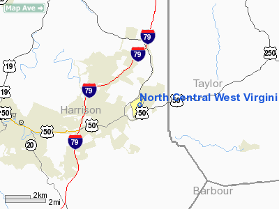
North Central West Virginia Airport (IATA: CKB, ICAO: KCKB, FAA LID: CKB) is a public airport located in Bridgeport, about 6 miles (9.7 km) east of Clarksburg, both cities in Harrison County, West Virginia, United States. It is owned and operated by the Benedum Airport Authority, serving Harrison and Marion County, and was formerly known as Benedum Airport and Harrison-Marion Regional Airport. The airport is mostly used for general aviation, but is also served by one commercial airline. Service is subsidized by the Essential Air Service program. History
The airport first opened in 1935 as the Tri-County Airport, a joint effort of Harrison, Marion and Taylor County. It was a grass airstrip operated on leased land. In 1937, Marion and Taylor County withdrew from the project. In 1938, Harrison County purchased additional land and expanded the airport. The current airport authority was established in 1960. The runway was extended to a length of 7,000 feet (2,100 m) in 1999.
Facilities and aircraft
North Central West Virginia Airport covers an area of 434 acres (176 ha) and contains one asphalt paved runway designated 3/21 which measures 7,000 x 150 ft (2,134 x 46 m), making it the second longest in the state. (Lewisburg 7,004 ft.). It also has one helipad designated H1 with a 50 x 50 ft (15 x 15 m) concrete surface.
For the 12-month period ending December 31, 2006, the airport had 59,253 aircraft operations, an average of 162 per day: 68% general aviation, 27% military and 5% scheduled commercial. There are 85 aircraft based at this airport: 69% single-engine, 18% multi-engine, 4% jet and 9% military.
Airline and destinations
| Airlines |
Destinations |
| United Express operated by Colgan Air |
Morgantown, Washington-Dulles |
The above content comes from Wikipedia and is published under free licenses – click here to read more.
Location & QuickFacts
| FAA Information Effective: | 2008-09-25 |
| Airport Identifier: | CKB |
| Airport Status: | Operational |
| Longitude/Latitude: | 080-13-41.1000W/39-17-47.9000N
-80.228083/39.296639 (Estimated) |
| Elevation: | 1217 ft / 370.94 m (Surveyed) |
| Land: | 434 acres |
| From nearest city: | 1 nautical miles NE of Clarksburg, WV |
| Location: | Harrison County, WV |
| Magnetic Variation: | 08W (1995) |
Owner & Manager
| Ownership: | Publicly owned |
| Owner: | Benedum Airport Authority |
| Address: | 2000 Aviation Way
Bridgeport, WV 26330 |
| Phone number: | 304-842-3400 |
| Manager: | James R Griffith |
| Address: | 2000 Aviation Way
Bridgeport, WV 26330 |
| Phone number: | 304-842-3400 |
Airport Operations and Facilities
| Airport Use: | Open to public |
| Wind indicator: | Yes |
| Control Tower: | Yes |
| Lighting Schedule: | DUSK-DAWN
ACTVT HIRL RY 03/21, MALSR RY 21, & PAPI RY 21 - CTAF. |
| Beacon Color: | Clear-Green (lighted land airport) |
| Landing fee charge: | Yes
LNDG FEE FOR ALL ACFT OVER 6500 LBS. |
| Sectional chart: | Cincinnati |
| Region: | AEA - Eastern |
| Boundary ARTCC: | ZOB - Cleveland |
| Tie-in FSS: | EKN - Elkins |
| FSS on Airport: | No |
| FSS Toll Free: | 1-800-WX-BRIEF |
| NOTAMs Facility: | CKB (NOTAM-d service avaliable) |
| Certification type/date: | I A S 05/1973
PPR 24 HRS FOR UNSCHEDULED ACR OPNS WITH MORE THAN 30 PSGR SEATS CALL AMGR 304-842-3400. |
| Federal Agreements: | NGY |
Airport Communications
| CTAF: | 126.700 |
| Unicom: | 123.000 |
Airport Services
| Fuel available: | 100LLA
FUEL NOT AVBL DURG HRS 2300-0500. |
| Airframe Repair: | MAJOR |
| Power Plant Repair: | MAJOR |
| Bottled Oxygen: | NONE |
| Bulk Oxygen: | NONE |
Runway Information
Runway 03/21
| Dimension: | 7000 x 150 ft / 2133.6 x 45.7 m |
| Surface: | ASPH, Good Condition
HELIPAD, H-1 SFC CONDITION FAIR, PAVEMENT CRACKING. |
| Surface Treatment: | Saw-cut or plastic Grooved |
| Weight Limit: | Single wheel: 80000 lbs.
Dual wheel: 125000 lbs.
Dual tandem wheel: 180000 lbs.
Dual dual tandem wheel: 180000 lbs. |
| Edge Lights: | High |
| |
Runway 03 |
Runway 21 |
| Longitude: | 080-13-58.3618W | 080-13-23.8134W |
| Latitude: | 39-17-16.0337N | 39-18-19.7926N |
| Elevation: | 1183.00 ft | 1217.00 ft |
| Alignment: | 23 | 127 |
| ILS Type: | | ILS
|
| Traffic Pattern: | Left | Left |
| Markings: | Precision instrument, Good Condition | Precision instrument, Good Condition |
| Crossing Height: | 59.00 ft | 45.00 ft |
| VASI: | 4-box on left side | 4-light PAPI on left side |
| Visual Glide Angle: | 3.44° | 3.00° |
| RVR Equipment: | | touchdown |
| Approach lights: | | MALSR |
| Runway End Identifier: | Yes | |
| Obstruction: | 43 ft trees, 600.0 ft from runway, 525 ft right of centerline, 9:1 slope to clear | 189 ft trees, 6500.0 ft from runway, 300 ft right of centerline, 33:1 slope to clear |
|
Helipad H1
| Dimension: | 50 x 50 ft / 15.2 x 15.2 m |
| Surface: | CONC, Fair Condition
HELIPAD, H-1 SFC CONDITION FAIR, PAVEMENT CRACKING. |
| |
Runway H1 |
Runway |
| Traffic Pattern: | Left | Left |
|
Radio Navigation Aids
| ID |
Type |
Name |
Ch |
Freq |
Var |
Dist |
| RQY | NDB | Randolph County | | 284.00 | 07W | 29.7 nm |
| JTM | NDB | Braxton | | 234.00 | 06W | 41.7 nm |
| VV | NDB | Camor | | 299.00 | 08W | 41.7 nm |
| CKB | VOR/DME | Clarksburg | 073X | 112.60 | 04W | 3.2 nm |
| MGW | VORTAC | Morgantown | 053X | 111.60 | 05W | 23.1 nm |
| EKN | VORTAC | Elkins | 089X | 114.20 | 07W | 23.7 nm |
Remarks
- DEER & BIRDS ON & INVOF ARPT.
Images and information placed above are from
http://www.airport-data.com/airport/CKB/
We thank them for the data!
| General Info
|
| Country |
United States
|
| State |
WEST VIRGINIA
|
| FAA ID |
CKB
|
| Latitude |
39-17-47.900N
|
| Longitude |
080-13-41.100W
|
| Elevation |
1217 feet
|
| Near City |
CLARKSBURG
|
We don't guarantee the information is fresh and accurate. The data may
be wrong or outdated.
For more up-to-date information please refer to other sources.
|
|


