 |
|
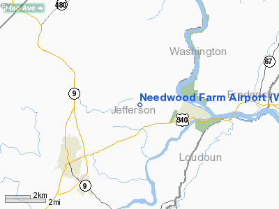
Location & QuickFacts
| FAA Information Effective: | 2008-09-25 |
| Airport Identifier: | WV21 |
| Airport Status: | Operational |
| Longitude/Latitude: | 077-47-41.0000W/39-19-50.0000N
-77.794722/39.330556 (Estimated) |
| Elevation: | 440 ft / 134.11 m (Estimated) |
| Land: | 15 acres |
| From nearest city: | 3 nautical miles W of Harpers Ferry, WV |
| Location: | Jefferson County, WV |
| Magnetic Variation: | 10W (1995) |
Owner & Manager
| Ownership: | Privately owned |
| Owner: | Lelia D Gibson Heirs |
| Address: | 201 Needwood Farm Ln
Harpers Ferry, WV 25425 |
| Phone number: | 304-725-2688 |
| Manager: | James Gibson |
| Address: | 201 Needwood Farm Ln
Harpers Ferry, WV 25425 |
| Phone number: | 304-725-2688 |
Airport Operations and Facilities
| Airport Use: | Private |
| Wind indicator: | Yes |
| Segmented Circle: | No |
| Control Tower: | No |
| Sectional chart: | Washington |
| Region: | AEA - Eastern |
| Boundary ARTCC: | ZDC - Washington |
| Tie-in FSS: | EKN - Elkins |
| FSS Toll Free: | 1-800-WX-BRIEF |
Runway Information
Runway 02/20
| Dimension: | 2000 x 75 ft / 609.6 x 22.9 m |
| Surface: | TURF, Fair Condition |
| |
Runway 02 |
Runway 20 |
| Traffic Pattern: | Left | Left |
| Obstruction: | 25 ft trees, 600.0 ft from runway | 25 ft , 100.0 ft from runway |
|
Radio Navigation Aids
| ID |
Type |
Name |
Ch |
Freq |
Var |
Dist |
| TZ | NDB | Cogan | | 364.00 | 10W | 19.4 nm |
| GDX | NDB | Goodwin Lake | | 227.00 | 08W | 22.7 nm |
| GAI | NDB | Gaithersburg | | 385.00 | 09W | 30.8 nm |
| GTN | NDB | Georgetown | | 323.00 | 09W | 39.5 nm |
| FND | NDB | Ellicott | | 371.00 | 11W | 47.4 nm |
| CBE | NDB | Cumberland | | 317.00 | 07W | 48.1 nm |
| CJR | NDB | Culpeper | | 252.00 | 09W | 48.2 nm |
| DC | NDB | Oxonn | | 332.00 | 11W | 49.4 nm |
| LUA | NDB | Caverns | | 245.00 | 09W | 49.4 nm |
| FDK | VOR | Frederick | | 109.00 | 08W | 20.1 nm |
| HGR | VOR | Hagerstown | | 109.80 | 07W | 22.3 nm |
| DCA | VOR/DME | Washington | 047X | 111.00 | 09W | 45.3 nm |
| MRB | VORTAC | Martinsburg | 058X | 112.10 | 07W | 4.1 nm |
| AML | VORTAC | Armel | 082X | 113.50 | 08W | 28.3 nm |
| LDN | VORTAC | Linden | 090X | 114.30 | 06W | 34.4 nm |
| THS | VORTAC | St Thomas | 097X | 115.00 | 07W | 36.9 nm |
| EMI | VORTAC | Westminster | 126X | 117.90 | 08W | 39.2 nm |
| CSN | VORTAC | Casanova | 110X | 116.30 | 06W | 41.6 nm |
| DCA | VOT | Washington National | | 109.40 | | 46.0 nm |
Remarks
- PRVDD VFR ONLY, CLEAR 20:1 APCH/DEP PATH FOR EA RY, & OPERATE TO MINIMIZE NOISE.
Images and information placed above are from
http://www.airport-data.com/airport/WV21/
We thank them for the data!
| General Info
|
| Country |
United States
|
| State |
WEST VIRGINIA
|
| FAA ID |
WV21
|
| Latitude |
39-19-50.000N
|
| Longitude |
077-47-41.000W
|
| Elevation |
440 feet
|
| Near City |
HARPERS FERRY
|
We don't guarantee the information is fresh and accurate. The data may
be wrong or outdated.
For more up-to-date information please refer to other sources.
|
|


