 |
|
Morgantown Muni-walter L. Bill Hart Fld Airport |
Morgantown Municipal Airport
Walter L. Bill Hart Field |
| IATA: MGW – ICAO: KMGW – FAA LID: MGW |
| Summary |
| Airport type |
Public |
| Operator |
City of Morgantown |
| Location |
Morgantown, West Virginia |
| Elevation AMSL |
1,248 ft / 380.4 m |
| Coordinates |
39°38′34″N 79°54′59″W / 39.64278°N 79.91639°W / 39.64278; -79.91639Coordinates: 39°38′34″N 79°54′59″W / 39.64278°N 79.91639°W / 39.64278; -79.91639 |
| Runways |
| Direction |
Length |
Surface |
| ft |
m |
| 18/36 |
5,199 |
1,585 |
Asphalt |
| 5/23 |
2,769 |
844 |
Asphalt |
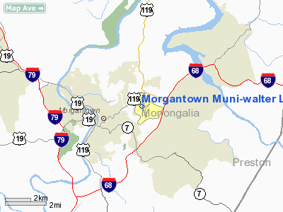
Morgantown Municipal Airport (IATA: MGW, ICAO: KMGW, FAA LID: MGW), also known as Walter L. Bill Hart Field, is a public airport located three miles (5 km) east of the central business district (CBD) of Morgantown, a city in Monongalia County, West Virginia, USA. The airport covers 638 acres (258 ha) and has two runways. It is mostly used for general aviation, but is also served by one commercial airline.
Airline and destinations
| Airlines |
Destinations |
| United Express operated by Colgan Air |
Clarksburg, Washington-Dulles |
The above content comes from Wikipedia and is published under free licenses – click here to read more.
Location & QuickFacts
| FAA Information Effective: | 2008-09-25 |
| Airport Identifier: | MGW |
| Airport Status: | Operational |
| Longitude/Latitude: | 079-54-58.7310W/39-38-34.4670N
-79.916314/39.642907 (Estimated) |
| Elevation: | 1248 ft / 380.39 m (Surveyed) |
| Land: | 638 acres |
| From nearest city: | 3 nautical miles E of Morgantown, WV |
| Location: | Monongalia County, WV |
| Magnetic Variation: | 09W (2000) |
Owner & Manager
| Ownership: | Publicly owned |
| Owner: | City Of Morgantown |
| Address: | 389 Spruce St
Morgantown, WV 26505 |
| Phone number: | 304-284-7405 |
| Manager: | Robert E. Hammel |
| Address: | 100 Hart Field Rd
Morgantown, WV 26505 |
| Phone number: | 304-291-7461 |
Airport Operations and Facilities
| Airport Use: | Open to public |
| Wind indicator: | Yes |
| Segmented Circle: | No |
| Control Tower: | Yes |
| Lighting Schedule: | DUSK-DAWN
WHEN ATCT CLSD ACTVT HIRL RY 18/36; MIRL RY 05/23; REIL RY 36; MALSR RY 18 & TWY LGTS - CTAF. |
| Beacon Color: | Clear-Green (lighted land airport) |
| Landing fee charge: | Yes
LNDG FEE FOR ACFT 6500 LBS & OVER. |
| Sectional chart: | Cincinnati |
| Region: | AEA - Eastern |
| Boundary ARTCC: | ZOB - Cleveland |
| Tie-in FSS: | EKN - Elkins |
| FSS on Airport: | No |
| FSS Toll Free: | 1-800-WX-BRIEF |
| NOTAMs Facility: | MGW (NOTAM-d service avaliable) |
| Certification type/date: | I A S 04/1981
PPR 24 HRS FOR UNSCHEDULED ACR OPNS, CALL AMGR 304-291-7461. |
| Federal Agreements: | NGHY |
Airport Communications
| CTAF: | 125.100 |
| Unicom: | 122.950 |
Airport Services
| Fuel available: | 100LLA |
| Airframe Repair: | MINOR |
| Power Plant Repair: | MINOR |
| Bottled Oxygen: | NONE |
| Bulk Oxygen: | NONE |
Runway Information
Runway 05/23
| Dimension: | 2769 x 75 ft / 844.0 x 22.9 m |
| Surface: | ASPH, Good Condition |
| Weight Limit: | Single wheel: 12500 lbs. |
| Edge Lights: | Medium |
| |
Runway 05 |
Runway 23 |
| Longitude: | 079-55-02.8810W | 079-54-37.9150W |
| Latitude: | 39-38-20.1170N | 39-38-39.5120N |
| Elevation: | 1240.00 ft | 1241.00 ft |
| Alignment: | 45 | 127 |
| Traffic Pattern: | Left | Left |
| Markings: | Basic, Good Condition | Basic, Good Condition |
|
Runway 18/36
| Dimension: | 5199 x 150 ft / 1584.7 x 45.7 m |
| Surface: | ASPH, Good Condition |
| Surface Treatment: | Saw-cut or plastic Grooved |
| Weight Limit: | Single wheel: 65000 lbs.
Dual wheel: 90000 lbs.
Dual tandem wheel: 175000 lbs. |
| Edge Lights: | High |
| |
Runway 18 |
Runway 36 |
| Longitude: | 079-55-07.5700W | 079-54-58.7690W |
| Latitude: | 39-39-02.4050N | 39-38-11.4850N |
| Elevation: | 1236.00 ft | 1244.00 ft |
| Alignment: | 127 | 127 |
| ILS Type: | ILS
| |
| Traffic Pattern: | Left | Left |
| Markings: | Precision instrument, Good Condition | Precision instrument, Good Condition |
| Crossing Height: | 60.00 ft | 52.00 ft |
| VASI: | 4-light PAPI on left side | 4-box on left side |
| Visual Glide Angle: | 3.00° | 3.00° |
| Approach lights: | MALSR | |
| Runway End Identifier: | | Yes
REIL RY 36 OUT OF SERVICE INDEFLY. |
| Obstruction: | 16 ft tree, 759.0 ft from runway, 425 ft right of centerline, 34:1 slope to clear | , 50:1 slope to clear |
|
Radio Navigation Aids
| ID |
Type |
Name |
Ch |
Freq |
Var |
Dist |
| VV | NDB | Camor | | 299.00 | 08W | 16.5 nm |
| PNU | NDB | Washington County | | 255.00 | 08W | 32.2 nm |
| MKP | NDB | Mc Keesport | | 287.00 | 07W | 43.3 nm |
| RQY | NDB | Randolph County | | 284.00 | 07W | 45.1 nm |
| CKB | VOR/DME | Clarksburg | 073X | 112.60 | 04W | 28.5 nm |
| AGC | VOR/DME | Allegheny | 037X | 110.00 | 09W | 38.6 nm |
| GRV | VOR/DME | Grantsville | 070X | 112.30 | 06W | 40.1 nm |
| AIR | VOR/DME | Bellaire | 118X | 117.10 | 07W | 47.3 nm |
| HLG | VOR/DME | Wheeling | 059X | 112.20 | 07W | 47.7 nm |
| ESL | VOR/DME | Kessel | 045X | 110.80 | 06W | 49.8 nm |
| MGW | VORTAC | Morgantown | 053X | 111.60 | 05W | 5.8 nm |
| IHD | VORTAC | Indian Head | 019X | 108.20 | 06W | 32.6 nm |
| EKN | VORTAC | Elkins | 089X | 114.20 | 07W | 44.6 nm |
Remarks
- DEER & BIRDS ON & INVOF ARPT.
- FBO HOURS ARE FROM 0530 UNTIL 2300, 24-HR PHONE NUMBER 304-296-2359.
- RY 5-23 IS NOT AVAILABLE FOR AIR CARRIER OPS, ONLY FOR AIRCRAFT 12,500 POUND OR LESS.
Images and information placed above are from
http://www.airport-data.com/airport/MGW/
We thank them for the data!
| General Info
|
| Country |
United States
|
| State |
WEST VIRGINIA
|
| FAA ID |
MGW
|
| Latitude |
39-38-34.467N
|
| Longitude |
079-54-58.731W
|
| Elevation |
1248 feet
|
| Near City |
MORGANTOWN
|
We don't guarantee the information is fresh and accurate. The data may
be wrong or outdated.
For more up-to-date information please refer to other sources.
|
|


